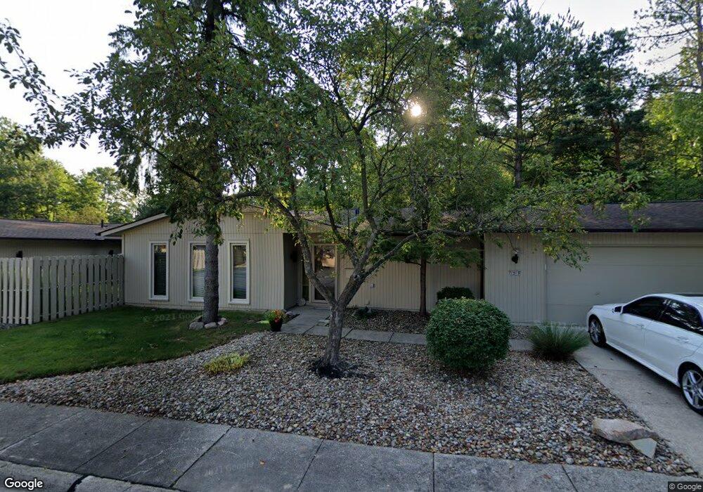
12919 Dell Ridge Ct Strongsville, OH 44149
Estimated Value: $195,000 - $245,000
2
Beds
2
Baths
1,488
Sq Ft
$151/Sq Ft
Est. Value
About This Home
This home is located at 12919 Dell Ridge Ct, Strongsville, OH 44149 and is currently estimated at $224,840, approximately $151 per square foot. 12919 Dell Ridge Ct is a home located in Cuyahoga County with nearby schools including Strongsville High School, Strongsville Academy, and Sts Joseph & John Interparochial School.
Ownership History
Date
Name
Owned For
Owner Type
Purchase Details
Closed on
Dec 3, 2024
Sold by
Wydick Thomas J and Wydick Debra A
Bought by
Tdw Trust and Wydick
Current Estimated Value
Purchase Details
Closed on
Jan 24, 2014
Sold by
Thomas Dane R
Bought by
Wydick Thomas J and Wydick Debra A
Purchase Details
Closed on
Sep 28, 1983
Sold by
Lynda Anderson
Bought by
Thomas Dana Bsr
Purchase Details
Closed on
Apr 27, 1982
Sold by
Anderson Gary L and Anderson Lynda
Bought by
Lynda Anderson
Purchase Details
Closed on
Feb 17, 1981
Sold by
Anderson Gary L
Bought by
Anderson Gary L and Anderson Lynda
Purchase Details
Closed on
Nov 21, 1979
Sold by
Mack Otto J and Mack Kathleen M
Bought by
Anderson Gary L
Purchase Details
Closed on
Jan 1, 1975
Bought by
Mack Otto J and Mack Kathleen M
Create a Home Valuation Report for This Property
The Home Valuation Report is an in-depth analysis detailing your home's value as well as a comparison with similar homes in the area
Home Values in the Area
Average Home Value in this Area
Purchase History
| Date | Buyer | Sale Price | Title Company |
|---|---|---|---|
| Tdw Trust | -- | Ohio Real Title | |
| Wydick Thomas J | $78,500 | Signature Title | |
| Thomas Dana Bsr | $82,900 | -- | |
| Lynda Anderson | -- | -- | |
| Anderson Gary L | -- | -- | |
| Anderson Gary L | $75,000 | -- | |
| Mack Otto J | -- | -- |
Source: Public Records
Tax History Compared to Growth
Tax History
| Year | Tax Paid | Tax Assessment Tax Assessment Total Assessment is a certain percentage of the fair market value that is determined by local assessors to be the total taxable value of land and additions on the property. | Land | Improvement |
|---|---|---|---|---|
| 2024 | $2,939 | $62,580 | $6,265 | $56,315 |
| 2023 | $3,215 | $51,350 | $5,150 | $46,200 |
| 2022 | $3,192 | $51,350 | $5,150 | $46,200 |
| 2021 | $3,167 | $51,350 | $5,150 | $46,200 |
| 2020 | $2,711 | $38,890 | $3,890 | $35,000 |
| 2019 | $2,631 | $111,100 | $11,100 | $100,000 |
| 2018 | $2,325 | $38,890 | $3,890 | $35,000 |
| 2017 | $2,304 | $34,730 | $3,470 | $31,260 |
| 2016 | $2,285 | $34,730 | $3,470 | $31,260 |
| 2015 | $1,908 | $34,730 | $3,470 | $31,260 |
| 2014 | $1,908 | $37,350 | $3,710 | $33,640 |
Source: Public Records
Map
Nearby Homes
- 19767 Dell Dr
- 19982 Westwood Dr
- 12694 Ionia Ct
- 12647 Edgepark Cir
- 13066 Olympus Way
- 12539 Olympus Way
- 12385 Corinth Ct
- 13156 Olympus Way
- 13099 Olympus Way
- 13237 Tomson Dr
- 13236 Tomson Dr
- 12651 Alameda Dr
- 20469 Westwood Park Blvd
- 14112 Settlers Way
- 19620 Porters Ln Unit 15F
- 19160 Wheelers Ln
- 20078 Trapper Trail
- 11499 Pearl Rd Unit A106
- 11479 Pearl Rd Unit A101
- 11432 Pearl Rd
- 12919 Dell Ridge Ct Unit 7029
- 12903 Dell Ridge Ct Unit 7028
- 12891 Dell Ridge Ct Unit 7027
- 19863 Dell Dr Unit 7037
- 19859 Dell Dr
- 12902 Dell Ridge Ct Unit 7033
- 12960 Dell Ridge Ct
- 19753 Dell Dr Unit 7024
- 19761 Dell Dr Unit 7025
- 12946 Dell Ridge Ct Unit 7031
- 19853 Dell Dr Unit 7035
- 19841 Dell Dr Unit 7034
- 19830 Westwood Dr
- 19858 Westwood Dr
- 19735 Dell Dr
- 19749 Dell Dr
- 19735 Dell Dr Unit 7022
- 19888 Westwood Dr
- 19798 Dell Dr Unit 7008