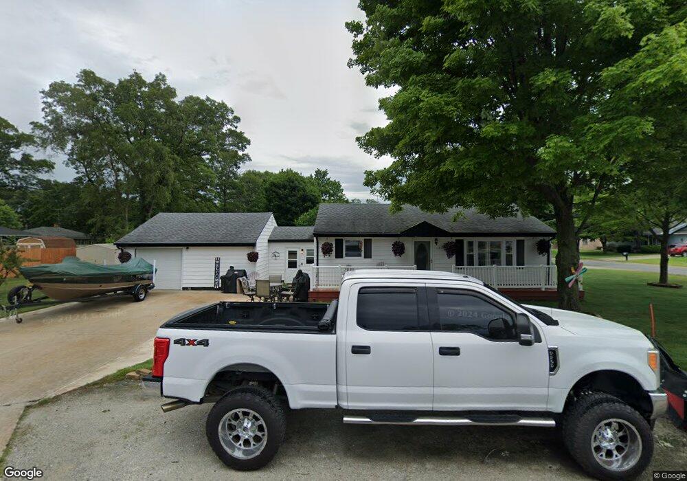
1292 Gordon St Muskegon, MI 49442
Estimated Value: $157,000 - $178,473
2
Beds
1
Bath
964
Sq Ft
$175/Sq Ft
Est. Value
About This Home
This home is located at 1292 Gordon St, Muskegon, MI 49442 and is currently estimated at $168,618, approximately $174 per square foot. 1292 Gordon St is a home located in Muskegon County with nearby schools including Orchard View Early Elementary School, Cardinal Elementary School, and Orchard View Middle School.
Ownership History
Date
Name
Owned For
Owner Type
Purchase Details
Closed on
Nov 23, 2010
Sold by
Rhanor Patricia L
Bought by
Bean Kassi A
Current Estimated Value
Home Financials for this Owner
Home Financials are based on the most recent Mortgage that was taken out on this home.
Original Mortgage
$43,354
Outstanding Balance
$28,458
Interest Rate
4.17%
Mortgage Type
FHA
Estimated Equity
$140,160
Purchase Details
Closed on
Sep 13, 2007
Sold by
Carroll Flossie and Dodge Patty
Bought by
Rhanor Patricia L
Home Financials for this Owner
Home Financials are based on the most recent Mortgage that was taken out on this home.
Original Mortgage
$83,521
Interest Rate
6.63%
Mortgage Type
FHA
Create a Home Valuation Report for This Property
The Home Valuation Report is an in-depth analysis detailing your home's value as well as a comparison with similar homes in the area
Home Values in the Area
Average Home Value in this Area
Purchase History
| Date | Buyer | Sale Price | Title Company |
|---|---|---|---|
| Bean Kassi A | $44,000 | None Available | |
| Rhanor Patricia L | -- | None Available |
Source: Public Records
Mortgage History
| Date | Status | Borrower | Loan Amount |
|---|---|---|---|
| Open | Bean Kassi A | $43,354 | |
| Previous Owner | Rhanor Patricia L | $83,521 |
Source: Public Records
Tax History Compared to Growth
Tax History
| Year | Tax Paid | Tax Assessment Tax Assessment Total Assessment is a certain percentage of the fair market value that is determined by local assessors to be the total taxable value of land and additions on the property. | Land | Improvement |
|---|---|---|---|---|
| 2025 | $1,319 | $65,600 | $0 | $0 |
| 2024 | $392 | $60,600 | $0 | $0 |
| 2023 | $375 | $50,800 | $0 | $0 |
| 2022 | $1,204 | $43,400 | $0 | $0 |
| 2021 | $1,185 | $38,600 | $0 | $0 |
| 2020 | $1,162 | $36,300 | $0 | $0 |
| 2019 | $1,537 | $33,900 | $0 | $0 |
| 2018 | $1,567 | $32,800 | $0 | $0 |
| 2017 | $1,193 | $32,300 | $0 | $0 |
| 2016 | $319 | $29,400 | $0 | $0 |
| 2015 | -- | $28,100 | $0 | $0 |
| 2014 | -- | $29,800 | $0 | $0 |
| 2013 | -- | $26,500 | $0 | $0 |
Source: Public Records
Map
Nearby Homes
- 1935 Catherine Ave
- VL Quarterline Rd
- 1774 Mclaughlin Ave
- 1949 Summerset Dr
- 1937 E Isabella Ave
- 1434 S Quarterline Rd
- 1885 E Isabella Ave
- 1718 Langeland Ave
- 1838 Oak Park Dr
- 1059 Gordon St
- 1657 Langeland Ave
- 1051 West St
- 1915 Kregel Ave
- 1650 Bush Ave
- 1556 Carlton St
- 1190 Center St
- 477 Mclaughlin Ave
- 1100 Harvey St
- 1130 Center St
- 947 Carlton St
- 1920 Francis Ave
- 1930 Francis Ave
- 1291 Gordon St
- 1272 Gordon St
- 1899 Francis Ave
- 1925 Calvin Ave
- 1915 Francis Ave
- 1940 Francis Ave
- 1927 Francis Ave
- 1931 Calvin Ave
- 1880 Francis Ave
- 1941 Calvin Ave
- 1891 Calvin Ave
- 1941 Francis Ave
- 1870 Francis Ave
- 1875 Francis Ave
- 1950 Francis Ave
- 1951 Calvin Ave
- 1920 Winslow Dr
- 1860 Francis Ave