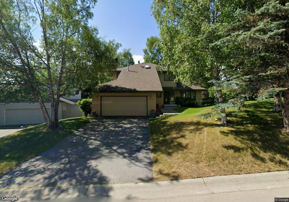
12920 Cumberland Cir Anchorage, AK 99516
Huffman-O'Malley NeighborhoodEstimated Value: $357,000 - $609,000
3
Beds
3
Baths
2,018
Sq Ft
$264/Sq Ft
Est. Value
About This Home
This home is located at 12920 Cumberland Cir, Anchorage, AK 99516 and is currently estimated at $532,053, approximately $263 per square foot. 12920 Cumberland Cir is a home located in Anchorage Municipality with nearby schools including Huffman Elementary School, Goldenview Middle School, and South Anchorage High School.
Ownership History
Date
Name
Owned For
Owner Type
Purchase Details
Closed on
Mar 22, 2004
Sold by
Cooper Lawrence J and Cooper Tammy L
Bought by
Ditz Mary
Current Estimated Value
Home Financials for this Owner
Home Financials are based on the most recent Mortgage that was taken out on this home.
Original Mortgage
$266,475
Outstanding Balance
$124,713
Interest Rate
5.69%
Mortgage Type
Purchase Money Mortgage
Estimated Equity
$407,340
Purchase Details
Closed on
Nov 11, 1994
Sold by
Novak Robert A and Novak Bonnie Oneill
Bought by
Cooper Lawrence J and Cooper Tammy L
Home Financials for this Owner
Home Financials are based on the most recent Mortgage that was taken out on this home.
Original Mortgage
$171,000
Interest Rate
8.86%
Mortgage Type
New Conventional
Create a Home Valuation Report for This Property
The Home Valuation Report is an in-depth analysis detailing your home's value as well as a comparison with similar homes in the area
Home Values in the Area
Average Home Value in this Area
Purchase History
| Date | Buyer | Sale Price | Title Company |
|---|---|---|---|
| Ditz Mary | -- | -- | |
| Cooper Lawrence J | -- | -- |
Source: Public Records
Mortgage History
| Date | Status | Borrower | Loan Amount |
|---|---|---|---|
| Open | Ditz Mary | $266,475 | |
| Previous Owner | Cooper Lawrence J | $171,000 |
Source: Public Records
Tax History Compared to Growth
Tax History
| Year | Tax Paid | Tax Assessment Tax Assessment Total Assessment is a certain percentage of the fair market value that is determined by local assessors to be the total taxable value of land and additions on the property. | Land | Improvement |
|---|---|---|---|---|
| 2025 | $7,566 | $484,600 | $112,700 | $371,900 |
| 2024 | $7,566 | $468,600 | $112,700 | $355,900 |
| 2023 | $7,379 | $433,300 | $112,700 | $320,600 |
| 2022 | $6,925 | $411,200 | $112,700 | $298,500 |
| 2021 | $7,217 | $400,500 | $112,700 | $287,800 |
| 2020 | $6,713 | $394,900 | $112,700 | $282,200 |
| 2019 | $6,218 | $380,100 | $112,700 | $267,400 |
| 2018 | $6,063 | $369,700 | $112,700 | $257,000 |
| 2017 | $5,894 | $376,400 | $112,700 | $263,700 |
| 2016 | $5,756 | $389,500 | $112,700 | $276,800 |
| 2015 | $5,756 | $389,500 | $112,700 | $276,800 |
| 2014 | $5,756 | $380,300 | $119,300 | $261,000 |
Source: Public Records
Map
Nearby Homes
- 2701 Kempton Hills Dr
- 3040 Chesapeake Cir
- 13470 Baywind Cir
- 2020 Steeple Dr
- 13481 Baywind Dr
- 13530 Westwind Dr
- 12283 Timberwood Cir
- 2521 Winterchase Cir
- 3025 Huffman Rd
- 2048 Meander Dr
- 13540 Seachant Cir
- 12241 Gander St
- 13105 Stephenson St
- 12101 Wagner St
- 2000 Jarvis Ave
- 13322 Diggins Dr
- 1800 Hamilton Dr
- 000 Wagner St
- 1677 Circlewood Dr
- 3833 Eastwind Dr
- 12910 Cumberland Cir
- 12900 Cumberland Cir
- 12921 Wellsford Cir
- 12911 Wellsford Cir
- 2621 Kempton Hills Dr
- 12901 Wellsford Cir
- 12921 Cumberland Cir
- 12830 Cumberland Cir
- 12931 Cumberland Cir
- 12911 Cumberland Cir
- 2731 Kempton Hills Dr
- 12901 Cumberland Cir
- 12831 Wellsford Cir
- 12820 Cumberland Cir
- 2700 Kempton Hills Dr
- 13001 Galveston Cir
- 12831 Cumberland Cir
- 2710 Kempton Hills Dr
- 2741 Kempton Hills Dr
- 2720 Kempton Hills Dr