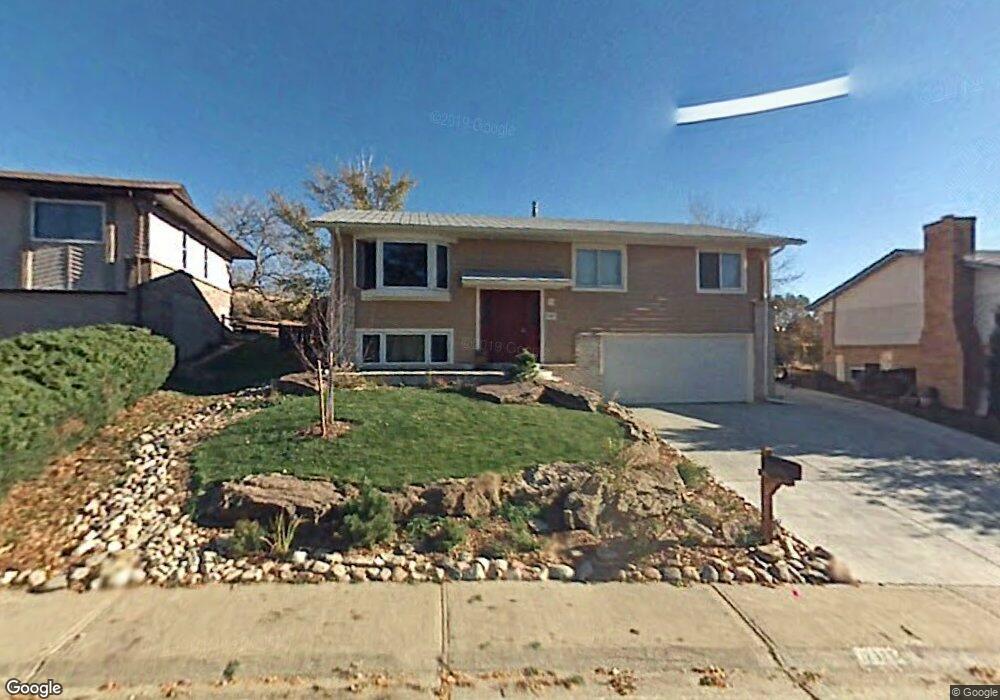
12927 W Oregon Dr Lakewood, CO 80228
Green Mountain NeighborhoodEstimated Value: $742,000 - $786,000
3
Beds
3
Baths
2,550
Sq Ft
$296/Sq Ft
Est. Value
About This Home
This home is located at 12927 W Oregon Dr, Lakewood, CO 80228 and is currently estimated at $755,502, approximately $296 per square foot. 12927 W Oregon Dr is a home located in Jefferson County with nearby schools including Hutchinson Elementary School, Dunstan Middle School, and Green Mountain High School.
Ownership History
Date
Name
Owned For
Owner Type
Purchase Details
Closed on
Sep 29, 2021
Sold by
Curtis Christopher E and Curtis Genoiva D
Bought by
Kremers Adam and Kahl Brittany
Current Estimated Value
Home Financials for this Owner
Home Financials are based on the most recent Mortgage that was taken out on this home.
Original Mortgage
$572,800
Outstanding Balance
$522,340
Interest Rate
2.8%
Mortgage Type
New Conventional
Estimated Equity
$233,162
Purchase Details
Closed on
Feb 22, 2016
Sold by
Jamie R Lowrie Trust
Bought by
Curtis Christopher E and Curtis Genoiva D
Home Financials for this Owner
Home Financials are based on the most recent Mortgage that was taken out on this home.
Original Mortgage
$387,000
Interest Rate
3.92%
Mortgage Type
New Conventional
Purchase Details
Closed on
Jan 23, 2015
Sold by
Lowrie Jamie R
Bought by
Jamie R Lowrie Trust
Purchase Details
Closed on
Jan 14, 2015
Sold by
Lowrie Jon D
Bought by
Lowrie Jamie R
Purchase Details
Closed on
Nov 6, 2012
Sold by
Jon D Lowrie Living Trust
Bought by
Lowrie Jon D
Home Financials for this Owner
Home Financials are based on the most recent Mortgage that was taken out on this home.
Original Mortgage
$269,637
Interest Rate
3.3%
Mortgage Type
FHA
Purchase Details
Closed on
Feb 22, 2012
Sold by
Lowrie Jon D
Bought by
Jon D Lowrie Living Trust
Purchase Details
Closed on
May 27, 2004
Sold by
Tollerud Ronald L and Tollerud Diana L
Bought by
Lowrie Jon D and Lowrie Felice Amador
Home Financials for this Owner
Home Financials are based on the most recent Mortgage that was taken out on this home.
Original Mortgage
$213,200
Interest Rate
5.62%
Mortgage Type
New Conventional
Purchase Details
Closed on
May 25, 2000
Sold by
Salvation Army The
Bought by
Tollerud Ronald L and Tollerud Diana L
Home Financials for this Owner
Home Financials are based on the most recent Mortgage that was taken out on this home.
Original Mortgage
$187,642
Interest Rate
7%
Create a Home Valuation Report for This Property
The Home Valuation Report is an in-depth analysis detailing your home's value as well as a comparison with similar homes in the area
Home Values in the Area
Average Home Value in this Area
Purchase History
| Date | Buyer | Sale Price | Title Company |
|---|---|---|---|
| Kremers Adam | $716,000 | Land Title Guarantee Company | |
| Curtis Christopher E | $430,000 | First American | |
| Jamie R Lowrie Trust | -- | First American | |
| Jamie R Lowrie Trust | -- | None Available | |
| Lowrie Jamie R | -- | None Available | |
| Lowrie Jon D | -- | Land Title Guarantee Company | |
| Jon D Lowrie Living Trust | -- | None Available | |
| Lowrie Jon D | $266,500 | Chicago Title Co | |
| Tollerud Ronald L | $184,000 | -- |
Source: Public Records
Mortgage History
| Date | Status | Borrower | Loan Amount |
|---|---|---|---|
| Open | Kremers Adam | $572,800 | |
| Previous Owner | Curtis Christopher E | $387,000 | |
| Previous Owner | Lowrie Jon D | $269,637 | |
| Previous Owner | Lowrie Jon D | $213,200 | |
| Previous Owner | Tollerud Ronald L | $187,642 | |
| Closed | Lowrie Jon D | $53,300 |
Source: Public Records
Tax History Compared to Growth
Tax History
| Year | Tax Paid | Tax Assessment Tax Assessment Total Assessment is a certain percentage of the fair market value that is determined by local assessors to be the total taxable value of land and additions on the property. | Land | Improvement |
|---|---|---|---|---|
| 2024 | $3,940 | $43,693 | $18,083 | $25,610 |
| 2023 | $3,940 | $43,693 | $18,083 | $25,610 |
| 2022 | $3,138 | $34,012 | $15,844 | $18,168 |
| 2021 | $3,183 | $34,991 | $16,300 | $18,691 |
| 2020 | $2,919 | $32,234 | $14,741 | $17,493 |
| 2019 | $2,881 | $32,234 | $14,741 | $17,493 |
| 2018 | $2,653 | $28,709 | $8,814 | $19,895 |
| 2017 | $2,332 | $28,709 | $8,814 | $19,895 |
| 2016 | $2,061 | $23,676 | $6,403 | $17,273 |
| 2015 | $1,905 | $23,676 | $6,403 | $17,273 |
| 2014 | $1,905 | $20,050 | $6,136 | $13,914 |
Source: Public Records
Map
Nearby Homes
- 12948 W Oregon Dr
- 1825 S Zang Ct
- 13231 W Montana Ave
- 12742 W Florida Dr
- 13172 W Montana Ave
- 1414 S Ward St
- 13233 W Utah Cir
- 1650 S Deframe St Unit B5
- 1332 S Yank St
- 1501 S Welch Cir
- 1882 S Zinnia Way
- 12711 W Jewell Cir
- 13349 W Alameda Pkwy Unit 303
- 13349 W Alameda Pkwy Unit 104
- 13349 W Alameda Pkwy Unit 102
- 1425 S Welch Cir
- 1648 S Cole St Unit B7
- 1697 S Cole St Unit C2
- 1655 S Cole St Unit B1
- 322 S Alkire St
- 12937 W Oregon Dr
- 12917 W Oregon Dr
- 12947 W Oregon Dr
- 12938 W Oregon Dr
- 12918 W Oregon Dr
- 12957 W Oregon Dr
- 12958 W Oregon Dr
- 12967 W Oregon Dr
- 1817 S Welch Cir
- 12968 W Oregon Dr
- 1542 S Yank St
- 1552 S Yank St
- 12985 W Montana Dr
- 12977 W Oregon Dr
- 12989 W Montana Dr
- 12624 W Hawaii Ave
- 1815 S Welch Cir
- 12644 W Hawaii Ave
- 1538 S Yank St
- 12664 W Hawaii Ave