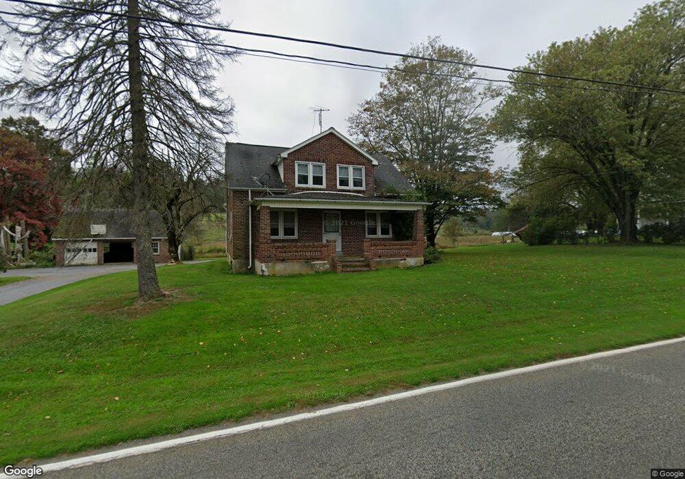
1293 Weisstown Rd Boyertown, PA 19512
Colebrookdale Township NeighborhoodEstimated Value: $268,000 - $352,000
3
Beds
1
Bath
1,344
Sq Ft
$220/Sq Ft
Est. Value
About This Home
This home is located at 1293 Weisstown Rd, Boyertown, PA 19512 and is currently estimated at $296,305, approximately $220 per square foot. 1293 Weisstown Rd is a home located in Berks County with nearby schools including Boyertown Area Senior High School and Brookeside Montessori School.
Ownership History
Date
Name
Owned For
Owner Type
Purchase Details
Closed on
Jan 28, 2002
Sold by
Wilding Helen and Psota Janet
Bought by
Hillegas Michael J and Hillegas Michelle A
Current Estimated Value
Home Financials for this Owner
Home Financials are based on the most recent Mortgage that was taken out on this home.
Original Mortgage
$130,000
Interest Rate
6.64%
Purchase Details
Closed on
Apr 28, 1988
Bought by
Schoenly David
Create a Home Valuation Report for This Property
The Home Valuation Report is an in-depth analysis detailing your home's value as well as a comparison with similar homes in the area
Home Values in the Area
Average Home Value in this Area
Purchase History
| Date | Buyer | Sale Price | Title Company |
|---|---|---|---|
| Hillegas Michael J | $240,000 | -- | |
| Wilding Helen | -- | -- | |
| Schoenly David | -- | -- |
Source: Public Records
Mortgage History
| Date | Status | Borrower | Loan Amount |
|---|---|---|---|
| Previous Owner | Hillegas Michael J | $130,000 |
Source: Public Records
Tax History Compared to Growth
Tax History
| Year | Tax Paid | Tax Assessment Tax Assessment Total Assessment is a certain percentage of the fair market value that is determined by local assessors to be the total taxable value of land and additions on the property. | Land | Improvement |
|---|---|---|---|---|
| 2025 | $1,508 | $101,200 | $43,200 | $58,000 |
| 2024 | $4,469 | $101,200 | $43,200 | $58,000 |
| 2023 | $4,308 | $101,200 | $43,200 | $58,000 |
| 2022 | $4,119 | $101,200 | $43,200 | $58,000 |
| 2021 | $4,034 | $101,200 | $43,200 | $58,000 |
| 2020 | $3,945 | $101,200 | $43,200 | $58,000 |
| 2019 | $3,848 | $101,200 | $43,200 | $58,000 |
| 2018 | $3,712 | $101,200 | $43,200 | $58,000 |
| 2017 | $3,556 | $101,200 | $43,200 | $58,000 |
| 2016 | $1,129 | $101,200 | $43,200 | $58,000 |
| 2015 | $1,129 | $101,200 | $43,200 | $58,000 |
| 2014 | $1,129 | $101,200 | $43,200 | $58,000 |
Source: Public Records
Map
Nearby Homes
- 1028 Weisstown Rd
- 280 Indian Ln
- 201 Henry Ave
- 24 Alans Ln
- 190 Red Oak Dr
- 0 Rte 73 Unit PABK2041020
- 626 N Reading Ave
- 160-A Spring Garden Dr
- 119 Schaeffer St
- 0 Spring Garden Dr
- 34 Chestnut Ln
- Norris Plan at Spring Garden Meadows
- 24 Cherry St
- 100 College St
- 0 W Philadelphia Ave
- 151 S Reading Ave
- 231 N Franklin St
- 2131 Weisstown Rd
- 332 S Reading Ave
- 275 Washington Rd
- 1295 Weisstown Rd
- 00 Weisstown Rd
- 1190 Weisstown Rd
- 1380 Weisstown Rd
- 1370 Weisstown Rd
- 1390 Weisstown Rd
- 621 N Funk Rd
- 1470 Weisstown Rd
- 1420 Orchard Ln
- 881 Unger Ln
- 1424 Orchard Ln
- 1480 Weisstown Rd
- 1124 Weisstown Rd
- 835 Unger Ln
- 1419 Orchard Ln
- 1473 Weisstown Rd
- 1482 Weisstown Rd
- 599 N Funk Rd
- 0 Weisstown Rd
- 810 Weisstown Rd