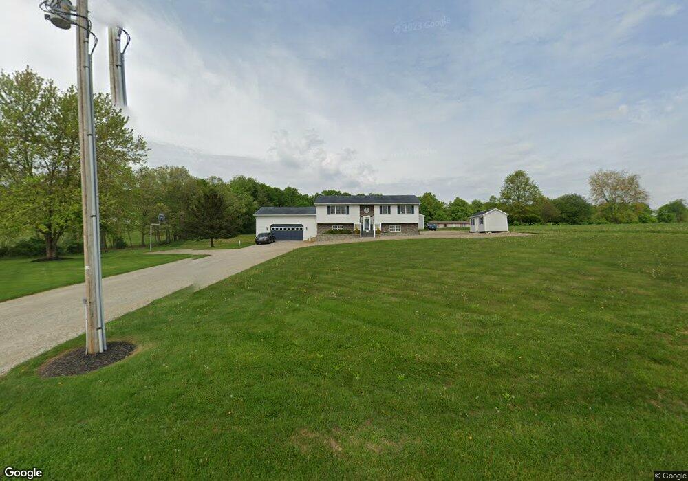
12931 Gilchrist Rd Mount Vernon, OH 43050
Estimated Value: $354,000 - $453,000
4
Beds
3
Baths
1,368
Sq Ft
$294/Sq Ft
Est. Value
About This Home
This home is located at 12931 Gilchrist Rd, Mount Vernon, OH 43050 and is currently estimated at $402,513, approximately $294 per square foot. 12931 Gilchrist Rd is a home located in Knox County with nearby schools including Mount Vernon High School.
Ownership History
Date
Name
Owned For
Owner Type
Purchase Details
Closed on
Aug 11, 2006
Sold by
Canterbury Rocky and Canterbury Tammmie
Bought by
Shupp David W
Current Estimated Value
Home Financials for this Owner
Home Financials are based on the most recent Mortgage that was taken out on this home.
Original Mortgage
$160,000
Outstanding Balance
$96,530
Interest Rate
6.85%
Mortgage Type
New Conventional
Estimated Equity
$305,983
Purchase Details
Closed on
Apr 6, 1990
Sold by
Cornelius Bernard R and Cornelius J
Bought by
Canterbury Rocky and Canterbury Tammie
Purchase Details
Closed on
Jul 6, 1989
Sold by
Gabbert Gale L and Eula May
Bought by
Cornelius Bernard R and Cornelius J
Create a Home Valuation Report for This Property
The Home Valuation Report is an in-depth analysis detailing your home's value as well as a comparison with similar homes in the area
Home Values in the Area
Average Home Value in this Area
Purchase History
| Date | Buyer | Sale Price | Title Company |
|---|---|---|---|
| Shupp David W | $150,000 | None Available | |
| Canterbury Rocky | $7,500 | -- | |
| Cornelius Bernard R | $31,300 | -- |
Source: Public Records
Mortgage History
| Date | Status | Borrower | Loan Amount |
|---|---|---|---|
| Open | Shupp David W | $160,000 |
Source: Public Records
Tax History Compared to Growth
Tax History
| Year | Tax Paid | Tax Assessment Tax Assessment Total Assessment is a certain percentage of the fair market value that is determined by local assessors to be the total taxable value of land and additions on the property. | Land | Improvement |
|---|---|---|---|---|
| 2024 | $4,283 | $100,470 | $30,000 | $70,470 |
| 2023 | $4,283 | $100,470 | $30,000 | $70,470 |
| 2022 | $3,203 | $69,290 | $20,690 | $48,600 |
| 2021 | $3,203 | $69,290 | $20,690 | $48,600 |
| 2020 | $3,125 | $69,290 | $20,690 | $48,600 |
| 2019 | $3,231 | $66,460 | $19,940 | $46,520 |
| 2018 | $3,233 | $66,460 | $19,940 | $46,520 |
| 2017 | $3,180 | $66,460 | $19,940 | $46,520 |
| 2016 | $2,963 | $61,530 | $18,460 | $43,070 |
| 2015 | $2,975 | $61,530 | $18,460 | $43,070 |
| 2014 | $2,989 | $61,530 | $18,460 | $43,070 |
| 2013 | $3,129 | $62,600 | $17,350 | $45,250 |
Source: Public Records
Map
Nearby Homes
- 13618 Gilchrist Rd
- 12627 Upper Gilchrist Rd
- 14021 Gilchrist Rd
- 11791 McManis Rd
- 104 Colonial Woods Dr Unit 4
- 188 Plymouth Rd
- 117 Colonial Woods Dr
- 17421 Coshocton Rd
- 13999 Wooster Rd
- 17970 Scott Rd
- 0 Venture Dr Unit 20240369
- 14499 Wooster Rd
- 14702 Wooster Rd
- 1737 Vernonview Dr
- 20561 Canada Rd
- 17 Upland Terrace
- 84 Woodlake Trail
- 42 Wildwood Ln
- 0 Wildwood Ln
- 55 Wildwood Ln
- 12981 Gilchrist Rd
- 13041 Gilchrist Rd
- 12859 Gilchrist Rd
- 12815 Gilchrist Rd
- 13083 Gilchrist Rd
- 13105 Upper Gilchrist Rd
- 13123 Upper Gilchrist Rd
- 13081 Upper Gilchrist Rd
- 13013 Upper Gilchrist Rd
- 13057 Upper Gilchrist Rd
- 13153 Upper Gilchrist Rd
- 12985 Upper Gilchrist Rd
- 12943 Upper Gilchrist Rd
- 13221 Upper Gilchrist Rd
- 12913 Upper Gilchrist Rd
- 13281 Upper Gilchrist Rd
- 18490 Paige Rd
- 18454 Paige Rd
- 18420 Paige Rd
- 18320 Paige Rd