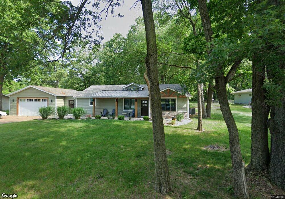
12932 Bernice Ave Unit 2 Wayland, MI 49348
Estimated Value: $323,000 - $497,000
3
Beds
2
Baths
1,600
Sq Ft
$238/Sq Ft
Est. Value
About This Home
This home is located at 12932 Bernice Ave Unit 2, Wayland, MI 49348 and is currently estimated at $381,053, approximately $238 per square foot. 12932 Bernice Ave Unit 2 is a home located in Barry County with nearby schools including Wayland High School.
Ownership History
Date
Name
Owned For
Owner Type
Purchase Details
Closed on
Aug 12, 2008
Sold by
Deutsche Bank National Trust Co
Bought by
Mclain Jacob
Current Estimated Value
Home Financials for this Owner
Home Financials are based on the most recent Mortgage that was taken out on this home.
Original Mortgage
$86,255
Interest Rate
6.52%
Purchase Details
Closed on
Dec 6, 2007
Sold by
Vanhaften Patrick
Bought by
Deutsche Bank National Trust Co and Rbsgc 2007-A
Purchase Details
Closed on
Jun 1, 2006
Sold by
Godley Gary and Godley Jackie
Bought by
Vanhaften Patrick
Home Financials for this Owner
Home Financials are based on the most recent Mortgage that was taken out on this home.
Original Mortgage
$14,000
Interest Rate
6.68%
Mortgage Type
Credit Line Revolving
Create a Home Valuation Report for This Property
The Home Valuation Report is an in-depth analysis detailing your home's value as well as a comparison with similar homes in the area
Home Values in the Area
Average Home Value in this Area
Purchase History
| Date | Buyer | Sale Price | Title Company |
|---|---|---|---|
| Mclain Jacob | $73,900 | Attorneys Title Agency Llc | |
| Deutsche Bank National Trust Co | $116,764 | None Available | |
| Vanhaften Patrick | $140,000 | Accurate Land Title Llc |
Source: Public Records
Mortgage History
| Date | Status | Borrower | Loan Amount |
|---|---|---|---|
| Previous Owner | Mclain Jacob | $86,255 | |
| Previous Owner | Vanhaften Patrick | $14,000 | |
| Previous Owner | Vanhaften Patrick | $112,000 |
Source: Public Records
Tax History Compared to Growth
Tax History
| Year | Tax Paid | Tax Assessment Tax Assessment Total Assessment is a certain percentage of the fair market value that is determined by local assessors to be the total taxable value of land and additions on the property. | Land | Improvement |
|---|---|---|---|---|
| 2025 | $2,041 | $134,200 | $0 | $0 |
| 2024 | $2,041 | $134,000 | $0 | $0 |
| 2023 | $3,390 | $91,700 | $0 | $0 |
| 2022 | $3,390 | $91,700 | $0 | $0 |
| 2021 | $3,390 | $92,200 | $0 | $0 |
| 2020 | $2,186 | $80,000 | $0 | $0 |
| 2019 | $2,186 | $89,500 | $0 | $0 |
| 2018 | $1,930 | $61,800 | $16,100 | $45,700 |
| 2017 | $1,930 | $61,800 | $0 | $0 |
| 2016 | -- | $53,400 | $0 | $0 |
| 2015 | -- | $52,900 | $0 | $0 |
| 2014 | -- | $52,900 | $0 | $0 |
Source: Public Records
Map
Nearby Homes
- 35 Cannonball Ln
- 12712 Sunrise Ct
- 12940 Cleland Ave
- 3140 Sandy Beach St
- 2724 Pasture Ln
- 1875 Edwin Dr
- 1980 Parker Dr
- 1736 Parker Dr
- 12169 Pine Meadows Dr
- 12031 Sandstone Dr
- 3298 Elmwood Beach Rd
- 11065 W M 179 Hwy
- 11908 Erica Ln Unit Site 66
- 2919 Beatrice Ave
- 2919 Beatrice Ave
- 11617 Winchester Dr
- 11633 Marsh Rd
- 4304 Trails End Rd
- 5289 Marsh Rd
- 590 129th Ave
- 2637 Patterson Rd
- 12954 Bernice Ave
- 12898 Bernice Ave
- 2625 S Patterson Rd
- 2533 Patterson Rd
- 2617 S Patterson Rd
- 12886 Bernice St
- 2749 Lutone Ave
- 12886 Bernice Ave
- 2634 2nd St
- 2664 Patterson Rd
- 2745 S Patterson Rd
- 2775 S Patterson Rd
- 0 Bernice Ave
- 12889 Bernice Ave
- 2626 Abbey Rd
- 2641 Abbey Rd
- 2605 S Patterson Rd
- 2635 2nd St
- 2635 Abbey Rd