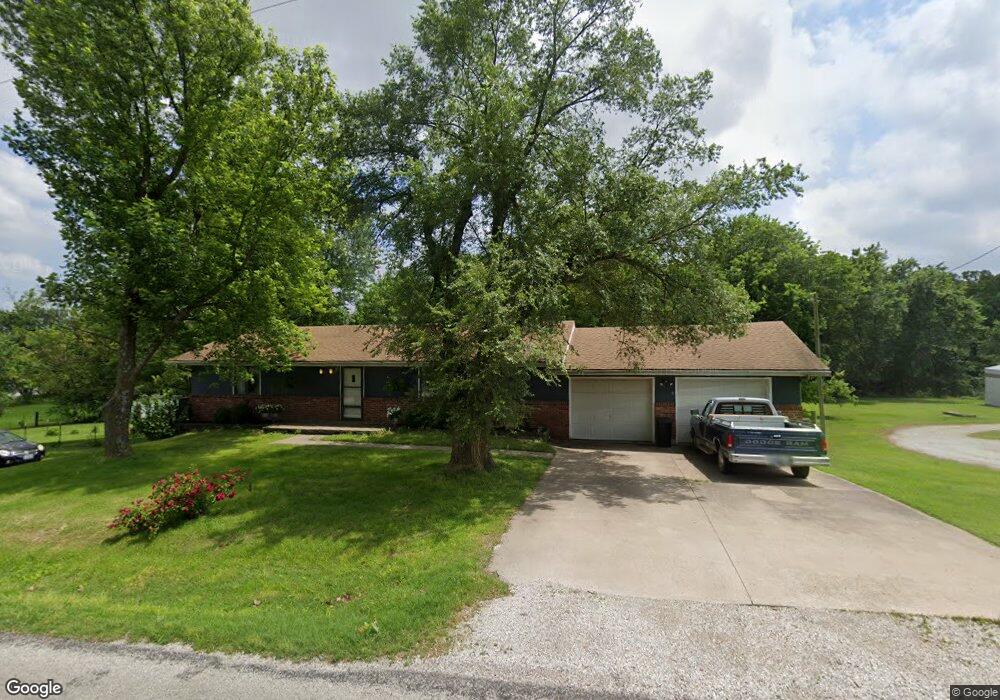
12933 Mulberry Rd Unit 1 Neosho, MO 64850
Estimated Value: $236,000 - $274,000
3
Beds
3
Baths
1,850
Sq Ft
$136/Sq Ft
Est. Value
About This Home
This home is located at 12933 Mulberry Rd Unit 1, Neosho, MO 64850 and is currently estimated at $252,431, approximately $136 per square foot. 12933 Mulberry Rd Unit 1 is a home located in Newton County with nearby schools including Neosho High School, Ozark Christian Academy, and Neosho Christian Schools.
Ownership History
Date
Name
Owned For
Owner Type
Purchase Details
Closed on
Jul 9, 2021
Sold by
Smith and Tawn
Bought by
Young Bobby J and Young Florence
Current Estimated Value
Home Financials for this Owner
Home Financials are based on the most recent Mortgage that was taken out on this home.
Original Mortgage
$177,500
Outstanding Balance
$161,054
Interest Rate
2.9%
Mortgage Type
VA
Estimated Equity
$91,377
Purchase Details
Closed on
Mar 31, 2014
Sold by
Simms Mary M
Bought by
Smith Jeff and Smith Tawn
Home Financials for this Owner
Home Financials are based on the most recent Mortgage that was taken out on this home.
Original Mortgage
$77,077
Interest Rate
4.25%
Mortgage Type
FHA
Create a Home Valuation Report for This Property
The Home Valuation Report is an in-depth analysis detailing your home's value as well as a comparison with similar homes in the area
Home Values in the Area
Average Home Value in this Area
Purchase History
| Date | Buyer | Sale Price | Title Company |
|---|---|---|---|
| Young Bobby J | $173,950 | None Listed On Document | |
| Smith Jeff | $77,847 | -- |
Source: Public Records
Mortgage History
| Date | Status | Borrower | Loan Amount |
|---|---|---|---|
| Open | Young Bobby J | $177,500 | |
| Previous Owner | Smith Jeff | $77,077 |
Source: Public Records
Tax History Compared to Growth
Tax History
| Year | Tax Paid | Tax Assessment Tax Assessment Total Assessment is a certain percentage of the fair market value that is determined by local assessors to be the total taxable value of land and additions on the property. | Land | Improvement |
|---|---|---|---|---|
| 2024 | $1,157 | $20,920 | -- | -- |
| 2023 | $1,157 | $20,920 | $2,584 | $18,336 |
| 2022 | $1,157 | $18,860 | -- | -- |
| 2021 | $1,041 | $18,860 | $0 | $0 |
| 2020 | $950 | $17,330 | $0 | $0 |
| 2019 | $868 | $17,330 | $0 | $0 |
| 2018 | $875 | $17,330 | $0 | $0 |
| 2017 | $862 | $17,330 | $0 | $0 |
| 2016 | $862 | $17,100 | $0 | $0 |
| 2015 | -- | $17,100 | $0 | $0 |
| 2014 | -- | $18,970 | $0 | $0 |
Source: Public Records
Map
Nearby Homes
- 12882 Larissa Dr
- 13844 Jay Dr
- 12228 Lauren Ln
- 1700 Rosewood Dr
- 12735 Lynn Ln
- 12735 Lynn Ln Unit 3.5AC
- 2203 Timbercrest Dr
- 1701 Radcliff Dr
- 12735 Lynn Dr
- 1003 Greenbrook Dr
- 2007 Bogey Ln
- Tr 5b Swc 86 Highway & Kodiak
- 1401 Ridgewood Rd
- 1306 Marion Dr
- 2032 Eagle Dr
- 005 Kodiak Rd
- Tract 4 SW Swc 86 Highway & Kodiak Rd
- 11438 Norway Rd
- TR 5A Swc 86 Hwy & Kodiak Rd
- Tr 5a Swc 86 Highway & Kodiak
- 12933 Mulberry Rd
- 12967 Mulberry Rd
- 12800 Mulberry Rd
- 14135 Shady Lane Dr
- 12942 Margaret Ln
- 13942 Kodiak Rd
- 12899 Mulberry Rd
- 14172 Shady Lane Dr
- 12798 Mulberry Rd
- 12903 Margaret Ln
- 12963 Margaret Ln
- 13908 Kodiak Rd
- 12752 Mulberry Rd
- 12731 Mulberry Rd
- 14255 N Shady Lane Dr
- 14251 Shady Lane Dr
- 14269 Shady Lane Dr
- 14237 Shady Lane Dr
- 14204 Shady Lane Dr
- 14283 Shady Lane Dr