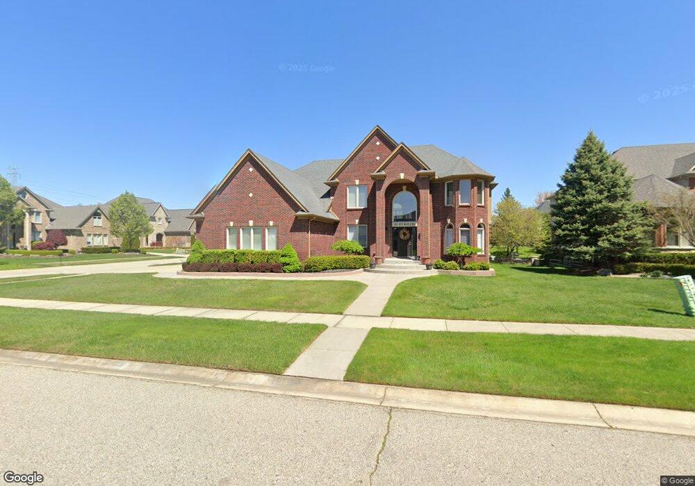
12933 Red Maple Dr Shelby Township, MI 48315
Estimated Value: $731,000 - $835,000
4
Beds
4
Baths
3,659
Sq Ft
$210/Sq Ft
Est. Value
About This Home
This home is located at 12933 Red Maple Dr, Shelby Township, MI 48315 and is currently estimated at $770,193, approximately $210 per square foot. 12933 Red Maple Dr is a home with nearby schools including Crissman Elementary School, Malow Junior High School, and Eisenhower High School.
Ownership History
Date
Name
Owned For
Owner Type
Purchase Details
Closed on
Oct 25, 2006
Sold by
Vi Tal Building Corp
Bought by
Vi Tal Building Corp
Current Estimated Value
Home Financials for this Owner
Home Financials are based on the most recent Mortgage that was taken out on this home.
Original Mortgage
$31,868
Outstanding Balance
$19,030
Interest Rate
6.38%
Mortgage Type
Unknown
Estimated Equity
$751,163
Purchase Details
Closed on
Sep 6, 2005
Sold by
Shelby Jag Development Llc
Bought by
Vital Building Corp
Home Financials for this Owner
Home Financials are based on the most recent Mortgage that was taken out on this home.
Original Mortgage
$2,868,800
Interest Rate
6.01%
Mortgage Type
Purchase Money Mortgage
Purchase Details
Closed on
May 17, 2005
Sold by
Thomas Anthony Development Corp
Bought by
Shelby Development Llc
Create a Home Valuation Report for This Property
The Home Valuation Report is an in-depth analysis detailing your home's value as well as a comparison with similar homes in the area
Home Values in the Area
Average Home Value in this Area
Purchase History
| Date | Buyer | Sale Price | Title Company |
|---|---|---|---|
| Vi Tal Building Corp | -- | Greco | |
| Yatooma Jimmy | $150,000 | Greco | |
| Vital Building Corp | -- | -- | |
| Shelby Development Llc | $4,845,000 | Chicago Title Insurance Co |
Source: Public Records
Mortgage History
| Date | Status | Borrower | Loan Amount |
|---|---|---|---|
| Open | Yatooma Jimmy | $31,868 | |
| Open | Yatooma Jimmy | $388,132 | |
| Closed | Vi Tal Building Corp | $31,868 | |
| Previous Owner | Vital Building Corp | $2,868,800 |
Source: Public Records
Tax History Compared to Growth
Tax History
| Year | Tax Paid | Tax Assessment Tax Assessment Total Assessment is a certain percentage of the fair market value that is determined by local assessors to be the total taxable value of land and additions on the property. | Land | Improvement |
|---|---|---|---|---|
| 2025 | $7,066 | $366,000 | $0 | $0 |
| 2024 | $4,182 | $324,700 | $0 | $0 |
| 2023 | $3,961 | $277,700 | $0 | $0 |
| 2022 | $6,389 | $249,800 | $0 | $0 |
| 2021 | $6,215 | $247,200 | $0 | $0 |
| 2020 | $3,646 | $237,200 | $0 | $0 |
| 2019 | $5,690 | $221,000 | $0 | $0 |
| 2018 | $5,621 | $223,200 | $0 | $0 |
| 2017 | $5,520 | $222,600 | $40,150 | $182,450 |
| 2016 | $5,480 | $222,600 | $0 | $0 |
| 2015 | $5,401 | $201,600 | $0 | $0 |
| 2012 | -- | $0 | $0 | $0 |
Source: Public Records
Map
Nearby Homes
- 54679 White Pine Ln
- 54381 Pelican Ln
- 54810 Blue Cloud Dr
- 12771 N Pointe Dr
- 55589 Oak Pointe Dr
- 13823 Blue Beech Ln
- 54158 Blue Cloud Dr
- 11988 Whispering Oak Ln
- 11924 Raintree Ct
- 55717 Oak Pointe Dr
- 55358 Bay Oaks Ct Unit 18
- 55697 Oak Pointe Dr
- 55733 Oak Pointe Dr
- 55762 Oak Pointe Dr
- 55746 Oak Pointe Dr
- 55726 Oak Pointe Dr
- 55710 Oak Pointe Dr
- 53629 Wayburn Ct
- 55798 Oak Pointe Dr
- 11884 Shawnee Point
- 12971 Red Maple Dr
- 12932 Black Walnut Dr
- 12970 Black Walnut Dr
- 54632 White Pine Ln
- 12989 Red Maple Dr
- 54701 White Pine Ln
- 54745 White Pine Ln
- 54657 White Pine Ln
- 54625 Whitepine
- 54637 Sassafras Dr
- 13027 Red Maple Dr
- 12998 Black Walnut Dr
- 54600 White Pine Ln
- 54625 White Pine Ln Unit Bldg-Unit
- 54625 White Pine Ln
- 54793 White Pine Ln
- 54599 Sassafras Dr
- 54710 Glen Oaks Dr
- 54688 Glen Oaks Dr
- 12951 Black Walnut Dr