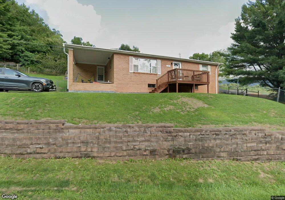
1294 Earls Branch Rd Cedar Bluff, VA 24609
Estimated Value: $111,000 - $198,000
3
Beds
1
Bath
1,258
Sq Ft
$115/Sq Ft
Est. Value
About This Home
This home is located at 1294 Earls Branch Rd, Cedar Bluff, VA 24609 and is currently estimated at $144,314, approximately $114 per square foot. 1294 Earls Branch Rd is a home located in Tazewell County.
Ownership History
Date
Name
Owned For
Owner Type
Purchase Details
Closed on
Sep 25, 2014
Sold by
Mccracken Randall and Mccracken Kimberly S
Bought by
Mccracken Brandon
Current Estimated Value
Home Financials for this Owner
Home Financials are based on the most recent Mortgage that was taken out on this home.
Original Mortgage
$26,000
Interest Rate
4.12%
Mortgage Type
New Conventional
Create a Home Valuation Report for This Property
The Home Valuation Report is an in-depth analysis detailing your home's value as well as a comparison with similar homes in the area
Purchase History
| Date | Buyer | Sale Price | Title Company |
|---|---|---|---|
| Mccracken Brandon | $51,000 | None Available |
Source: Public Records
Mortgage History
| Date | Status | Borrower | Loan Amount |
|---|---|---|---|
| Closed | Mccracken Brandon | $26,000 |
Source: Public Records
Tax History
| Year | Tax Paid | Tax Assessment Tax Assessment Total Assessment is a certain percentage of the fair market value that is determined by local assessors to be the total taxable value of land and additions on the property. | Land | Improvement |
|---|---|---|---|---|
| 2025 | $564 | $97,200 | $12,000 | $85,200 |
| 2024 | $564 | $97,200 | $12,000 | $85,200 |
| 2023 | $448 | $77,200 | $6,000 | $71,200 |
| 2022 | $448 | $77,200 | $6,000 | $71,200 |
| 2021 | $448 | $77,200 | $6,000 | $71,200 |
| 2020 | $448 | $77,200 | $6,000 | $71,200 |
| 2019 | $448 | $77,200 | $6,000 | $71,200 |
| 2018 | $400 | $77,200 | $6,000 | $71,200 |
| 2017 | $400 | $72,800 | $6,000 | $66,800 |
| 2016 | -- | $72,800 | $6,000 | $66,800 |
| 2015 | -- | $72,800 | $6,000 | $66,800 |
| 2014 | -- | $72,800 | $6,000 | $66,800 |
| 2013 | -- | $72,800 | $6,000 | $66,800 |
Source: Public Records
Map
Nearby Homes
- 386 Keen Rd
- TBD Cliff Rd
- 18537 Governor G C Peery Hwy
- 18466 Governor George C Peery Hwy
- 149 Cochran Hollow Rd
- 624&638 Baptist Valley Rd
- TBD Lickbranch Rd
- 5910 Dry Fork Rd
- 220 220 Easy St
- TBD Dry Fork Rd
- 4330 Ravens Nest Branch Rd
- 2906 Pounding Mill Branch Rd
- 955 Wakefield Dr
- 160 Riverbend Ln
- TBD Green Acres Rd
- 6426 Baptist Valley Rd
- 1532 Indian Creek Rd
- TBD Bandy Rd Whitaker Ridge Area
- 153 Ashley St
- 721 Pond St
- 1336 Earls Branch Rd
- 1317 Earls Branch Rd
- 1356 Earls Branch Rd
- 1356 Earls Branch Rd
- 1265 Earls Branch Rd
- 1372 Earls Branch Rd
- 146 Richardson Hollow Rd
- 124 Ferndale St
- 1274 Earls Branch Rd
- 236 Richardson Hollow Rd
- 226 Ferndale St
- 1268 Earls Branch Rd
- 313 Richardson Hollow Rd
- 1457 Earls Branch Rd
- 1475 Earls Branch Rd
- 230 Ferndale St
- 232 Ferndale St
- 1486 Earls Branch Rd
- 1052 Earls Branch Rd
- 1518 Earls Branch Rd
Your Personal Tour Guide
Ask me questions while you tour the home.