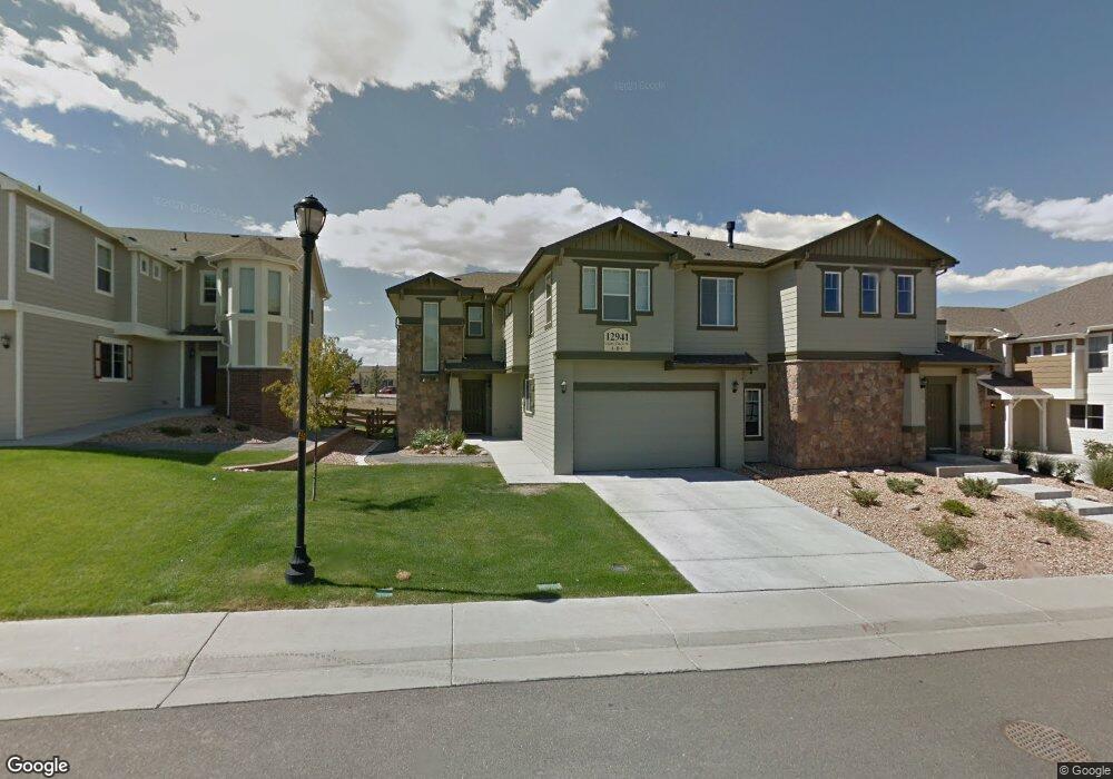
12941 Grant Cir W Thornton, CO 80241
Estimated Value: $393,000 - $404,817
2
Beds
2
Baths
1,162
Sq Ft
$343/Sq Ft
Est. Value
About This Home
This home is located at 12941 Grant Cir W, Thornton, CO 80241 and is currently estimated at $398,204, approximately $342 per square foot. 12941 Grant Cir W is a home located in Adams County with nearby schools including Hunters Glen Elementary School, Century Middle School, and Mountain Range High School.
Ownership History
Date
Name
Owned For
Owner Type
Purchase Details
Closed on
May 6, 2025
Sold by
Keith Holli
Bought by
Wolfe Gary and Wolfe Cheri
Current Estimated Value
Purchase Details
Closed on
Oct 8, 2018
Sold by
Laporte Henry J and Laporte Linda Laporte
Bought by
Qu Mindong
Purchase Details
Closed on
Feb 12, 2015
Sold by
Laporte Henry J and Laporte Linda M
Bought by
Henry J Laporte & Linda Laporte Family T
Purchase Details
Closed on
Mar 26, 2014
Sold by
Owings Larry
Bought by
Laporte Henry J and Laporte Linda M
Purchase Details
Closed on
Jun 3, 2011
Sold by
Villas At Thorncreek Llc
Bought by
Owings Larry
Home Financials for this Owner
Home Financials are based on the most recent Mortgage that was taken out on this home.
Original Mortgage
$159,393
Interest Rate
4.5%
Mortgage Type
FHA
Create a Home Valuation Report for This Property
The Home Valuation Report is an in-depth analysis detailing your home's value as well as a comparison with similar homes in the area
Home Values in the Area
Average Home Value in this Area
Purchase History
| Date | Buyer | Sale Price | Title Company |
|---|---|---|---|
| Wolfe Gary | $395,000 | Land Title | |
| Qu Mindong | $301,000 | Colorado Escrow & Title | |
| Henry J Laporte & Linda Laporte Family T | -- | None Available | |
| Laporte Henry J | $170,000 | Heritage Title | |
| Owings Larry | $163,539 | Land Title Guarantee Company |
Source: Public Records
Mortgage History
| Date | Status | Borrower | Loan Amount |
|---|---|---|---|
| Previous Owner | Owings Larry | $159,393 |
Source: Public Records
Tax History Compared to Growth
Tax History
| Year | Tax Paid | Tax Assessment Tax Assessment Total Assessment is a certain percentage of the fair market value that is determined by local assessors to be the total taxable value of land and additions on the property. | Land | Improvement |
|---|---|---|---|---|
| 2024 | $2,417 | $24,190 | $5,000 | $19,190 |
| 2023 | $2,392 | $27,060 | $4,400 | $22,660 |
| 2022 | $2,263 | $20,540 | $4,240 | $16,300 |
| 2021 | $2,337 | $20,540 | $4,240 | $16,300 |
| 2020 | $2,278 | $20,420 | $4,360 | $16,060 |
| 2019 | $2,283 | $20,420 | $4,360 | $16,060 |
| 2018 | $2,006 | $17,430 | $1,160 | $16,270 |
| 2017 | $1,824 | $17,430 | $1,160 | $16,270 |
| 2016 | $1,421 | $13,220 | $1,280 | $11,940 |
| 2015 | $1,419 | $13,220 | $1,280 | $11,940 |
| 2014 | -- | $10,870 | $1,280 | $9,590 |
Source: Public Records
Map
Nearby Homes
- 12921 Grant Cir W Unit B
- 12910 Grant Cir W Unit C
- 12901 Grant Cir W Unit C
- 12962 Grant Cir E Unit C
- 13043 Grant Cir E Unit C
- 13141 Grant Cir N Unit B
- 13151 Grant Cir N Unit B
- 13151 Grant Cir N Unit C
- 0 128th & Washington St
- 634 E 130th Way
- 609 W 130th Ave
- 943 E 130th Dr
- 13283 Clarkson St
- 12901 Galapago St
- 1124 E 130th Ave Unit C
- 1089 E 131st Dr
- 811 W 128th Place
- 1162 E 130th Ave Unit B
- 834 W 128th Place
- 12941 Lafayette St Unit G
- 12941 Grant Cir W Unit C
- 12941 Grant Cir W Unit A
- 12941 Grant Cir W Unit B
- 12951 Grant Cirw Unit C
- 12951 Grant Cir W Unit A
- 12951 Grant Cir W Unit B
- 12951 Grant Cir W Unit C
- 12951 Grant Cir W Unit 34C
- 12931 Grant Cir W Unit C
- 12931 Grant Cir W Unit A
- 12931 Grant Cir W Unit B
- 12950 Grant Cir Unit C
- 12950 Grant Cir W Unit C
- 12950 Grant Cir W Unit B
- 12950 Grant Cir W Unit A
- 12940 Grant Cir W Unit A
- 12940 Grant Cir W Unit C
- 12940 Grant Cir W Unit 78C
- 12921 Grant Cir W Unit A
- 12921 Grant Cir W Unit C