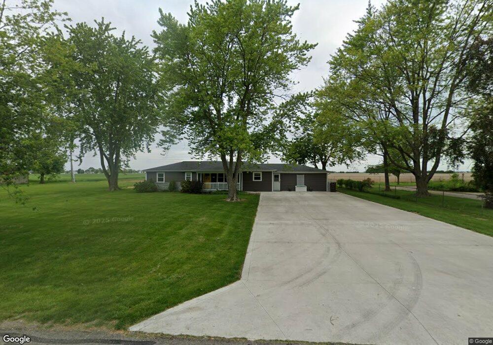
12941 Maple Ave Paulding, OH 45879
Estimated Value: $191,000 - $225,000
3
Beds
2
Baths
1,868
Sq Ft
$108/Sq Ft
Est. Value
About This Home
This home is located at 12941 Maple Ave, Paulding, OH 45879 and is currently estimated at $202,088, approximately $108 per square foot. 12941 Maple Ave is a home located in Paulding County with nearby schools including Paulding High School.
Ownership History
Date
Name
Owned For
Owner Type
Purchase Details
Closed on
Jul 18, 2008
Sold by
Pease Chad R and Pease Angel N
Bought by
Pease Chad R and Pease Angel N
Current Estimated Value
Purchase Details
Closed on
Aug 2, 2001
Sold by
Stoller Brian S
Bought by
Pease Chad R and Pease Angel N
Purchase Details
Closed on
Nov 17, 1998
Bought by
Pease Chad R and Pease Angel N
Create a Home Valuation Report for This Property
The Home Valuation Report is an in-depth analysis detailing your home's value as well as a comparison with similar homes in the area
Home Values in the Area
Average Home Value in this Area
Purchase History
| Date | Buyer | Sale Price | Title Company |
|---|---|---|---|
| Pease Chad R | -- | None Available | |
| Pease Chad R | $80,000 | -- | |
| Pease Chad R | $38,500 | -- |
Source: Public Records
Tax History
| Year | Tax Paid | Tax Assessment Tax Assessment Total Assessment is a certain percentage of the fair market value that is determined by local assessors to be the total taxable value of land and additions on the property. | Land | Improvement |
|---|---|---|---|---|
| 2025 | $2,535 | $58,490 | $13,650 | $44,840 |
| 2024 | $2,535 | $44,980 | $10,500 | $34,480 |
| 2023 | $2,026 | $40,950 | $10,500 | $30,450 |
| 2022 | $1,799 | $40,950 | $10,500 | $30,450 |
| 2021 | $1,583 | $32,240 | $7,880 | $24,360 |
| 2020 | $1,420 | $32,240 | $7,880 | $24,360 |
| 2019 | $1,432 | $30,040 | $7,880 | $22,160 |
| 2018 | $1,354 | $30,040 | $7,880 | $22,160 |
| 2017 | $1,355 | $30,040 | $7,880 | $22,160 |
| 2016 | $1,361 | $30,040 | $7,880 | $22,160 |
| 2015 | $1,253 | $28,080 | $7,880 | $20,200 |
| 2014 | $1,247 | $28,080 | $7,880 | $20,200 |
| 2013 | $1,344 | $28,080 | $7,880 | $20,200 |
Source: Public Records
Map
Nearby Homes
- 830 N Walnut St
- 1118 Emerald Rd
- 713 N Walnut St
- 741 Tom Tim Dr
- 516 N Williams St
- 13688 Kay St
- 406 N Cherry St
- 301 N Main St
- 215 N Dewitt St
- 780 W Jackson St
- 717 W Harrison St
- 520 W Wayne St
- 111 W Wayne St
- 714 W Wayne St
- 200 German St
- 701 E Wayne St
- 742 E Perry St
- 11051 Road 93
- 15010 U S 127
- 225 2nd St
- 12811 Maple Ave
- 12155 Royer Ave
- 12932 Maple Ave
- 12035 Royer Ave
- 12335 Royer Ave
- 12866 Maple Ave
- 12531 Royer Ave
- 12741 Maple Ave
- 1098 N Williams St
- 1096 N Williams St
- 1110 N Williams St
- 12673 Maple Ave
- 12702 Maple Ave
- 1250 N Williams St
- 1090 N Williams St
- 0 N Williams St Unit 5079840
- 1082 N Williams St
- 12605 Maple Ave
- 12642 Maple Ave
- 12582 Maple Ave
Your Personal Tour Guide
Ask me questions while you tour the home.