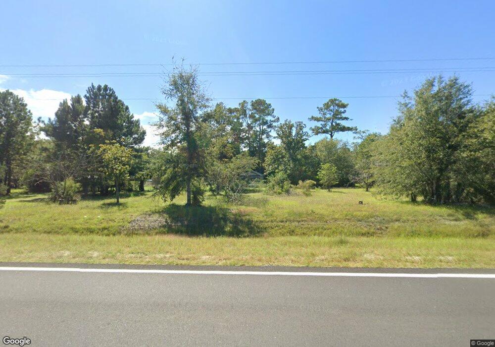
12947 Highway 110 W Hortense, GA 31543
Estimated Value: $58,212 - $211,000
--
Bed
1
Bath
936
Sq Ft
$129/Sq Ft
Est. Value
About This Home
This home is located at 12947 Highway 110 W, Hortense, GA 31543 and is currently estimated at $120,553, approximately $128 per square foot. 12947 Highway 110 W is a home located in Brantley County with nearby schools including Nahunta Primary School, Nahunta Elementary School, and Brantley County Middle School.
Ownership History
Date
Name
Owned For
Owner Type
Purchase Details
Closed on
Apr 15, 2021
Sold by
Herrin Shamra Helena Davis
Bought by
Owens Michael Leon
Current Estimated Value
Purchase Details
Closed on
Aug 13, 2018
Sold by
Davis Timothy Ashton
Bought by
Herrin Helena Shamara Davis and Herrin John Daniel
Purchase Details
Closed on
Jul 10, 2017
Sold by
Herrin Shamara Helena Davi
Bought by
Herrin John Daniel
Purchase Details
Closed on
Nov 29, 2016
Sold by
Marvin Harry
Bought by
Davis Timothy Ashton
Create a Home Valuation Report for This Property
The Home Valuation Report is an in-depth analysis detailing your home's value as well as a comparison with similar homes in the area
Home Values in the Area
Average Home Value in this Area
Purchase History
| Date | Buyer | Sale Price | Title Company |
|---|---|---|---|
| Owens Michael Leon | $28,000 | -- | |
| Herrin Helena Shamara Davis | -- | -- | |
| Herrin John Daniel | -- | -- | |
| Davis Timothy Ashton | -- | -- | |
| Crews William Joseph | -- | -- | |
| Herrin Shamara Helena Davis | -- | -- |
Source: Public Records
Tax History Compared to Growth
Tax History
| Year | Tax Paid | Tax Assessment Tax Assessment Total Assessment is a certain percentage of the fair market value that is determined by local assessors to be the total taxable value of land and additions on the property. | Land | Improvement |
|---|---|---|---|---|
| 2024 | $666 | $11,502 | $1,452 | $10,050 |
| 2023 | $662 | $11,370 | $1,320 | $10,050 |
| 2022 | $658 | $11,174 | $1,320 | $9,854 |
| 2021 | $616 | $10,177 | $1,320 | $8,857 |
| 2020 | $626 | $10,177 | $1,320 | $8,857 |
| 2019 | $626 | $10,177 | $1,320 | $8,857 |
| 2018 | $0 | $11,444 | $2,587 | $8,857 |
| 2017 | -- | $11,444 | $2,587 | $8,857 |
Source: Public Records
Map
Nearby Homes
- 771 Heritage Cir
- 151 Lisa Ln
- 0 Heritage Cir Unit 1656067
- 0 Heritage Cir Unit 1656069
- 0 Heritage Cir Unit 1656065
- 0 Heritage Cir Unit 1655955
- 0 Heritage Cir Unit 1655952
- 41 Middle Rd
- 1005 Fort McIntosh Loop
- 18583 Raybon Rd E
- 57 Mcintosh Trail
- 603 Cumberland Rd
- 559 Cumberland Rd
- 0 Dogwood Rd
- 743 Sandy Loop
- 944 Warners Landing
- 23 Pinebark Rd
- 0 Weeping Willow Rd
- Off Dogwood Rd
- 7535 Browntown Rd
- 00 Horseshoe Dr
- 12994 Highway 110 W
- 84 Horseshoe Dr
- 0 Hy 110 Unit 16841
- 13091 Highway 110 W
- 12730 Highway 110 W
- 376 Horseshoe Dr
- 387 Horseshoe Dr
- 25 Deer Run Trail
- 419 Horseshoe Dr
- 53 Deer Run Trail
- 109 Deer Run Trail
- 141 Deer Run Trail
- 13489 Highway 110 W
- 435 Deer Run Trail
- 349 Deer Run Trail
- 299 Deer Run Trail
- 547 Deer Run Trail
- 211 Deer Run Trail
- 5 Deer Run Trail
