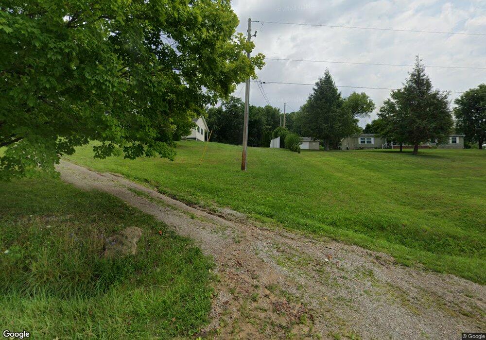
12948 State Route 691 Nelsonville, OH 45764
Estimated Value: $160,347 - $246,000
3
Beds
2
Baths
1,344
Sq Ft
$141/Sq Ft
Est. Value
About This Home
This home is located at 12948 State Route 691, Nelsonville, OH 45764 and is currently estimated at $188,837, approximately $140 per square foot. 12948 State Route 691 is a home located in Athens County with nearby schools including Nelsonville-York Elementary School, Nelsonville-York Junior High School, and Nelsonville-York High School.
Ownership History
Date
Name
Owned For
Owner Type
Purchase Details
Closed on
May 27, 2020
Sold by
Mcgee Joann and Mcgee Joann E
Bought by
Beyette Heather and Marquez Santillan Cesar
Current Estimated Value
Home Financials for this Owner
Home Financials are based on the most recent Mortgage that was taken out on this home.
Original Mortgage
$127,645
Outstanding Balance
$113,358
Interest Rate
3.3%
Mortgage Type
FHA
Estimated Equity
$75,479
Purchase Details
Closed on
Mar 14, 2001
Sold by
Mcgee John
Bought by
Mcgee Joann E
Create a Home Valuation Report for This Property
The Home Valuation Report is an in-depth analysis detailing your home's value as well as a comparison with similar homes in the area
Home Values in the Area
Average Home Value in this Area
Purchase History
| Date | Buyer | Sale Price | Title Company |
|---|---|---|---|
| Beyette Heather | $130,000 | Valmer Land Title Agency Llc | |
| Mcgee Joann E | -- | -- |
Source: Public Records
Mortgage History
| Date | Status | Borrower | Loan Amount |
|---|---|---|---|
| Open | Beyette Heather | $127,645 |
Source: Public Records
Tax History Compared to Growth
Tax History
| Year | Tax Paid | Tax Assessment Tax Assessment Total Assessment is a certain percentage of the fair market value that is determined by local assessors to be the total taxable value of land and additions on the property. | Land | Improvement |
|---|---|---|---|---|
| 2024 | $1,535 | $34,660 | $9,630 | $25,030 |
| 2023 | $1,509 | $34,660 | $9,630 | $25,030 |
| 2022 | $1,277 | $27,910 | $8,020 | $19,890 |
| 2021 | $1,282 | $27,910 | $8,020 | $19,890 |
| 2020 | $1,283 | $27,910 | $8,020 | $19,890 |
| 2019 | $1,105 | $23,910 | $6,770 | $17,140 |
| 2018 | $1,109 | $23,910 | $6,770 | $17,140 |
| 2017 | $1,578 | $23,910 | $6,770 | $17,140 |
| 2016 | $1,077 | $22,060 | $6,160 | $15,900 |
| 2015 | $1,456 | $22,060 | $6,160 | $15,900 |
| 2014 | $1,456 | $22,060 | $6,160 | $15,900 |
| 2013 | $1,333 | $21,240 | $5,810 | $15,430 |
Source: Public Records
Map
Nearby Homes
- 11685 State Route 691
- 12981 Spice Lick Rd
- 14946 Ohio 691
- 6559 Poston Rd
- 11250 Grass Run Rd
- 0 Lemaster Rd
- 0 Lemaster Rd Unit 23368524
- 0 Lemaster Rd Unit 11486521
- 10775 Rosewood Ln
- 5910 Vore Ridge Rd
- 4624 Rhoric Rd
- 0 Salem Rd
- 11676 Channingway Blvd
- 90 Main St
- 1310 E Canal St
- 27 North St
- 0 Shady Ln
- 8258 W Bailey Rd
- 12819 Upper River
- 57 Ohio Ave
- 12944 Ohio 691
- 12865 State Route 691
- 12936 State Route 691
- 12826 State Route 691
- 12845 State Route 691
- 12821 State Route 691
- 12776 State Route 691
- SR691 Highway
- 12666 State Route 691
- 12666 Ohio 691
- 12606 Ohio 691
- 12475 State Route 691
- 4282 Perry Ridge
- 12470 State Route 691
- 12425 State Route 691
- 4164 Perry Ridge
- 4331 Perry Ridge
- 4154 Perry Ridge
- 4374 Perry Ridge
- 4145 Perry Ridge
