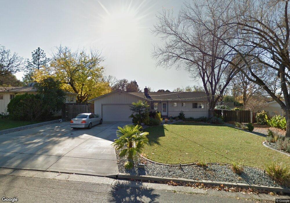
1295 Dusty Ln Redding, CA 96002
Mistletoe NeighborhoodEstimated Value: $269,000 - $308,000
3
Beds
2
Baths
1,238
Sq Ft
$236/Sq Ft
Est. Value
About This Home
This home is located at 1295 Dusty Ln, Redding, CA 96002 and is currently estimated at $292,087, approximately $235 per square foot. 1295 Dusty Ln is a home located in Shasta County with nearby schools including Mistletoe Elementary School, Enterprise High School, and Montessori Children's House of Shady Oaks.
Ownership History
Date
Name
Owned For
Owner Type
Purchase Details
Closed on
Apr 12, 2022
Sold by
Fox Shane T and Fox Shellie
Bought by
Shane T And Shellie M Fox Revocable Trust
Current Estimated Value
Purchase Details
Closed on
Sep 17, 2002
Sold by
Fox Shane T and Fox Shanna N
Bought by
Fox Shane T and Fox Shellie
Purchase Details
Closed on
Dec 9, 1998
Sold by
Revoc Liv Trust Schlichenmayer Richard & Doro and Schlichenmayer Richard
Bought by
Fox Shanna N
Home Financials for this Owner
Home Financials are based on the most recent Mortgage that was taken out on this home.
Original Mortgage
$89,514
Interest Rate
6.86%
Mortgage Type
FHA
Create a Home Valuation Report for This Property
The Home Valuation Report is an in-depth analysis detailing your home's value as well as a comparison with similar homes in the area
Home Values in the Area
Average Home Value in this Area
Purchase History
We collect this data history from publicly available records. To have your information removed, we recommend requesting removal directly through your county’s website.
| Date | Buyer | Sale Price | Title Company |
|---|---|---|---|
| Shane T And Shellie M Fox Revocable Trust | -- | Arel Justin G | |
| Fox Shane T | -- | -- | |
| Fox Shanna N | $90,000 | Placer Title Company |
Source: Public Records
Mortgage History
We collect this data history from publicly available records. To have your information removed, we recommend requesting removal directly through your county’s website.
| Date | Status | Borrower | Loan Amount |
|---|---|---|---|
| Previous Owner | Fox Shanna N | $89,514 | |
| Closed | Fox Shanna N | $4,475 |
Source: Public Records
Tax History
| Year | Tax Paid | Tax Assessment Tax Assessment Total Assessment is a certain percentage of the fair market value that is determined by local assessors to be the total taxable value of land and additions on the property. | Land | Improvement |
|---|---|---|---|---|
| 2025 | $1,838 | $167,559 | $48,848 | $118,711 |
| 2024 | $1,812 | $164,275 | $47,891 | $116,384 |
| 2023 | $1,812 | $161,054 | $46,952 | $114,102 |
| 2022 | $1,761 | $157,897 | $46,032 | $111,865 |
| 2021 | $1,701 | $154,802 | $45,130 | $109,672 |
| 2020 | $1,694 | $153,216 | $44,668 | $108,548 |
| 2019 | $1,680 | $150,213 | $43,793 | $106,420 |
| 2018 | $1,661 | $147,269 | $42,935 | $104,334 |
| 2017 | $1,690 | $144,383 | $42,094 | $102,289 |
| 2016 | $1,581 | $141,553 | $41,269 | $100,284 |
| 2015 | $1,568 | $139,428 | $40,650 | $98,778 |
| 2014 | $1,557 | $136,698 | $39,854 | $96,844 |
Source: Public Records
Map
Nearby Homes
- 1451 Carter Way
- 1448 Mistletoe Ln
- 1953 Cameo Ct
- 1568 Victor Ave
- 2093 Victor Ave
- 1479 Atajo Ct
- 1285 Lancers Ln
- 1890 Manchester Dr
- 785 Mallard St
- 1865 Dellwood Dr
- 1701 E Cypress Ave
- 2583 Reservoir Ln
- 2091 Oshea Way
- 948 Jamieson Ct
- 2631 Alfreda Way
- 1943 Bechelli Ln
- 1937 Bechelli Ln
- 1928 Bechelli Ln
- 1968 Bechelli Ln
- 2539 Yana Ave
- 1325 Dusty Ln
- 1289 Dusty Ln
- 1394 Carter Way
- 1412 Carter Way
- 1375 Dusty Ln Unit ONE
- 1375 Dusty Ln
- 1283 Dusty Ln
- 1372 Carter Way
- 1298 Dusty Ln
- 1430 Carter Way
- 1326 Dusty Ln
- 1294 Dusty Ln
- 1401 Dusty Ln
- 1288 Dusty Ln
- 1380 Dusty Ln
- 1279 Dusty Ln
- 1350 Carter Way
- 1280 Dusty Ln
- 1410 Dusty Ln
- 1787 Cedarwood Dr
Your Personal Tour Guide
Ask me questions while you tour the home.