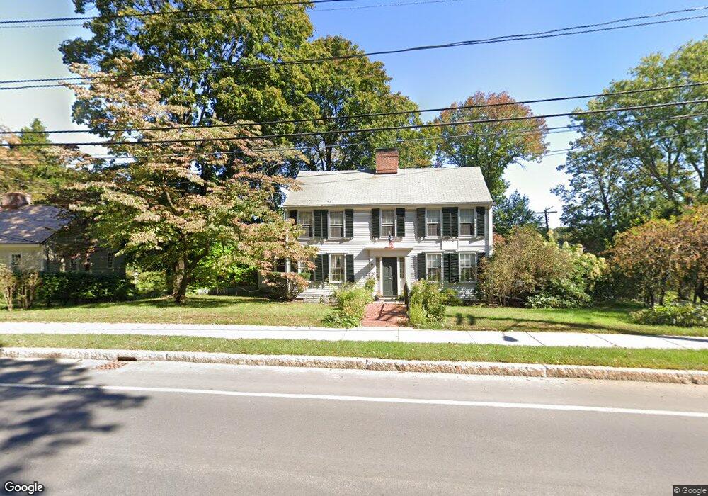
1295 Massachusetts Ave Lexington, MA 02420
Munroe Hill NeighborhoodEstimated Value: $1,398,000 - $1,667,000
4
Beds
3
Baths
2,376
Sq Ft
$640/Sq Ft
Est. Value
About This Home
This home is located at 1295 Massachusetts Ave, Lexington, MA 02420 and is currently estimated at $1,519,869, approximately $639 per square foot. 1295 Massachusetts Ave is a home located in Middlesex County with nearby schools including Bowman Elementary School, Jonas Clarke Middle School, and Lexington High School.
Ownership History
Date
Name
Owned For
Owner Type
Purchase Details
Closed on
Jun 28, 2024
Sold by
Grimes Katherine E
Bought by
Grimes Nt and Grimes
Current Estimated Value
Purchase Details
Closed on
Nov 29, 1990
Sold by
Smith R Lanpher
Bought by
Green David W
Home Financials for this Owner
Home Financials are based on the most recent Mortgage that was taken out on this home.
Original Mortgage
$288,000
Interest Rate
10.16%
Mortgage Type
Purchase Money Mortgage
Create a Home Valuation Report for This Property
The Home Valuation Report is an in-depth analysis detailing your home's value as well as a comparison with similar homes in the area
Home Values in the Area
Average Home Value in this Area
Purchase History
| Date | Buyer | Sale Price | Title Company |
|---|---|---|---|
| Grimes Nt | -- | None Available | |
| Grimes Nt | -- | None Available | |
| Green David W | $320,000 | -- | |
| Green David W | $320,000 | -- |
Source: Public Records
Mortgage History
| Date | Status | Borrower | Loan Amount |
|---|---|---|---|
| Previous Owner | Green David W | $150,000 | |
| Previous Owner | Green David W | $285,600 | |
| Previous Owner | Green David W | $288,000 |
Source: Public Records
Tax History Compared to Growth
Tax History
| Year | Tax Paid | Tax Assessment Tax Assessment Total Assessment is a certain percentage of the fair market value that is determined by local assessors to be the total taxable value of land and additions on the property. | Land | Improvement |
|---|---|---|---|---|
| 2025 | $16,767 | $1,371,000 | $765,000 | $606,000 |
| 2024 | $16,342 | $1,334,000 | $728,000 | $606,000 |
| 2023 | $16,003 | $1,231,000 | $662,000 | $569,000 |
| 2022 | $15,083 | $1,093,000 | $602,000 | $491,000 |
| 2021 | $14,577 | $1,013,000 | $573,000 | $440,000 |
| 2020 | $14,106 | $1,004,000 | $573,000 | $431,000 |
| 2019 | $13,527 | $958,000 | $546,000 | $412,000 |
| 2018 | $13,228 | $925,000 | $520,000 | $405,000 |
| 2017 | $12,795 | $883,000 | $486,000 | $397,000 |
| 2016 | $12,366 | $847,000 | $457,000 | $390,000 |
| 2015 | $11,829 | $796,000 | $416,000 | $380,000 |
| 2014 | $10,438 | $673,000 | $369,000 | $304,000 |
Source: Public Records
Map
Nearby Homes
- 10 Eliot Rd
- 1437 Massachusetts Ave
- 20 Marrett Rd
- 5 Carnegie Place
- 25 Maple St
- 1 Tricorne Rd
- 197 Woburn St
- 35 Tower Rd
- 36 Independence Ave
- 42 Winthrop Rd
- 71 Webb St
- 22 Bryant Rd
- 223 Waltham St
- 30 Meriam St Unit 30
- 1894 Massachusetts Ave
- 32 Edgewood Rd Unit 1
- 1900 Massachusetts Ave
- 24 Grapevine Ave
- 32 Forest St
- 218 Lowell St
- 1299 Massachusetts Ave Unit 1299
- 1299 Massachusetts Ave
- 1299 Massachusetts Ave Unit 1
- 1299 Massachusetts Ave
- 1 Pelham Rd
- 1308 Massachusetts Ave
- 1310 Massachusetts Ave
- 1312 Massachusetts Ave
- 1303 Massachusetts Ave Unit 6B
- 1303 Massachusetts Ave Unit 6A
- 1303 Massachusetts Ave Unit 6A and 6B
- 5 Hollow Ln
- 2 Hollow Ln
- 16 Tavern Ln
- 14 Tavern Ln
- 3 Eliot Rd
- 1314 Massachusetts Ave
- 4 Hollow Ln
- 12 Tavern Ln
- 1341 Massachusetts Ave