Estimated Value: $182,567 - $200,000
3
Beds
1
Bath
960
Sq Ft
$202/Sq Ft
Est. Value
About This Home
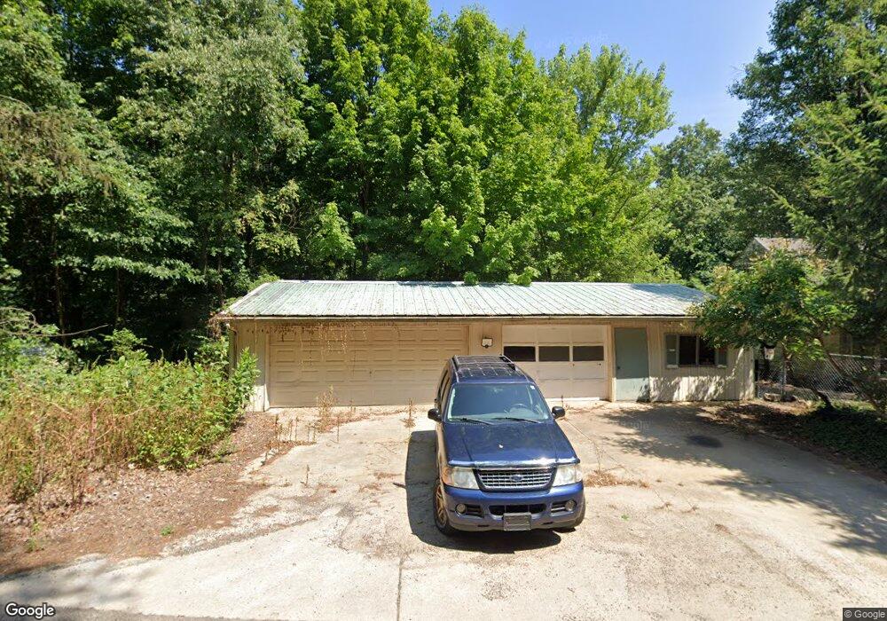
This home is located at 1295 W Bertrand Rd, Niles, MI 49120 and is currently estimated at $193,642, approximately $201 per square foot. 1295 W Bertrand Rd is a home located in Berrien County with nearby schools including Merritt Elementary School, Brandywine Elementary School, and Brandywine Middle School.
Ownership History
Date
Name
Owned For
Owner Type
Purchase Details
Closed on
Feb 9, 2007
Sold by
Ballard Trisha
Bought by
Oliphant Daniel L
Current Estimated Value
Home Financials for this Owner
Home Financials are based on the most recent Mortgage that was taken out on this home.
Original Mortgage
$77,400
Outstanding Balance
$46,642
Interest Rate
6.27%
Mortgage Type
Unknown
Estimated Equity
$147,000
Purchase Details
Closed on
Aug 5, 2002
Purchase Details
Closed on
Oct 22, 1998
Create a Home Valuation Report for This Property
The Home Valuation Report is an in-depth analysis detailing your home's value as well as a comparison with similar homes in the area
Purchase History
| Date | Buyer | Sale Price | Title Company |
|---|---|---|---|
| Oliphant Daniel L | -- | None Available | |
| -- | -- | -- | |
| -- | $68,000 | -- |
Source: Public Records
Mortgage History
| Date | Status | Borrower | Loan Amount |
|---|---|---|---|
| Open | Oliphant Daniel L | $77,400 |
Source: Public Records
Tax History
| Year | Tax Paid | Tax Assessment Tax Assessment Total Assessment is a certain percentage of the fair market value that is determined by local assessors to be the total taxable value of land and additions on the property. | Land | Improvement |
|---|---|---|---|---|
| 2025 | $1,036 | $71,600 | $0 | $0 |
| 2024 | $559 | $63,700 | $0 | $0 |
| 2023 | $533 | $54,100 | $0 | $0 |
| 2022 | $507 | $46,300 | $0 | $0 |
| 2021 | $928 | $44,500 | $16,900 | $27,600 |
| 2020 | $926 | $44,800 | $0 | $0 |
| 2019 | $909 | $36,500 | $13,100 | $23,400 |
| 2018 | $892 | $36,500 | $0 | $0 |
| 2017 | $882 | $36,700 | $0 | $0 |
| 2016 | $867 | $38,200 | $0 | $0 |
| 2015 | $831 | $36,300 | $0 | $0 |
| 2014 | $365 | $35,800 | $0 | $0 |
Source: Public Records
Map
Nearby Homes
- 1610 Whitetail Cir
- 1650 Whitetail Cir
- 1640 Forest St
- 2710 Weaver Rd
- 1680 River Bend Blvd
- 1670 River Bend Blvd
- 2618 Bond St
- 110 Ontario Rd
- 1560 Stonecreek Dr Unit 14
- 2816 Madison St
- 242 Higgins St
- 2639 S 3rd St
- 317 E Bertrand Rd
- 321 E Bertrand Rd
- 50615 Oakland Ave
- 20162 Wedgewood Dr
- Lot 4 Persimmon Dr Unit 4
- 1110 Dewitt Ave
- 3120 Woodlawn St
- 21380 Kroft Dr
- 1315 W Bertrand Rd
- 1280 W Bertrand Rd
- 1345 W Bertrand Rd
- 1340 W Bertrand Rd
- 1250 W Bertrand Rd
- 1260 W Bertrand Rd
- 1370 W Bertrand Rd
- 2780 Copp Rd
- 2750 Copp Rd
- 2760 Copp Rd
- 1390 W Bertrand Rd
- 1255 W Bertrand Rd
- 1195 W Bertrand Rd
- V/L #4 Bertrand Rd
- 2784 Copp Rd
- 1400 W Bertrand Rd
- 2765 Copp Rd
- 2775 Copp Rd
- 1185 W Bertrand Rd
- 2790 Copp Rd
Your Personal Tour Guide
Ask me questions while you tour the home.