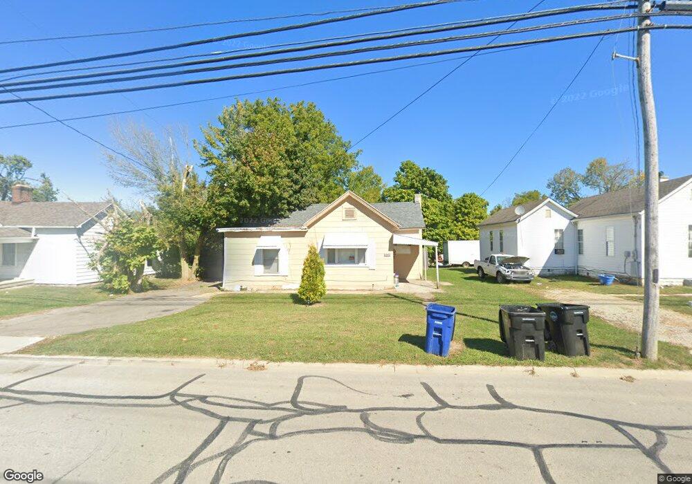
1295 W Main St Wilmington, OH 45177
Estimated Value: $119,000 - $202,000
3
Beds
1
Bath
1,120
Sq Ft
$140/Sq Ft
Est. Value
About This Home
This home is located at 1295 W Main St, Wilmington, OH 45177 and is currently estimated at $156,253, approximately $139 per square foot. 1295 W Main St is a home located in Clinton County with nearby schools including East End Elementary School, Roy E. Holmes Elementary School, and Denver Place Elementary School.
Ownership History
Date
Name
Owned For
Owner Type
Purchase Details
Closed on
Sep 29, 2008
Sold by
Fannie Mae
Bought by
Marine Bill D
Current Estimated Value
Purchase Details
Closed on
Jun 29, 2005
Sold by
Fisher Lawrence L and Estate Of Joy I Fisher
Bought by
Caplinger Donald G
Home Financials for this Owner
Home Financials are based on the most recent Mortgage that was taken out on this home.
Original Mortgage
$51,550
Interest Rate
5.75%
Mortgage Type
Fannie Mae Freddie Mac
Purchase Details
Closed on
Jan 1, 1990
Bought by
Caplinger Donald G
Create a Home Valuation Report for This Property
The Home Valuation Report is an in-depth analysis detailing your home's value as well as a comparison with similar homes in the area
Home Values in the Area
Average Home Value in this Area
Purchase History
| Date | Buyer | Sale Price | Title Company |
|---|---|---|---|
| Marine Bill D | -- | -- | |
| Caplinger Donald G | $51,600 | None Available | |
| Caplinger Donald G | -- | -- |
Source: Public Records
Mortgage History
| Date | Status | Borrower | Loan Amount |
|---|---|---|---|
| Previous Owner | Caplinger Donald G | $51,550 |
Source: Public Records
Tax History Compared to Growth
Tax History
| Year | Tax Paid | Tax Assessment Tax Assessment Total Assessment is a certain percentage of the fair market value that is determined by local assessors to be the total taxable value of land and additions on the property. | Land | Improvement |
|---|---|---|---|---|
| 2024 | $834 | $24,190 | $7,880 | $16,310 |
| 2023 | $834 | $24,190 | $7,880 | $16,310 |
| 2022 | $483 | $13,190 | $7,150 | $6,040 |
| 2021 | $489 | $13,190 | $7,150 | $6,040 |
| 2020 | $460 | $13,190 | $7,150 | $6,040 |
| 2019 | $448 | $11,730 | $7,150 | $4,580 |
| 2018 | $452 | $11,730 | $7,150 | $4,580 |
| 2017 | $220 | $11,730 | $7,150 | $4,580 |
| 2016 | $600 | $15,830 | $9,210 | $6,620 |
| 2015 | $591 | $15,830 | $9,210 | $6,620 |
| 2013 | $611 | $16,180 | $9,210 | $6,970 |
Source: Public Records
Map
Nearby Homes
- 1244 Mayfair Dr
- 909 W Main St
- 1706 Woodside Dr
- 1351 Mayfair Dr
- 1247 Peggy Ln
- 629 Oakridge Dr
- 585 Silverado Dr
- 588 John Chambers Dr
- 1087 Warren Dr
- 166 Glenwood Cir
- 423 Howard St
- 373 Thorne Ave
- 668 Catalpa Dr
- 584 Howard St
- 914 Hickory Trail Dr
- 987 N Nelson Ave
- 360 Summit St
- 0 N Wood St
- 462 Randolph St
- 555 Cross Creek Dr
- 1287 W Main St
- 1313 W Main St
- 0 N Nelson Ave
- 0 N Nelson Ave Unit 1780937
- 0 N Nelson Ave Unit 1119131
- 1263 W Main St
- 1320 W Main St
- 1290 W Main St
- 1 N Nelson Ave
- 1402 W Main St
- 1400 W Locust St
- 1187 W Main St
- 148 N Nelson Ave
- 0 W Main St Unit 2610507
- 0 W Main St
- 1150 W Locust St Unit 100
- 1358 Wayne Rd Unit 22
- 1360 Wayne Rd
- 1362 Wayne Rd Unit 24
- 1131 W Main St