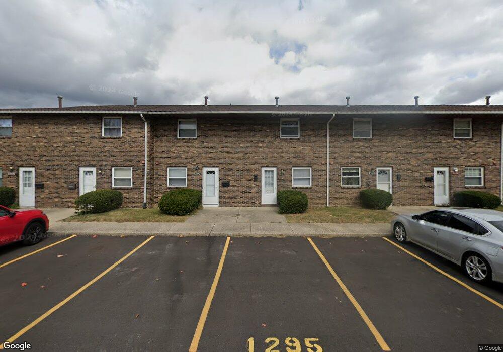
1295 Woodbrook Ln Unit 223 Columbus, OH 43223
Brookshire NeighborhoodEstimated Value: $112,269 - $127,000
2
Beds
2
Baths
960
Sq Ft
$122/Sq Ft
Est. Value
About This Home
This home is located at 1295 Woodbrook Ln Unit 223, Columbus, OH 43223 and is currently estimated at $117,567, approximately $122 per square foot. 1295 Woodbrook Ln Unit 223 is a home located in Franklin County with nearby schools including Lindbergh Elementary School, Hilltonia Middle School, and Briggs High School.
Ownership History
Date
Name
Owned For
Owner Type
Purchase Details
Closed on
Jan 10, 2014
Sold by
Easton Michael E
Bought by
Easton Michael and The Michael Easton Family Trust
Current Estimated Value
Purchase Details
Closed on
Aug 27, 2002
Sold by
Briggs J Richard and Briggs Marilyn
Bought by
Easton Michael E
Purchase Details
Closed on
Dec 24, 1991
Bought by
Briggs J Richard
Purchase Details
Closed on
Feb 13, 1991
Purchase Details
Closed on
Jan 1, 1984
Create a Home Valuation Report for This Property
The Home Valuation Report is an in-depth analysis detailing your home's value as well as a comparison with similar homes in the area
Home Values in the Area
Average Home Value in this Area
Purchase History
| Date | Buyer | Sale Price | Title Company |
|---|---|---|---|
| Easton Michael | -- | None Available | |
| Easton Michael E | $35,600 | -- | |
| Briggs J Richard | -- | -- | |
| -- | -- | -- | |
| -- | -- | -- |
Source: Public Records
Tax History Compared to Growth
Tax History
| Year | Tax Paid | Tax Assessment Tax Assessment Total Assessment is a certain percentage of the fair market value that is determined by local assessors to be the total taxable value of land and additions on the property. | Land | Improvement |
|---|---|---|---|---|
| 2024 | $1,259 | $27,480 | $5,250 | $22,230 |
| 2023 | $1,244 | $27,475 | $5,250 | $22,225 |
| 2022 | $683 | $12,850 | $1,540 | $11,310 |
| 2021 | $684 | $12,850 | $1,540 | $11,310 |
| 2020 | $685 | $12,850 | $1,540 | $11,310 |
| 2019 | $638 | $10,260 | $1,230 | $9,030 |
| 2018 | $538 | $10,260 | $1,230 | $9,030 |
| 2017 | $638 | $10,260 | $1,230 | $9,030 |
| 2016 | $483 | $7,110 | $1,300 | $5,810 |
| 2015 | $440 | $7,110 | $1,300 | $5,810 |
| 2014 | $441 | $7,110 | $1,300 | $5,810 |
| 2013 | $241 | $7,875 | $1,435 | $6,440 |
Source: Public Records
Map
Nearby Homes
- 1261 Woodbrook Ln Unit C
- 1261 Woodbrook Ln Unit D
- 1226 Woodbrook Cir W Unit 144
- 1226 Woodbrook Cir W Unit D
- 2345 Woodbrook Cir N Unit 100
- 2336 Woodbrook Cir N Unit 92 B
- 2336 Woodbrook Cir N Unit 91
- 2362 Woodbrook Cir N Unit 81
- 1119 Hardesty Place E Unit 1
- 0 S Central Ave
- 2382 Hardesty Dr S Unit Q-5
- 2430 Hardesty Dr S Unit S7
- 1085 Hardesty Place E Unit 4
- 2337 Hardesty Ct Unit 1
- 2547 Rosedale Ave
- 2322 Hardesty Ct Unit I11
- 2354 Hardesty Ct Unit JA6
- 2210 October Ridge Dr
- 2367 Hardesty Dr N Unit 1-1
- 2588 Regina Ave
- 1293 Woodbrook Ln
- 1297 Woodbrook Ln
- 1291 Woodbrook Ln
- 1299 Woodbrook Ln
- 1301 Woodbrook Ln
- 1289 Woodbrook Ln Unit 220
- 1287 Woodbrook Ln
- 1287 Woodbrook Ln Unit 219
- 1285 Woodbrook Ln Unit 218
- 1312 Woodbrook Ln
- 1314 Woodbrook Ln Unit 228
- 1279 Woodbrook Ln Unit 214
- 1279 Woodbrook Ln Unit 213
- 1279 Woodbrook Ln Unit 210
- 1279 Woodbrook Ln Unit 212
- 1279 Woodbrook Ln Unit 211
- 1279 Woodbrook Ln Unit 209
- 1279 Woodbrook Ln Unit 208
- 1279 Woodbrook Ln
- 1279 Woodbrook Ln