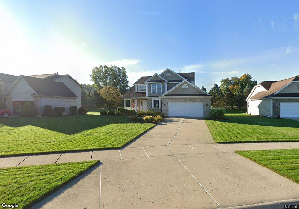
12954 Chartreuse Dr Dewitt, MI 48820
Estimated Value: $388,470 - $489,000
4
Beds
3
Baths
2,186
Sq Ft
$204/Sq Ft
Est. Value
About This Home
This home is located at 12954 Chartreuse Dr, Dewitt, MI 48820 and is currently estimated at $446,868, approximately $204 per square foot. 12954 Chartreuse Dr is a home located in Clinton County with nearby schools including Schavey Road Elementary School, Herbison Woods Elementary School, and Scott Elementary School.
Ownership History
Date
Name
Owned For
Owner Type
Purchase Details
Closed on
Nov 30, 2023
Sold by
Noel Mark W
Bought by
Mark W Noel Trust and Noel
Current Estimated Value
Purchase Details
Closed on
Nov 14, 2003
Sold by
Lakeside Preserve Llc
Bought by
Noel Mark W
Home Financials for this Owner
Home Financials are based on the most recent Mortgage that was taken out on this home.
Original Mortgage
$140,000
Interest Rate
5.81%
Mortgage Type
Purchase Money Mortgage
Create a Home Valuation Report for This Property
The Home Valuation Report is an in-depth analysis detailing your home's value as well as a comparison with similar homes in the area
Home Values in the Area
Average Home Value in this Area
Purchase History
| Date | Buyer | Sale Price | Title Company |
|---|---|---|---|
| Mark W Noel Trust | -- | None Listed On Document | |
| Noel Mark W | $36,000 | Metropolitan Title Okemos Se |
Source: Public Records
Mortgage History
| Date | Status | Borrower | Loan Amount |
|---|---|---|---|
| Previous Owner | Noel Mark W | $140,000 |
Source: Public Records
Tax History
| Year | Tax Paid | Tax Assessment Tax Assessment Total Assessment is a certain percentage of the fair market value that is determined by local assessors to be the total taxable value of land and additions on the property. | Land | Improvement |
|---|---|---|---|---|
| 2025 | $5,245 | $186,050 | $32,750 | $153,300 |
| 2024 | $15 | $170,350 | $29,700 | $140,650 |
| 2023 | $1,464 | $160,500 | $0 | $0 |
| 2022 | $4,750 | $144,800 | $25,700 | $119,100 |
| 2021 | $4,612 | $140,550 | $25,800 | $114,750 |
| 2020 | $4,327 | $138,900 | $24,400 | $114,500 |
| 2019 | $4,068 | $135,150 | $22,900 | $112,250 |
| 2018 | $3,894 | $124,800 | $21,000 | $103,800 |
| 2017 | $3,840 | $125,250 | $21,400 | $103,850 |
| 2016 | $3,840 | $118,850 | $18,200 | $100,650 |
| 2015 | $3,872 | $107,300 | $0 | $0 |
| 2011 | -- | $107,150 | $0 | $0 |
Source: Public Records
Map
Nearby Homes
- 4083 W Herbison Rd
- 00 Driftwood Dr
- 0 Driftwood Dr
- 3893 Sage Ln
- 3783 Wisteria Ln
- 13624 Sienna Pass
- 1605 Stauffer Ln
- 3421 Hawthorne Woods Pkwy
- 1226 S Geneva Dr
- 11740 Kalamata Dr
- 13894 Luroma Cir
- 3343 Silverspring Dr
- 3535 Stanwood Dr
- 13871 Kaleidoscope Dr
- 13865 Kaleidoscope Dr
- 14013 Ambrosia Ave
- 603 Cherry St
- 4975 W Cutler Rd
- 2407 W Clark Rd
- 15195 Nottingham Fields Pkwy
- 12956 Paradise Dr
- 12952 Chartreuse Dr
- 12958 Paradise Dr
- 12950 Chartreuse Dr
- 12951 Chartreuse Dr
- 12948 Chartreuse Dr
- 12960 Paradise Dr
- 12953 Paradise Dr
- 12955 Paradise Dr
- 12940 Paradise Dr
- 12935 Paradise Dr
- 12946 Chartreuse Dr
- 12945 Chartreuse Dr
- 12935 Chartreuse Dr
- 12920 Paradise Dr
- 12925 Paradise Dr
- 4295 Presidents Way Unit 11
- 12944 Chartreuse Dr
- 4300 Presidents Way Unit 1
- 12925 Chartreuse Dr
Your Personal Tour Guide
Ask me questions while you tour the home.