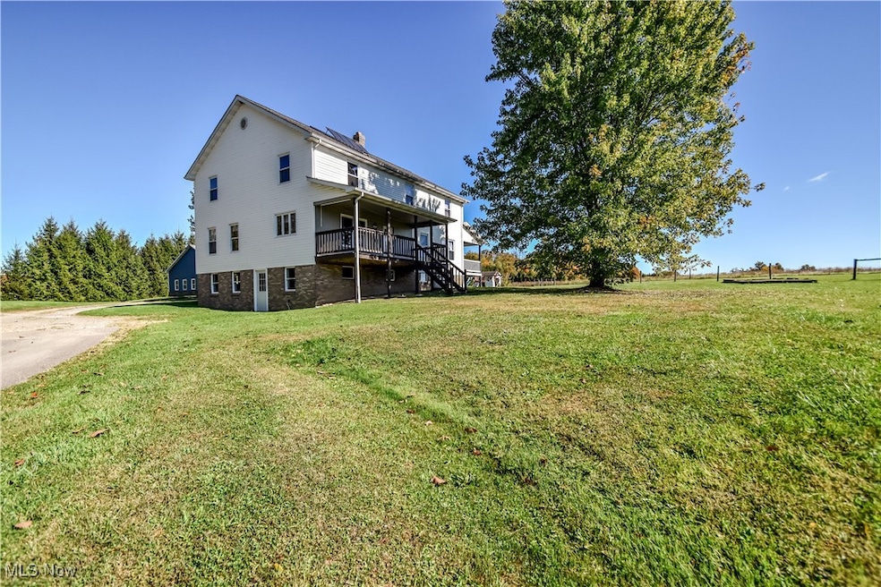
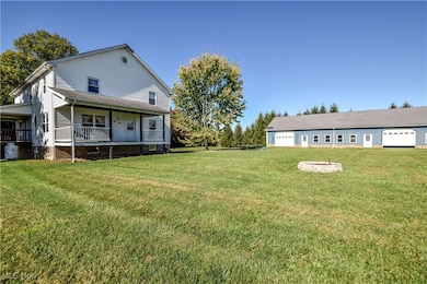

12954 State Route 88 Garrettsville, OH 44231
Estimated payment $3,029/month
Highlights
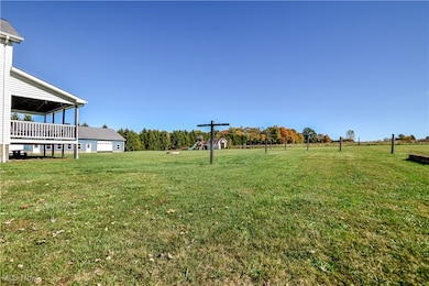
- Horse Property
- 2 Fireplaces
- 4 Car Detached Garage
- Colonial Architecture
- No HOA
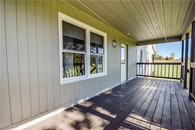
- Porch
About This Home
Spacious Country Home with Endless Potential
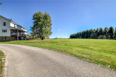
Nestled on a peaceful stretch of countryside, this 5-bedroom, 1-bath home offers room to grow inside and out. Thoughtfully designed and fully wired for electricity, the home is ready for modern updates while maintaining its traditional craftsmanship. Step inside to find a spacious layout featuring two cozy wood-burning fireplaces, generous bedrooms, and a large basement ready to be finished to suit your needs. The main bath is conveniently located, with ample space available for adding a second. Enjoy your mornings on the welcoming front porch overlooking expansive grounds—perfect for gardening, recreation, or simply soaking in the quiet. A large garage provides abundant storage and workspace for vehicles, hobbies, or equipment. This property offers a rare opportunity to create your dream country retreat with modern comforts already within reach.
Listing Agent
Platinum Real Estate Brokerage Email: tim@callteamcline.com, 440-749-5182 License #2022005754 Listed on: 10/20/2025

Co-Listing Agent
Platinum Real Estate Brokerage Email: tim@callteamcline.com, 440-749-5182 License #2025000208
Home Details
Home Type
- Single Family
Est. Annual Taxes
- $3,765
Year Built
- Built in 2003
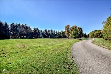
Lot Details
- 8.54 Acre Lot
- Lot Dimensions are 150x2599
- Partially Fenced Property
- Irregular Lot
Parking
- 4 Car Detached Garage
- Unpaved Parking
Home Design
- Colonial Architecture
- Fiberglass Roof
- Asphalt Roof
- Vinyl Siding
Interior Spaces
- 2-Story Property
- 2 Fireplaces
- Unfinished Basement
- Basement Fills Entire Space Under The House
Bedrooms and Bathrooms
- 5 Bedrooms | 1 Main Level Bedroom
- 1 Full Bathroom
Outdoor Features
- Horse Property
- Porch
Utilities
- No Cooling
- Heating Available
- Septic Tank
Community Details
- No Home Owners Association
Listing and Financial Details
- Assessor Parcel Number 250080300001003
Map
Home Values in the Area
Average Home Value in this Area
Tax History
| Year | Tax Paid | Tax Assessment Tax Assessment Total Assessment is a certain percentage of the fair market value that is determined by local assessors to be the total taxable value of land and additions on the property. | Land | Improvement |
|---|---|---|---|---|
| 2024 | $3,765 | $105,250 | $19,430 | $85,820 |
| 2023 | $3,448 | $84,350 | $14,000 | $70,350 |
| 2022 | $3,452 | $84,350 | $14,000 | $70,350 |
| 2021 | $3,342 | $84,350 | $14,000 | $70,350 |
| 2020 | $3,070 | $75,710 | $14,000 | $61,710 |
| 2019 | $3,077 | $75,710 | $14,000 | $61,710 |
| 2018 | $3,371 | $71,580 | $13,550 | $58,030 |
| 2017 | $3,370 | $71,580 | $13,550 | $58,030 |
| 2016 | $3,265 | $71,580 | $13,550 | $58,030 |
| 2015 | $3,282 | $71,580 | $13,550 | $58,030 |
| 2014 | $3,340 | $71,580 | $13,550 | $58,030 |
| 2013 | $3,312 | $71,580 | $13,550 | $58,030 |
Property History
| Date | Event | Price | List to Sale | Price per Sq Ft |
|---|---|---|---|---|
| 10/20/2025 10/20/25 | For Sale | $514,000 | -- | $122 / Sq Ft |
Purchase History
| Date | Type | Sale Price | Title Company |
|---|---|---|---|
| Quit Claim Deed | $2,000 | None Listed On Document | |
| Warranty Deed | $190,000 | Attorney | |
| Deed | $22,700 | -- |
Mortgage History
| Date | Status | Loan Amount | Loan Type |
|---|---|---|---|
| Previous Owner | $190,126 | New Conventional |
Source: MLS Now
MLS Number: 5166132
APN: 25-008-03-00-001-003
Disclaimer: Certain information contained herein is derived from information provided by parties other than Homes.com. All information provided is deemed reliable, but is not guaranteed to be accurate and should be independently verified.
![]() IDX information is provided exclusively for personal, non-commercial use, and may not be used for any purpose other than to identify prospective properties consumers may be interested in purchasing. Information is deemed reliable but not guaranteed.
IDX information is provided exclusively for personal, non-commercial use, and may not be used for any purpose other than to identify prospective properties consumers may be interested in purchasing. Information is deemed reliable but not guaranteed.
- 12928 State Route 88
- 12947 Brosius Rd
- 12707 Brosius Rd
- 12525 Brosius Rd
- 7991 Norton Rd
- 12157 State Route 88
- 18386 Mills Rd
- 16169 Mccall Rd
- 11838 Brosius Rd
- 16663 Main Market Rd
- 16790 Main Market Rd
- 11655 State Route 88
- 7972 State Route 305
- 12977 Main Market Rd
- Parcel C Nash Rd
- 0 Nash Rd Unit 5142384
- 6687 Winchell Rd
- 19109 Tilden Rd
- Lot 7 Wheeler Rd
- Lot 14 Wheeler Rd
- 6720 Bancroft Extension
- 11220 Vista Dr Unit 1st Floor
- 8140 Southwood Dr
- 15401 Madison Rd
- 15755 Grove St
- 16129 E High St
- 13807 Equestrian Dr
- 611 Ridge Rd
- 479 Ridge Rd
- 408 S Canal St
- 271 Folsom St NW Unit 6
- 8693 E Craig Dr
- 226 Barrington Place W
- 3100 Valley Dale Dr NW
- 8298 Valley Dr
- 8134 Chagrin Rd
- 300 N Bissell Rd
- 709 Sapp Rd
- 630 Countrywood Trail
- 1738 Oh-303