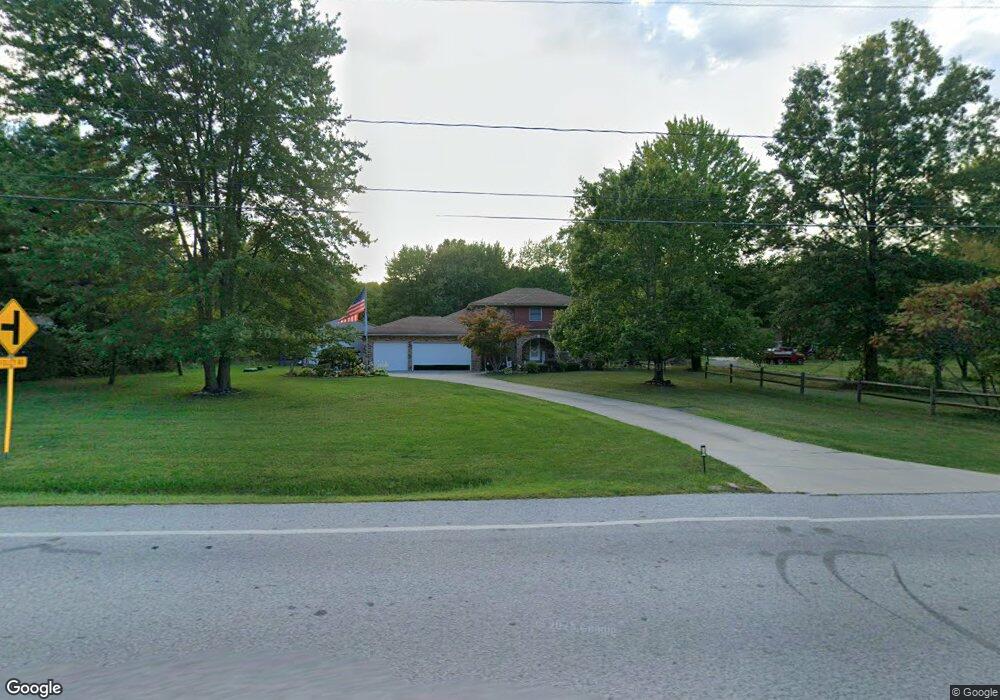
12956 Station Rd Columbia Station, OH 44028
Estimated Value: $499,000 - $588,000
6
Beds
5
Baths
3,223
Sq Ft
$171/Sq Ft
Est. Value
About This Home
This home is located at 12956 Station Rd, Columbia Station, OH 44028 and is currently estimated at $552,665, approximately $171 per square foot. 12956 Station Rd is a home located in Lorain County with nearby schools including Copopa Elementary School, Columbia Middle School, and Columbia High School.
Ownership History
Date
Name
Owned For
Owner Type
Purchase Details
Closed on
Sep 21, 2004
Sold by
Feruski Raymond and Feruski Elaine
Bought by
Difilippo Anna and Difilippo Rosetta S
Current Estimated Value
Home Financials for this Owner
Home Financials are based on the most recent Mortgage that was taken out on this home.
Original Mortgage
$229,500
Outstanding Balance
$112,712
Interest Rate
5.75%
Mortgage Type
Purchase Money Mortgage
Estimated Equity
$439,953
Purchase Details
Closed on
Sep 6, 2001
Sold by
Feruski Raymond A and Hirz Elaine W
Bought by
R & E Enterprises Trust
Purchase Details
Closed on
Aug 16, 1995
Sold by
Mendise Frank J
Bought by
Hirz Elaine W and Feruski Raymond A
Home Financials for this Owner
Home Financials are based on the most recent Mortgage that was taken out on this home.
Original Mortgage
$150,000
Interest Rate
7.64%
Mortgage Type
New Conventional
Create a Home Valuation Report for This Property
The Home Valuation Report is an in-depth analysis detailing your home's value as well as a comparison with similar homes in the area
Home Values in the Area
Average Home Value in this Area
Purchase History
| Date | Buyer | Sale Price | Title Company |
|---|---|---|---|
| Difilippo Anna | $255,000 | City Title Company | |
| R & E Enterprises Trust | -- | -- | |
| Hirz Elaine W | $199,000 | -- |
Source: Public Records
Mortgage History
| Date | Status | Borrower | Loan Amount |
|---|---|---|---|
| Open | Difilippo Anna | $229,500 | |
| Previous Owner | Hirz Elaine W | $150,000 |
Source: Public Records
Tax History Compared to Growth
Tax History
| Year | Tax Paid | Tax Assessment Tax Assessment Total Assessment is a certain percentage of the fair market value that is determined by local assessors to be the total taxable value of land and additions on the property. | Land | Improvement |
|---|---|---|---|---|
| 2024 | $6,497 | $159,635 | $26,086 | $133,550 |
| 2023 | $5,719 | $124,289 | $23,121 | $101,168 |
| 2022 | $5,598 | $124,289 | $23,121 | $101,168 |
| 2021 | $5,655 | $124,289 | $23,121 | $101,168 |
| 2020 | $4,693 | $94,690 | $20,050 | $74,640 |
| 2019 | $4,666 | $94,690 | $20,050 | $74,640 |
| 2018 | $4,705 | $94,690 | $20,050 | $74,640 |
| 2017 | $4,339 | $82,250 | $20,610 | $61,640 |
| 2016 | $4,370 | $82,250 | $20,610 | $61,640 |
| 2015 | $4,371 | $82,250 | $20,610 | $61,640 |
| 2014 | $4,149 | $78,030 | $19,550 | $58,480 |
| 2013 | $4,164 | $78,030 | $19,550 | $58,480 |
Source: Public Records
Map
Nearby Homes
- 26271 Royalton Rd
- 25931 Royalton Rd
- 23663 Victory Ln
- 11834 W River Rd
- 23855 W Rim Dr
- 33932 Abercorn Place
- 33964 Abercorn Place
- 33621 Henwell Rd
- 33700 Henwell Rd
- 33743 Henwell Rd
- 26571 Sprague Rd
- 9954 Ethan Dr
- 27056 Sprague Rd
- 9628 Kingston Trail
- 0 Cowley Rd Unit 5171639
- 27167 Watkin Rd
- 0 Sprague Rd
- 0 E River Rd Unit 5120285
- 17421 Honeysuckle Ln
- 12857 Caribou Ct
- 12980 Station Rd
- 12892 Station Rd
- 12927 Station Rd
- 12865 Station Rd
- 12858 Station Rd
- 12841 Station Rd
- 13089 Root Rd
- 12819 Station Rd
- 12800 Station Rd
- 13071 Root Rd
- 12757 Station Rd
- 13015 Root Rd
- 13025 Root Rd
- 12694 Station Rd
- 12711 Station Rd
- 13260 Station Rd
- 13185 Root Rd
- 26373 Folley Rd
- 12683 Station Rd
- 13255 Root Rd