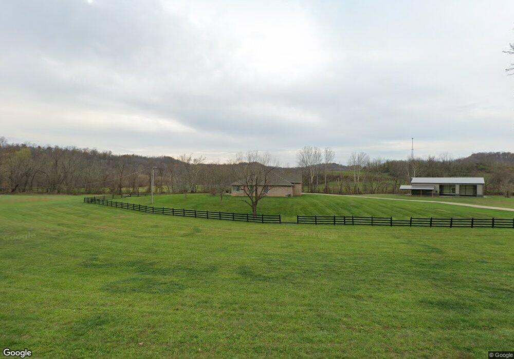
12958 State Route 243 Chesapeake, OH 45619
Estimated Value: $372,000 - $440,000
4
Beds
3
Baths
3,744
Sq Ft
$108/Sq Ft
Est. Value
About This Home
This home is located at 12958 State Route 243, Chesapeake, OH 45619 and is currently estimated at $402,600, approximately $107 per square foot. 12958 State Route 243 is a home located in Lawrence County with nearby schools including Chesapeake Elementary School, Chesapeake Middle School, and Chesapeake High School.
Ownership History
Date
Name
Owned For
Owner Type
Purchase Details
Closed on
May 24, 2021
Sold by
Sasser H Jearl H and Sasser Betty G
Bought by
Smith Levi T
Current Estimated Value
Home Financials for this Owner
Home Financials are based on the most recent Mortgage that was taken out on this home.
Original Mortgage
$259,200
Interest Rate
2.9%
Mortgage Type
New Conventional
Purchase Details
Closed on
Oct 9, 2007
Sold by
Hughes Kenneth R and Hughes Shelbie J
Bought by
Sasser H Jearl and Sasser Betty G
Home Financials for this Owner
Home Financials are based on the most recent Mortgage that was taken out on this home.
Original Mortgage
$292,000
Interest Rate
6.49%
Mortgage Type
Purchase Money Mortgage
Purchase Details
Closed on
Oct 11, 2000
Sold by
Hughes Kenneth R and Hughes Shel
Bought by
Hughes Kenneth R and Hughes Shel
Purchase Details
Closed on
Apr 18, 1996
Bought by
Hughes Kenneth R and Hughes Shel
Create a Home Valuation Report for This Property
The Home Valuation Report is an in-depth analysis detailing your home's value as well as a comparison with similar homes in the area
Home Values in the Area
Average Home Value in this Area
Purchase History
| Date | Buyer | Sale Price | Title Company |
|---|---|---|---|
| Smith Levi T | $288,000 | None Available | |
| Sasser H Jearl | $364,900 | Attorney | |
| Hughes Kenneth R | -- | -- | |
| Hughes Kenneth R | $50,000 | -- |
Source: Public Records
Mortgage History
| Date | Status | Borrower | Loan Amount |
|---|---|---|---|
| Previous Owner | Smith Levi T | $259,200 | |
| Previous Owner | Sasser H Jearl | $292,000 |
Source: Public Records
Tax History Compared to Growth
Tax History
| Year | Tax Paid | Tax Assessment Tax Assessment Total Assessment is a certain percentage of the fair market value that is determined by local assessors to be the total taxable value of land and additions on the property. | Land | Improvement |
|---|---|---|---|---|
| 2024 | -- | $103,870 | $18,660 | $85,210 |
| 2023 | $2,730 | $103,870 | $18,660 | $85,210 |
| 2022 | $2,728 | $103,870 | $18,660 | $85,210 |
| 2021 | $2,288 | $89,940 | $15,530 | $74,410 |
| 2020 | $2,303 | $89,940 | $15,530 | $74,410 |
| 2019 | $2,300 | $89,940 | $15,530 | $74,410 |
| 2018 | $2,311 | $89,790 | $15,530 | $74,260 |
| 2017 | $2,310 | $89,790 | $15,530 | $74,260 |
| 2016 | $2,147 | $89,790 | $15,530 | $74,260 |
| 2015 | $1,682 | $72,210 | $8,240 | $63,970 |
| 2014 | $1,682 | $72,210 | $8,240 | $63,970 |
| 2013 | $1,733 | $74,110 | $8,240 | $65,870 |
Source: Public Records
Map
Nearby Homes
- 253 Township Road 1357
- 14 Township Road 1356
- 275 Township Road 118
- 135 Township Road 85 E
- 3493 County Road 31
- 3171 County Road 31
- 152 Township Road 1483
- 101 Township Road 1119
- 983 County Road 104
- 1666 County Road 31
- 66 Township Road 1523
- 81 Township Road 158
- 1334 McKinney Creek-Hesson Hollow Rd N
- 301 Township Road 158
- 1334 Township Road 214th N
- 101 Township Road 1199
- 30 Township Road 1482
- 0 County Road 123
- 6757 County Road 15
- 6897 County Road 15
- 12958 Ohio 243
- 15961 Ohio 243
- 12935 State Route 243
- 13022 State Route 243
- 13013 State Route 243
- 12867 State Route 243
- 12789 State Route 243
- 44 Township Road 354
- 13124 State Route 243
- 19 Township Road 354
- 60 State Route 243
- 140 County Road 36
- 35 Township Road 354
- 76 Township Road 354
- 119 Township Road 354
- 0 Township Road 354
- 85 Township Road 354
- 105 Township Road 354
- 154 Township Road 354
- 130 Township Road 354