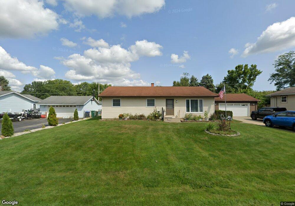
12958 W Clarendon Rd Beach Park, IL 60099
Estimated Value: $279,202 - $334,000
3
Beds
2
Baths
1,232
Sq Ft
$250/Sq Ft
Est. Value
About This Home
This home is located at 12958 W Clarendon Rd, Beach Park, IL 60099 and is currently estimated at $307,801, approximately $249 per square foot. 12958 W Clarendon Rd is a home located in Lake County with nearby schools including Kenneth Murphy School, Beach Park Middle School, and Zion-Benton Township High School.
Ownership History
Date
Name
Owned For
Owner Type
Purchase Details
Closed on
Oct 16, 1996
Sold by
Hockersmith David L and Hockersmith Nancy I
Bought by
Wirth Allen R and Wirth Christine M
Current Estimated Value
Home Financials for this Owner
Home Financials are based on the most recent Mortgage that was taken out on this home.
Original Mortgage
$116,000
Outstanding Balance
$10,983
Interest Rate
8.44%
Mortgage Type
VA
Estimated Equity
$296,818
Create a Home Valuation Report for This Property
The Home Valuation Report is an in-depth analysis detailing your home's value as well as a comparison with similar homes in the area
Home Values in the Area
Average Home Value in this Area
Purchase History
| Date | Buyer | Sale Price | Title Company |
|---|---|---|---|
| Wirth Allen R | $116,000 | -- |
Source: Public Records
Mortgage History
| Date | Status | Borrower | Loan Amount |
|---|---|---|---|
| Open | Wirth Allen R | $116,000 |
Source: Public Records
Tax History Compared to Growth
Tax History
| Year | Tax Paid | Tax Assessment Tax Assessment Total Assessment is a certain percentage of the fair market value that is determined by local assessors to be the total taxable value of land and additions on the property. | Land | Improvement |
|---|---|---|---|---|
| 2024 | $6,250 | $74,748 | $8,987 | $65,761 |
| 2023 | $6,030 | $67,500 | $8,676 | $58,824 |
| 2022 | $6,030 | $62,611 | $8,470 | $54,141 |
| 2021 | $5,485 | $54,539 | $8,255 | $46,284 |
| 2020 | $5,368 | $52,046 | $7,878 | $44,168 |
| 2019 | $5,342 | $49,379 | $7,474 | $41,905 |
| 2018 | $5,636 | $50,192 | $8,992 | $41,200 |
| 2017 | $5,584 | $47,217 | $8,459 | $38,758 |
| 2016 | $5,426 | $44,951 | $8,053 | $36,898 |
| 2015 | $5,242 | $41,224 | $7,385 | $33,839 |
| 2014 | $4,379 | $37,598 | $2,158 | $35,440 |
| 2012 | $4,441 | $39,071 | $2,243 | $36,828 |
Source: Public Records
Map
Nearby Homes
- 13051 Bucksburn Ct
- 39787 Torry Ln
- 13129 W Shannon Dr
- 13154 W Sheffield Ln
- 39631 N Warren Ln Unit 4625
- 39520 N Green Bay Rd
- 39616 N Warren Ln Unit 4824
- 13661 W Adams Rd
- 13551 W Adams Rd
- 13428 Victoria Ln
- 39401 N Green Bay Rd
- 39176 Welsh Ln Unit 5563
- 39092 Welsh Ln Unit 5501
- 39111 N Aberdeen Ln Unit 39111
- 12920 W Wadsworth Rd
- 39113 N Green Bay Rd
- 12640 W Wadsworth Rd
- 2414 Phillip Dr
- 2407 Phillip Dr
- 42334 N Heritage Lot 7 Trail
- 12936 W Clarendon Rd
- 12976 W Clarendon Rd
- 12974 W Clarendon Rd
- 12949 W Maplewood Rd
- 12965 W Maplewood Rd
- 12977 W Maplewood Rd
- 12951 W Clarendon Rd
- 12965 W Clarendon Rd
- 12983 W Clarendon Rd
- 39890 N Green Ave
- 13044 Bucksburn Ct
- 13036 Bucksburn Ct
- 12958 W Maplewood Rd
- 12960 W Peacock Rd
- 12936 W Maplewood Rd
- 13052 Bucksburn Ct
- 12982 W Peacock Rd
- 12895 W Clarendon Rd
- 12932 W Peacock Rd
- 13027 Bucksburn Ct