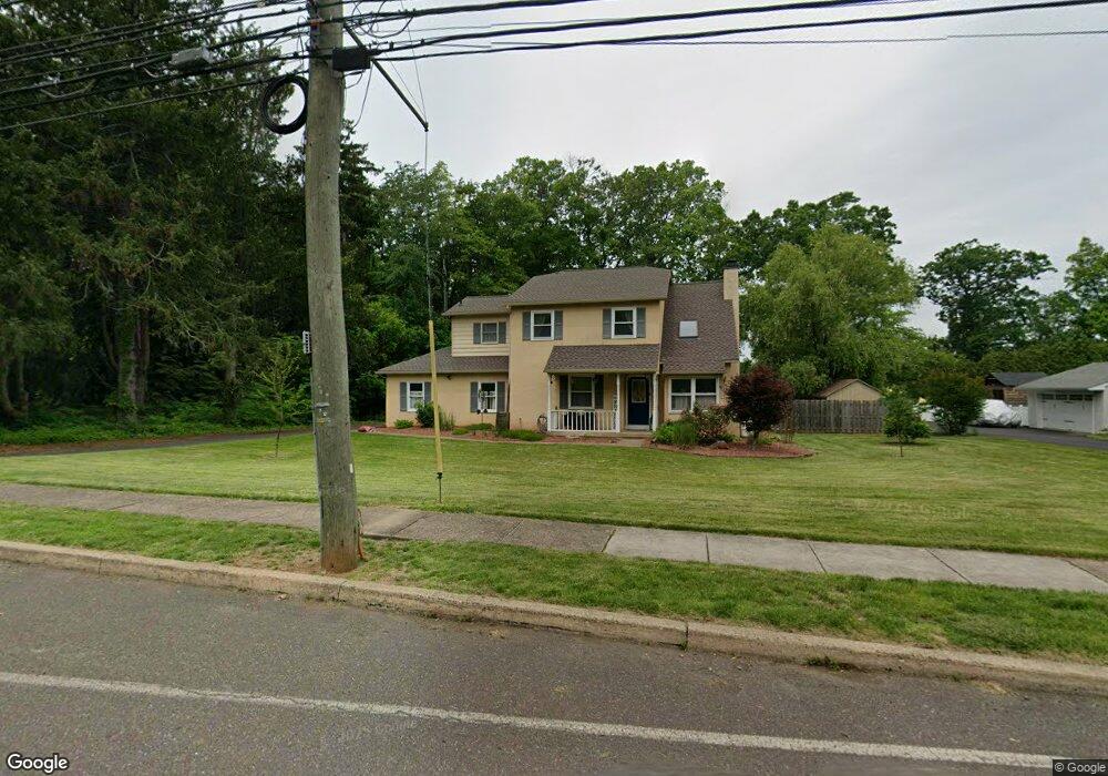
1296 Camp Hill Rd Fort Washington, PA 19034
Estimated Value: $725,273 - $860,000
3
Beds
3
Baths
2,210
Sq Ft
$349/Sq Ft
Est. Value
About This Home
This home is located at 1296 Camp Hill Rd, Fort Washington, PA 19034 and is currently estimated at $772,068, approximately $349 per square foot. 1296 Camp Hill Rd is a home located in Montgomery County with nearby schools including Fort Washington Elementary School, Sandy Run Middle School, and Upper Dublin High School.
Ownership History
Date
Name
Owned For
Owner Type
Purchase Details
Closed on
Dec 27, 2011
Sold by
Malkin Andrea L
Bought by
Schreier Lorelei R and Schreier Daron M
Current Estimated Value
Home Financials for this Owner
Home Financials are based on the most recent Mortgage that was taken out on this home.
Original Mortgage
$335,000
Interest Rate
4%
Purchase Details
Closed on
Jun 4, 2010
Sold by
Grello Tina L and Malkin Andrea L
Bought by
Malkin Andrea L
Purchase Details
Closed on
Apr 30, 2008
Sold by
Yalcingediz Berkant
Bought by
Malkin Andrea L and Grello Tina L
Home Financials for this Owner
Home Financials are based on the most recent Mortgage that was taken out on this home.
Original Mortgage
$354,400
Interest Rate
5.91%
Purchase Details
Closed on
Oct 15, 2004
Sold by
Jacobson Milton and Jacobson Merelyn E
Bought by
Yalcingediz Berkant
Create a Home Valuation Report for This Property
The Home Valuation Report is an in-depth analysis detailing your home's value as well as a comparison with similar homes in the area
Home Values in the Area
Average Home Value in this Area
Purchase History
| Date | Buyer | Sale Price | Title Company |
|---|---|---|---|
| Schreier Lorelei R | $360,000 | None Available | |
| Malkin Andrea L | -- | None Available | |
| Malkin Andrea L | $443,000 | None Available | |
| Yalcingediz Berkant | $400,000 | -- |
Source: Public Records
Mortgage History
| Date | Status | Borrower | Loan Amount |
|---|---|---|---|
| Previous Owner | Schreier Lorelei R | $335,000 | |
| Previous Owner | Malkin Andrea L | $354,400 | |
| Closed | Yalcingediz Berkant | $0 |
Source: Public Records
Tax History Compared to Growth
Tax History
| Year | Tax Paid | Tax Assessment Tax Assessment Total Assessment is a certain percentage of the fair market value that is determined by local assessors to be the total taxable value of land and additions on the property. | Land | Improvement |
|---|---|---|---|---|
| 2025 | $10,914 | $223,792 | $98,230 | $125,562 |
| 2024 | $10,914 | $223,792 | $98,230 | $125,562 |
| 2023 | $10,658 | $223,792 | $98,230 | $125,562 |
| 2022 | $10,426 | $223,792 | $98,230 | $125,562 |
| 2021 | $10,166 | $223,792 | $98,230 | $125,562 |
| 2020 | $9,873 | $223,792 | $98,230 | $125,562 |
| 2019 | $9,708 | $223,792 | $98,230 | $125,562 |
| 2018 | $9,707 | $223,792 | $98,230 | $125,562 |
| 2017 | $9,354 | $223,792 | $98,230 | $125,562 |
| 2016 | $9,266 | $223,792 | $98,230 | $125,562 |
| 2015 | $8,752 | $223,792 | $98,230 | $125,562 |
| 2014 | $8,752 | $223,792 | $98,230 | $125,562 |
Source: Public Records
Map
Nearby Homes
- 1425 Crosby Dr
- 1404 Cinnamon Cir
- 1423 Southwind Way
- 1354 Wentz Dr
- 1300 Kirks Ln
- 1525 Limekiln Pike
- 1485 Mundock Rd
- 1324 Highland Ave
- 1225 Nash Dr
- 411 Leah Dr
- 1478 Dillon Rd
- 536 Cardinal Dr
- 541 Cardinal Dr
- 501 Martin Ln
- 1021 Meetinghouse Rd
- 408 Summit Ave
- 1536 Fulton Dr
- 3225 Burn Brae Dr
- 3404 Honey Run Rd
- 402 Harrison Place
- 1300 Camp Hill Rd
- 1220 Camp Hill Rd
- 1324 Cinnamon Dr
- 1328 Cinnamon Dr
- 1320 Cinnamon Dr
- 1190 Camp Hill Rd
- 1307 Cinnamon Dr
- 1311 Cinnamon Dr
- 1345 Hideaway Cir
- 1315 Cinnamon Dr
- 1340 Hideaway Cir
- 1327 Cinnamon Dr
- 1180 Camp Hill Rd
- 1330 Camp Hill Rd
- 1331 Cinnamon Dr
- 1349 Hideaway Cir
- 1340 Camp Hill Rd
- 1344 Hideaway Cir
- 1348 Hideaway Cir
- 1335 Cinnamon Dr