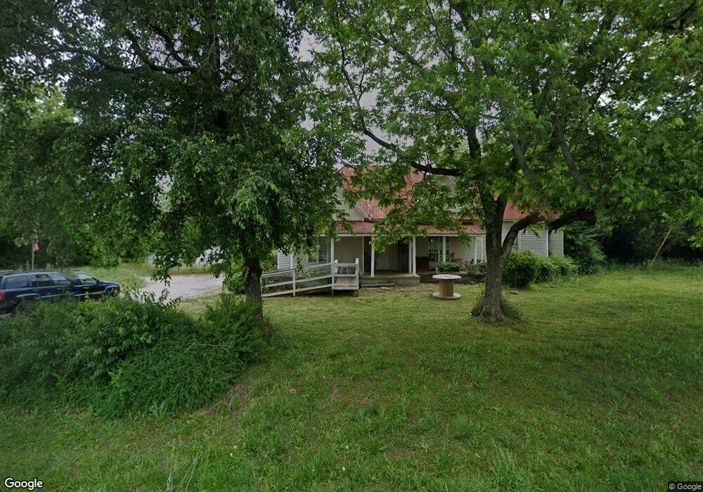
1296 Lincolnton Hwy Unit 1 Elberton, GA 30635
Estimated Value: $244,000 - $275,000
4
Beds
2
Baths
2,354
Sq Ft
$111/Sq Ft
Est. Value
About This Home
This home is located at 1296 Lincolnton Hwy Unit 1, Elberton, GA 30635 and is currently estimated at $260,329, approximately $110 per square foot. 1296 Lincolnton Hwy Unit 1 is a home located in Elbert County with nearby schools including Elbert County Primary School, Elbert County Elementary School, and Elbert County Middle School.
Ownership History
Date
Name
Owned For
Owner Type
Purchase Details
Closed on
May 28, 2025
Sold by
Conley Willis F
Bought by
Talley Deborah Lynn
Current Estimated Value
Purchase Details
Closed on
Sep 25, 2003
Sold by
Bank One National Association
Bought by
Conley Willis Franklin
Purchase Details
Closed on
Apr 1, 2003
Sold by
Veal Allan C
Bought by
Bank One National Association
Purchase Details
Closed on
Jun 12, 2001
Sold by
Childs Robert O
Bought by
Veal Allan C
Purchase Details
Closed on
Apr 1, 1998
Purchase Details
Closed on
Sep 1, 1984
Purchase Details
Closed on
Jun 1, 1983
Purchase Details
Closed on
Jun 1, 1982
Purchase Details
Closed on
Jan 1, 1956
Create a Home Valuation Report for This Property
The Home Valuation Report is an in-depth analysis detailing your home's value as well as a comparison with similar homes in the area
Home Values in the Area
Average Home Value in this Area
Purchase History
| Date | Buyer | Sale Price | Title Company |
|---|---|---|---|
| Talley Deborah Lynn | -- | -- | |
| Conley Willis Franklin | $89,000 | -- | |
| Bank One National Association | -- | -- | |
| Veal Allan C | -- | -- | |
| -- | $115,000 | -- | |
| -- | $74,500 | -- | |
| -- | -- | -- | |
| -- | -- | -- | |
| -- | -- | -- |
Source: Public Records
Tax History Compared to Growth
Tax History
| Year | Tax Paid | Tax Assessment Tax Assessment Total Assessment is a certain percentage of the fair market value that is determined by local assessors to be the total taxable value of land and additions on the property. | Land | Improvement |
|---|---|---|---|---|
| 2024 | $2,198 | $91,675 | $7,036 | $84,639 |
| 2023 | $2,198 | $91,675 | $7,036 | $84,639 |
| 2022 | $1,417 | $59,085 | $4,189 | $54,896 |
| 2021 | $1,419 | $59,085 | $4,189 | $54,896 |
| 2020 | $1,187 | $43,655 | $3,350 | $40,305 |
| 2019 | $1,233 | $43,655 | $3,350 | $40,305 |
| 2018 | $1,270 | $43,655 | $3,350 | $40,305 |
| 2017 | $1,255 | $39,932 | $3,350 | $36,582 |
| 2016 | $879 | $39,932 | $3,350 | $36,582 |
| 2015 | -- | $39,932 | $3,350 | $36,582 |
| 2014 | -- | $39,932 | $3,350 | $36,582 |
| 2013 | -- | $39,932 | $3,350 | $36,582 |
Source: Public Records
Map
Nearby Homes
- 1318 Lincolnton Hwy
- 2914 Cherokee Rd
- 1385 Lincolnton Hwy
- 0 Cherokee Rd Unit 10576301
- 3177 Calhoun Falls Hwy
- 2688 Calhoun Falls Hwy
- 2012 Lakeside Dr Unit LOT 47 / BEAVERDAM L
- 0 Mauldin Rd Unit 10657411
- 1943 Mauldin Rd
- 1112 Willis Rdige
- 3366 Hester Rd
- 0 Flatwoods Rd Unit 10649821
- 2470 Dr George Ward Rd
- 3563 Ernest Brown Rd
- 3831 Childston Dr
- 2164 Lincolnton Hwy
- 1415 Bobby Brown State Park Rd
- 1415 Bobby Brown St Pk Rd
- 00 Bobby Brown State Park Rd
- 1876 Bobby Brown State Park Rd
- 1296 Lincolnton Hwy
- 1312 Lincolnton Hwy
- 1303 Lincolnton Hwy
- 2929 Cherokee Rd
- 2873 Cherokee Rd
- 1372 Lincolnton Hwy
- 2829 Cherokee Rd
- 2829 Cherokee Rd
- 2868 Cherokee Rd
- 1389 Lincolnton Hwy
- 1341 Lincolnton Hwy
- 22 acres Cherokee Rd
- 10 acres Cherokee Rd
- 00 Cherokee Rd
- 2994 Cherokee Rd
- 0 Dimps Allen Rd Unit 7439643
- 1196 Lincolnton Hwy
- 1916 Dimps Allen Rd
- 1383 Lincolnton Hwy
- 1912 Dimps Allen Rd