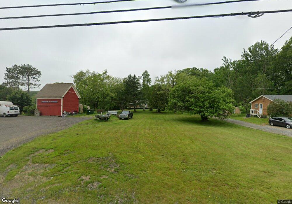
1296 State Route 32 Round Pond, ME 04564
Estimated Value: $358,785 - $632,000
--
Bed
--
Bath
--
Sq Ft
1
Acres
About This Home
This home is located at 1296 State Route 32, Round Pond, ME 04564 and is currently estimated at $502,696. 1296 State Route 32 is a home located in Lincoln County with nearby schools including Bristol Consolidated School.
Ownership History
Date
Name
Owned For
Owner Type
Purchase Details
Closed on
Aug 28, 2007
Sold by
Olson Larry D and Olson Kenneth R
Bought by
Etheridge Ruth L
Current Estimated Value
Home Financials for this Owner
Home Financials are based on the most recent Mortgage that was taken out on this home.
Original Mortgage
$35,000
Outstanding Balance
$22,397
Interest Rate
6.78%
Mortgage Type
Purchase Money Mortgage
Estimated Equity
$480,299
Purchase Details
Closed on
Jun 21, 2007
Sold by
Etheridge Ruth L
Bought by
Olson Kristie L
Create a Home Valuation Report for This Property
The Home Valuation Report is an in-depth analysis detailing your home's value as well as a comparison with similar homes in the area
Home Values in the Area
Average Home Value in this Area
Purchase History
| Date | Buyer | Sale Price | Title Company |
|---|---|---|---|
| Etheridge Ruth L | -- | -- | |
| Olson Kristie L | -- | -- |
Source: Public Records
Mortgage History
| Date | Status | Borrower | Loan Amount |
|---|---|---|---|
| Open | Etheridge Ruth L | $35,000 |
Source: Public Records
Tax History Compared to Growth
Tax History
| Year | Tax Paid | Tax Assessment Tax Assessment Total Assessment is a certain percentage of the fair market value that is determined by local assessors to be the total taxable value of land and additions on the property. | Land | Improvement |
|---|---|---|---|---|
| 2024 | $1,754 | $197,100 | $35,000 | $162,100 |
| 2023 | $1,567 | $197,100 | $35,000 | $162,100 |
| 2022 | $1,419 | $197,100 | $35,000 | $162,100 |
| 2021 | $1,385 | $192,400 | $35,000 | $157,400 |
| 2020 | $1,294 | $178,500 | $35,000 | $143,500 |
| 2019 | $1,205 | $178,500 | $35,000 | $143,500 |
| 2018 | $1,116 | $178,500 | $35,000 | $143,500 |
| 2017 | $1,116 | $178,500 | $35,000 | $143,500 |
| 2016 | $1,147 | $145,200 | $15,600 | $129,600 |
| 2015 | $1,227 | $145,200 | $15,600 | $129,600 |
| 2014 | $1,147 | $145,200 | $15,600 | $129,600 |
| 2013 | $1,118 | $145,200 | $15,600 | $129,600 |
Source: Public Records
Map
Nearby Homes
- 1276 State Route 32
- 31 Viking Way
- Lot 009 Reny Rd
- 359 Lower Round Pond Rd
- 153 Back Shore Rd
- 12 Nonesuch Ln
- Lot 10.6 Louds Island
- 146 Lower Round Pond Rd
- M6l54
- 17 Eastwood Ct
- M6L54 Bristol Rd
- M6L53 Bristol Rd
- Lot 149 Bristol Rd
- 033-1 Bristol Rd
- 9 Bearces Hill Rd
- 1212 Bristol Rd
- 0 Sodom Rd
- Lot 46 Carl Bailey Rd
- M10L40E4 Christian Hill Rd
- Map10 L39B Christian Hill Rd
- 1288 State Route 32
- 5 Moxie Cove Rd
- 1298 State Route 32
- 1332 Maine 32
- 1287 State Route 32
- 1281 State Route 32
- 11 Moxie Cove Rd
- 1273 State Route 32
- 3 R-43
- 23 Moxie Cove Rd
- 2 Post Office Rd
- 32 Maine 32
- 1251 State Route 32
- 42 Harbor Ln
- 47 Moxie Cove Rd
- 1242 State Route 32
- 18 Moxie Cove Rd
- 548 Lower Round Pond Rd
- 57 Harbor Ln
- 53 Harbor Ln