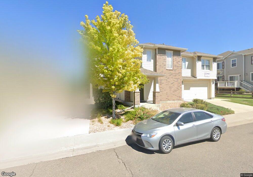
12965 Grant Cir E Unit A Thornton, CO 80241
Estimated Value: $398,000 - $430,000
2
Beds
3
Baths
1,565
Sq Ft
$266/Sq Ft
Est. Value
About This Home
This home is located at 12965 Grant Cir E Unit A, Thornton, CO 80241 and is currently estimated at $415,552, approximately $265 per square foot. 12965 Grant Cir E Unit A is a home located in Adams County with nearby schools including Hunters Glen Elementary School, Century Middle School, and Mountain Range High School.
Ownership History
Date
Name
Owned For
Owner Type
Purchase Details
Closed on
Sep 9, 2022
Sold by
Schuerger Kathleen J
Bought by
Housley Brent and Perez Viola G
Current Estimated Value
Home Financials for this Owner
Home Financials are based on the most recent Mortgage that was taken out on this home.
Original Mortgage
$412,392
Outstanding Balance
$391,938
Interest Rate
5.3%
Mortgage Type
FHA
Estimated Equity
$23,614
Purchase Details
Closed on
Mar 18, 2005
Sold by
D R Horton Inc
Bought by
Schuerger Kathleen J
Home Financials for this Owner
Home Financials are based on the most recent Mortgage that was taken out on this home.
Original Mortgage
$186,950
Interest Rate
5.66%
Mortgage Type
Unknown
Create a Home Valuation Report for This Property
The Home Valuation Report is an in-depth analysis detailing your home's value as well as a comparison with similar homes in the area
Purchase History
| Date | Buyer | Sale Price | Title Company |
|---|---|---|---|
| Housley Brent | $420,000 | -- | |
| Schuerger Kathleen J | $207,739 | Land Title |
Source: Public Records
Mortgage History
| Date | Status | Borrower | Loan Amount |
|---|---|---|---|
| Open | Housley Brent | $412,392 | |
| Previous Owner | Schuerger Kathleen J | $186,950 |
Source: Public Records
Tax History
| Year | Tax Paid | Tax Assessment Tax Assessment Total Assessment is a certain percentage of the fair market value that is determined by local assessors to be the total taxable value of land and additions on the property. | Land | Improvement |
|---|---|---|---|---|
| 2025 | $2,640 | $28,080 | $5,440 | $22,640 |
| 2024 | $2,640 | $25,810 | $5,000 | $20,810 |
| 2023 | $2,613 | $29,230 | $4,400 | $24,830 |
| 2022 | $2,611 | $23,700 | $4,240 | $19,460 |
| 2021 | $2,698 | $23,700 | $4,240 | $19,460 |
| 2020 | $2,594 | $23,250 | $4,360 | $18,890 |
| 2019 | $2,599 | $23,250 | $4,360 | $18,890 |
| 2018 | $2,296 | $19,950 | $1,160 | $18,790 |
| 2017 | $2,087 | $19,950 | $1,160 | $18,790 |
| 2016 | $1,669 | $15,530 | $1,280 | $14,250 |
| 2015 | $1,667 | $15,530 | $1,280 | $14,250 |
| 2014 | -- | $14,200 | $1,280 | $12,920 |
Source: Public Records
Map
Nearby Homes
- 12982 Grant Cir E Unit A
- 12992 Grant Cir E Unit A
- 12962 Grant Cir E Unit A
- 13012 Grant Cir E Unit A
- 13023 Grant Cir E Unit C
- 13000 Grant Cir W Unit B
- 12913 Grant Cir E Unit A
- 13151 Grant Cir N Unit C
- 0 128th & Washington St
- 434 W 128th Dr
- 495 W 128th Dr
- 609 W 130th Ave
- 1074 E 132nd Way
- 1162 E 130th Ave Unit B
- 807 W 129th Place
- 12880 Inca St
- 12870 Inca St
- 12905 Lafayette St Unit H
- 811 W 128th Place
- 13550 Washington St Unit 7C
- 12965 Grant Cir E Unit C
- 12965 Grant Cir E Unit B
- 12948 Grant Cir W Unit C
- 12948 Grant Cir W
- 12948 Grant Cir W Unit B
- 12948 Grant Cir W Unit A
- 12963 Grant Cir E Unit C
- 12963 Grant Cir E Unit B
- 12963 Grant Cir E Unit A
- 12963 Grant Cir E Unit E
- 12953 Grant Cire A
- 12953 Grant Cir E #C
- 12960 Grant Cir W Unit A
- 12960 Grant Cir W Unit C
- 12960 Grant Cir W Unit B
- 12960 Grant Cir W
- 12953 Grant Cir E Unit C
- 12953 Grant Cir E Unit B
- 12953 Grant Cir E Unit A
- 12969 Grant Cir E Unit C
Your Personal Tour Guide
Ask me questions while you tour the home.