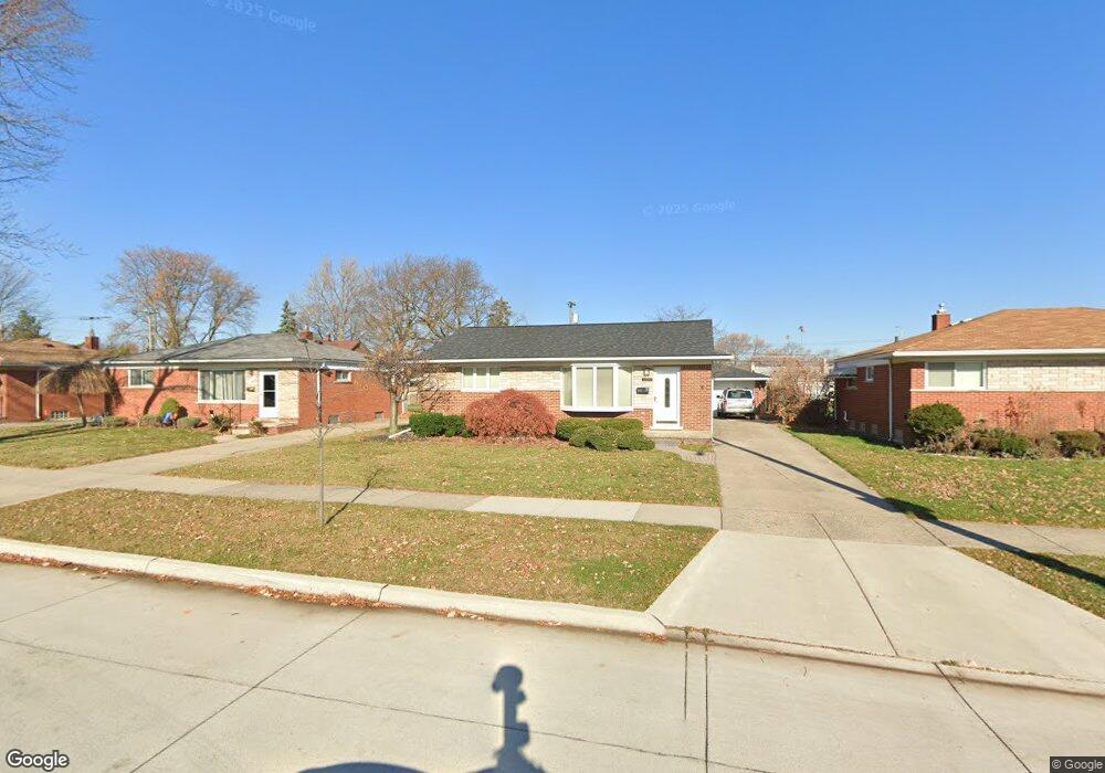
12965 Stanley Dr Warren, MI 48088
Northeast Warren NeighborhoodEstimated Value: $201,000 - $229,000
3
Beds
2
Baths
1,038
Sq Ft
$209/Sq Ft
Est. Value
About This Home
This home is located at 12965 Stanley Dr, Warren, MI 48088 and is currently estimated at $217,183, approximately $209 per square foot. 12965 Stanley Dr is a home located in Macomb County with nearby schools including Warren Woods Tower High School, Frontier International Academy Elementary, and De La Salle Collegiate.
Ownership History
Date
Name
Owned For
Owner Type
Purchase Details
Closed on
Jan 10, 2018
Sold by
Reilly Howard E and Reily Beverly J
Bought by
Koory Phillip
Current Estimated Value
Home Financials for this Owner
Home Financials are based on the most recent Mortgage that was taken out on this home.
Original Mortgage
$120,280
Outstanding Balance
$101,398
Interest Rate
3.9%
Mortgage Type
FHA
Estimated Equity
$115,785
Create a Home Valuation Report for This Property
The Home Valuation Report is an in-depth analysis detailing your home's value as well as a comparison with similar homes in the area
Home Values in the Area
Average Home Value in this Area
Purchase History
| Date | Buyer | Sale Price | Title Company |
|---|---|---|---|
| Koory Phillip | $122,500 | Chirco Title Agency Inc |
Source: Public Records
Mortgage History
| Date | Status | Borrower | Loan Amount |
|---|---|---|---|
| Open | Koory Phillip | $120,280 |
Source: Public Records
Tax History
| Year | Tax Paid | Tax Assessment Tax Assessment Total Assessment is a certain percentage of the fair market value that is determined by local assessors to be the total taxable value of land and additions on the property. | Land | Improvement |
|---|---|---|---|---|
| 2025 | $3,987 | $100,630 | $0 | $0 |
| 2024 | $39 | $97,140 | $0 | $0 |
| 2023 | $3,726 | $87,810 | $0 | $0 |
| 2022 | $3,571 | $78,380 | $0 | $0 |
| 2021 | $3,504 | $71,810 | $0 | $0 |
| 2020 | $3,358 | $67,650 | $0 | $0 |
| 2019 | $3,208 | $62,750 | $0 | $0 |
| 2018 | $63 | $55,260 | $0 | $0 |
| 2017 | $2,026 | $50,270 | $9,810 | $40,460 |
| 2016 | $2,010 | $50,270 | $0 | $0 |
| 2015 | -- | $45,210 | $0 | $0 |
| 2012 | -- | $39,690 | $0 | $0 |
Source: Public Records
Map
Nearby Homes
- 29143 Dover Ave
- 29134 Palomino Dr
- 29230 Moulin Ave
- 29105 Palomino Dr
- 28263 Newport Dr
- 29531 Eiffel Ave
- 29579 Fairfield Dr
- 54765 Palomino Ave
- 28564 Aspen Dr
- 29442 Pinto Dr
- 29010 Wagner Dr
- 28625 Bradner Dr
- 29337 Roan Dr
- 12876 Martin Rd
- 13015 Walter Ave
- 29226 Scarborough Dr
- 12855 Ray Dr
- 29417 Scarborough Dr Unit 28
- 13517 Yvonne Dr
- 29251 Bon Mar Dr
- 13007 Stanley Dr
- 12953 Stanley Dr
- 12941 Stanley Dr
- 13012 E 12 Mile Rd
- 13000 E 12 Mile Rd
- 13024 E 12 Mile Rd
- 13031 Stanley Dr
- 12929 Stanley Dr
- 13036 E 12 Mile Rd
- 12954 Stanley Dr
- 28774 Suburban Dr
- 12940 Stanley Dr
- 13048 E 12 Mile Rd
- 12917 Stanley Dr
- 12980 E 12 Mile Rd
- 12928 Stanley Dr
- 28762 Suburban Dr
- 28753 Suburban Dr Unit Bldg-Unit
- 28753 Suburban Dr
- 12916 Stanley Dr
Your Personal Tour Guide
Ask me questions while you tour the home.