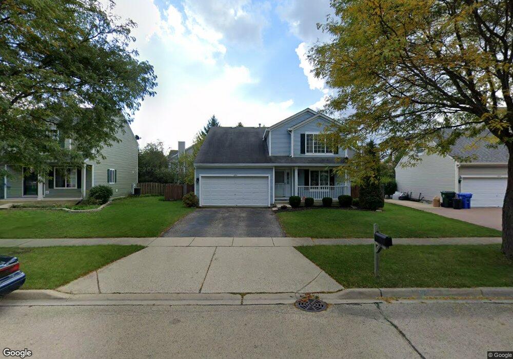
1297 Angeline Dr South Elgin, IL 60177
Estimated Value: $385,000 - $419,081
4
Beds
3
Baths
1,978
Sq Ft
$204/Sq Ft
Est. Value
About This Home
This home is located at 1297 Angeline Dr, South Elgin, IL 60177 and is currently estimated at $402,770, approximately $203 per square foot. 1297 Angeline Dr is a home located in Kane County with nearby schools including Fox Meadow Elementary School, Kenyon Woods Middle School, and South Elgin High School.
Ownership History
Date
Name
Owned For
Owner Type
Purchase Details
Closed on
Oct 22, 1996
Sold by
Sundance Holdings Inc
Bought by
Lara David and Lara Shannon R
Current Estimated Value
Home Financials for this Owner
Home Financials are based on the most recent Mortgage that was taken out on this home.
Original Mortgage
$133,129
Outstanding Balance
$12,408
Interest Rate
8.26%
Mortgage Type
FHA
Estimated Equity
$390,362
Create a Home Valuation Report for This Property
The Home Valuation Report is an in-depth analysis detailing your home's value as well as a comparison with similar homes in the area
Home Values in the Area
Average Home Value in this Area
Purchase History
| Date | Buyer | Sale Price | Title Company |
|---|---|---|---|
| Lara David | $141,000 | -- |
Source: Public Records
Mortgage History
| Date | Status | Borrower | Loan Amount |
|---|---|---|---|
| Open | Lara David | $133,129 |
Source: Public Records
Tax History Compared to Growth
Tax History
| Year | Tax Paid | Tax Assessment Tax Assessment Total Assessment is a certain percentage of the fair market value that is determined by local assessors to be the total taxable value of land and additions on the property. | Land | Improvement |
|---|---|---|---|---|
| 2024 | $8,938 | $121,267 | $28,317 | $92,950 |
| 2023 | $8,520 | $109,555 | $25,582 | $83,973 |
| 2022 | $8,080 | $99,895 | $23,326 | $76,569 |
| 2021 | $7,611 | $93,395 | $21,808 | $71,587 |
| 2020 | $7,383 | $89,160 | $20,819 | $68,341 |
| 2019 | $7,112 | $84,930 | $19,831 | $65,099 |
| 2018 | $6,975 | $80,009 | $18,682 | $61,327 |
| 2017 | $6,631 | $75,637 | $17,661 | $57,976 |
| 2016 | $6,317 | $70,171 | $16,385 | $53,786 |
| 2015 | -- | $64,318 | $15,018 | $49,300 |
| 2014 | -- | $61,036 | $14,833 | $46,203 |
| 2013 | -- | $62,646 | $15,224 | $47,422 |
Source: Public Records
Map
Nearby Homes
- 435 Sandhurst Ln Unit 3
- 1370 Marleigh Ln
- 1436 Marleigh Ln
- 590 Fenwick Ln
- 1458 Woodland Dr
- 387 S Pointe Ave
- 8N594 S Mclean Blvd
- 1419 S Pembroke Dr
- 962 Ascot Dr
- 126 Kingsport Dr
- 269 Kingsport Dr
- 291 Kingsport Dr
- 289 Kingsport Dr
- 287 Kingsport Dr
- 285 Kingsport Dr
- 283 Kingsport Dr
- 281 Kingsport Dr
- 280 Kingsport Dr
- 282 Kingsport Dr
- 284 Kingsport Dr
- 1291 Angeline Dr
- 1305 Angeline Dr
- 1290 Sandhurst Ln Unit 1
- 1287 Angeline Dr
- 1311 Angeline Dr
- 1312 Sandhurst Ln Unit 2
- 1314 Sandhurst Ln Unit 3
- 1310 Sandhurst Ln Unit 1
- 1316 Sandhurst Ln Unit 4
- 1312 Sandhurst Ln Unit 1312
- 1312 Sandhurst Ln Unit B
- 1284 Sandhurst Ln
- 1280 Sandhurst Ln Unit 1
- 1286 Sandhurst Ln Unit 4
- 1282 Sandhurst Ln Unit 2
- 1300 Angeline Dr
- 1294 Angeline Dr
- 1283 Angeline Dr
- 1294 Sandhurst Ln Unit 3
- 1252 Sandhurst Ln Unit 2