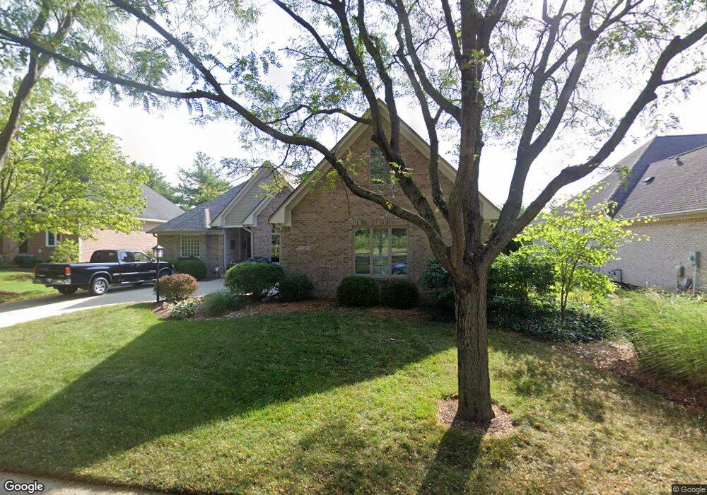
12975 Macalister Trace Carmel, IN 46033
East Carmel NeighborhoodEstimated Value: $555,731 - $719,000
3
Beds
2
Baths
2,541
Sq Ft
$243/Sq Ft
Est. Value
About This Home
This home is located at 12975 Macalister Trace, Carmel, IN 46033 and is currently estimated at $617,683, approximately $243 per square foot. 12975 Macalister Trace is a home located in Hamilton County with nearby schools including Prairie Trace Elementary School, Clay Middle School, and Carmel High School.
Ownership History
Date
Name
Owned For
Owner Type
Purchase Details
Closed on
Aug 23, 2011
Sold by
Goldman Harold I and Goldman Charlene
Bought by
Murray Michael D and Murray Jennifer J
Current Estimated Value
Home Financials for this Owner
Home Financials are based on the most recent Mortgage that was taken out on this home.
Original Mortgage
$240,000
Outstanding Balance
$93,753
Interest Rate
4.58%
Mortgage Type
New Conventional
Estimated Equity
$523,930
Purchase Details
Closed on
Mar 5, 2002
Sold by
Bdc/Cardinal Associates Lp
Bought by
Williams Custom Art Builders
Create a Home Valuation Report for This Property
The Home Valuation Report is an in-depth analysis detailing your home's value as well as a comparison with similar homes in the area
Home Values in the Area
Average Home Value in this Area
Purchase History
| Date | Buyer | Sale Price | Title Company |
|---|---|---|---|
| Murray Michael D | -- | None Available | |
| Williams Custom Art Builders | -- | -- |
Source: Public Records
Mortgage History
| Date | Status | Borrower | Loan Amount |
|---|---|---|---|
| Open | Murray Michael D | $240,000 |
Source: Public Records
Tax History
| Year | Tax Paid | Tax Assessment Tax Assessment Total Assessment is a certain percentage of the fair market value that is determined by local assessors to be the total taxable value of land and additions on the property. | Land | Improvement |
|---|---|---|---|---|
| 2025 | $5,017 | $470,300 | $149,900 | $320,400 |
| 2024 | $4,841 | $448,200 | $149,900 | $298,300 |
| 2023 | $4,841 | $448,200 | $149,900 | $298,300 |
| 2022 | $4,575 | $400,100 | $149,900 | $250,200 |
| 2021 | $4,177 | $368,400 | $149,900 | $218,500 |
| 2020 | $4,177 | $368,400 | $149,900 | $218,500 |
| 2019 | $3,974 | $350,700 | $84,200 | $266,500 |
| 2018 | $3,671 | $329,900 | $84,200 | $245,700 |
| 2017 | $3,667 | $329,600 | $84,200 | $245,400 |
| 2016 | $3,674 | $335,200 | $84,200 | $251,000 |
| 2014 | $3,165 | $293,800 | $72,300 | $221,500 |
| 2013 | $3,165 | $306,500 | $72,300 | $234,200 |
Source: Public Records
Map
Nearby Homes
- 5741 Turnbull Ct
- 13137 Brooks Landing Place
- 5971 Sandalwood Dr
- 5790 Annandale Dr
- 5873 Lost Oaks Dr
- 12751 Kiawah Dr
- 12550 Scottish Bend
- 13135 Player Cir
- 7191 Pymbroke Cir
- 5872 Sandalwood Dr
- 12498 Shadow Cove Way
- 7300 Pymbroke Cir
- 7248 River Glen Dr
- 7257 River Glen Dr
- 11927 Halla Place
- 5983 Clearview Dr
- 220 Heady Ln
- 5714 Opus Dr
- 14081 Trueblood Ln
- 11833 Hoster Rd
- 12963 MacAlister Trc
- 12963 Macalister Trace
- 12974 Abraham Run
- 12951 Macalister Trace
- 12999 Macalister Trace
- 12962 Abraham Run
- 12986 Abraham Run
- 12950 Abraham Run
- 12992 Abraham Run
- 13011 MacAlister Trc
- 13011 Macalister Trace
- 12998 Abraham Run
- 12942 Abraham Run
- 12973 Abraham Run
- 12780 River Rd
- 12985 Abraham Run
- 12957 Abraham Run
- 12997 Abraham Run
- 12938 Abraham Run
- 13023 Fletcher Trace
Your Personal Tour Guide
Ask me questions while you tour the home.