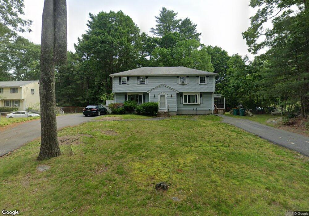
1298 East St Unit A Mansfield, MA 02048
Estimated Value: $372,000 - $455,000
3
Beds
2
Baths
1,200
Sq Ft
$341/Sq Ft
Est. Value
About This Home
This home is located at 1298 East St Unit A, Mansfield, MA 02048 and is currently estimated at $408,741, approximately $340 per square foot. 1298 East St Unit A is a home located in Bristol County with nearby schools including Jordan/Jackson Elementary School, Everett W. Robinson Elementary School, and Harold L. Qualters Middle School.
Ownership History
Date
Name
Owned For
Owner Type
Purchase Details
Closed on
Dec 30, 2008
Sold by
Fortier Bruce G
Bought by
Bernstein Samuel and Situ Caihong
Current Estimated Value
Home Financials for this Owner
Home Financials are based on the most recent Mortgage that was taken out on this home.
Original Mortgage
$82,000
Outstanding Balance
$54,508
Interest Rate
6.17%
Mortgage Type
Purchase Money Mortgage
Estimated Equity
$354,233
Purchase Details
Closed on
Dec 27, 1996
Sold by
Mcpherran Gregory and Mcpherran Lisa E
Bought by
Fortier Bruce G
Home Financials for this Owner
Home Financials are based on the most recent Mortgage that was taken out on this home.
Original Mortgage
$90,200
Interest Rate
7.55%
Mortgage Type
Purchase Money Mortgage
Create a Home Valuation Report for This Property
The Home Valuation Report is an in-depth analysis detailing your home's value as well as a comparison with similar homes in the area
Home Values in the Area
Average Home Value in this Area
Purchase History
| Date | Buyer | Sale Price | Title Company |
|---|---|---|---|
| Bernstein Samuel | $205,000 | -- | |
| Fortier Bruce G | $95,000 | -- |
Source: Public Records
Mortgage History
| Date | Status | Borrower | Loan Amount |
|---|---|---|---|
| Open | Bernstein Samuel | $82,000 | |
| Previous Owner | Fortier Bruce G | $90,200 |
Source: Public Records
Tax History Compared to Growth
Tax History
| Year | Tax Paid | Tax Assessment Tax Assessment Total Assessment is a certain percentage of the fair market value that is determined by local assessors to be the total taxable value of land and additions on the property. | Land | Improvement |
|---|---|---|---|---|
| 2025 | $4,187 | $317,900 | $0 | $317,900 |
| 2024 | $3,850 | $285,200 | $0 | $285,200 |
| 2023 | $3,662 | $259,900 | $0 | $259,900 |
| 2022 | $3,654 | $240,900 | $0 | $240,900 |
| 2021 | $3,622 | $235,800 | $0 | $235,800 |
| 2020 | $3,453 | $224,800 | $0 | $224,800 |
| 2019 | $3,421 | $224,800 | $0 | $224,800 |
| 2018 | $3,382 | $217,200 | $0 | $217,200 |
| 2017 | $3,262 | $217,200 | $0 | $217,200 |
| 2016 | $2,976 | $193,100 | $0 | $193,100 |
| 2015 | $2,771 | $178,800 | $0 | $178,800 |
Source: Public Records
Map
Nearby Homes
- 1360 East St
- 157 Highland St
- 154 Highland St
- 11 Hilltop Ln
- 27 Necco Rd
- 6 Pinebrook Ln Unit 6
- 18 Millfarm Dr
- 108 Norton Ave Unit 24
- 108 Norton Ave Unit 4
- 36 Sierra Dr
- 5 Ian Keats Dr
- 28 Heidi Rd
- 34 Kevins Way
- 96 Kevins Way
- 9 Shagbark Rd
- 0 Kensington Rd
- 23 Estelle Marsan Dr
- 4 Plantation Rd
- 0 Knollwood & 0 Rear Kensington
- 46 Kerry Dr
- 1298 East St
- 1300 East St
- 1288 East St Unit 1290
- 1288-1290 East St
- 1290 East St
- 1308 East St Unit 1310
- 1282 East St
- 10 Echo Hills Dr
- 1320 East St
- 1318 East St
- 1318 East St Unit 1
- 1276 East St
- 1309 East St
- 1323 East St
- 1328 East St Unit 1330
- 1330 East St
- 1330 East St Unit 1330
- 14 Echo Hills Dr
- 1285 East St
- 1268 East St