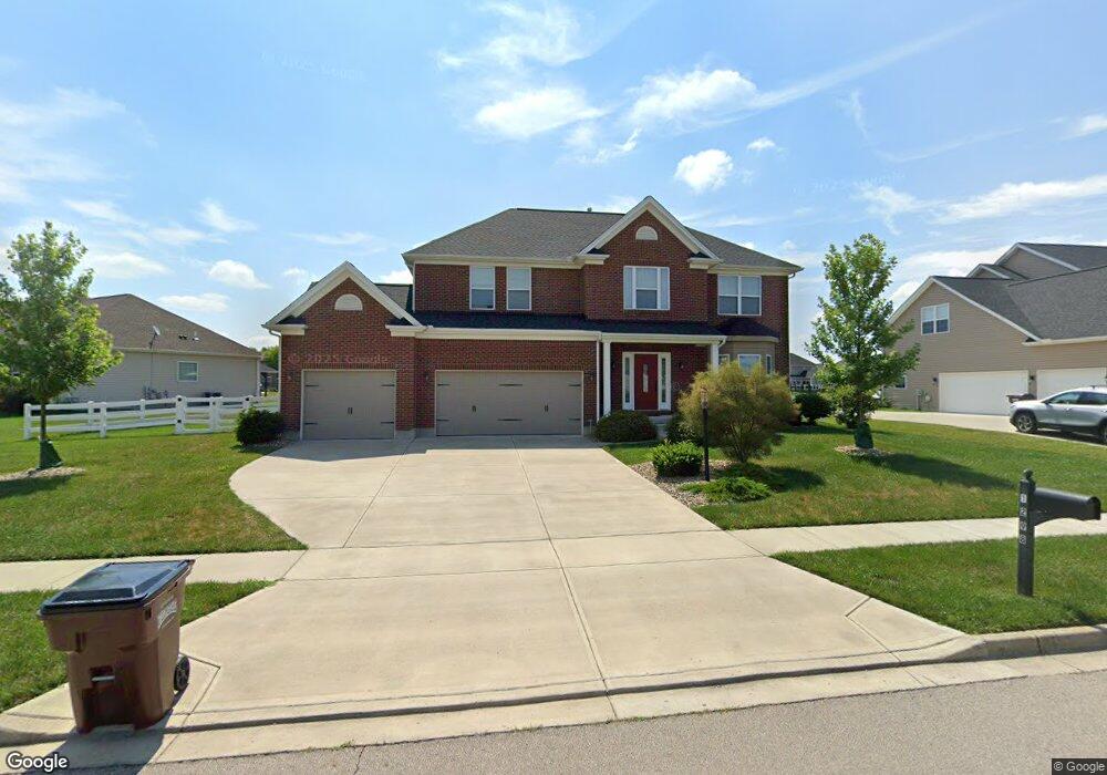
1298 Patriot Way Dayton, OH 45459
Estimated Value: $542,155 - $602,000
4
Beds
3
Baths
2,741
Sq Ft
$207/Sq Ft
Est. Value
About This Home
This home is located at 1298 Patriot Way, Dayton, OH 45459 and is currently estimated at $566,539, approximately $206 per square foot. 1298 Patriot Way is a home located in Greene County with nearby schools including Trebein Elementary School, Jacob Coy Middle School, and Beavercreek High School.
Ownership History
Date
Name
Owned For
Owner Type
Purchase Details
Closed on
Jun 9, 2021
Sold by
Saucier Nicholas R and Saucier Erin L
Bought by
Cunningham Christopher K and Cunningham Ashley M
Current Estimated Value
Home Financials for this Owner
Home Financials are based on the most recent Mortgage that was taken out on this home.
Original Mortgage
$327,920
Outstanding Balance
$298,181
Interest Rate
2.9%
Mortgage Type
Future Advance Clause Open End Mortgage
Estimated Equity
$259,940
Purchase Details
Closed on
Jul 11, 2014
Sold by
M L Huddleston Construction Co Inc
Bought by
Saucier Nicholas R and Saucier Erin L
Home Financials for this Owner
Home Financials are based on the most recent Mortgage that was taken out on this home.
Original Mortgage
$366,715
Interest Rate
4.14%
Mortgage Type
VA
Create a Home Valuation Report for This Property
The Home Valuation Report is an in-depth analysis detailing your home's value as well as a comparison with similar homes in the area
Home Values in the Area
Average Home Value in this Area
Purchase History
| Date | Buyer | Sale Price | Title Company |
|---|---|---|---|
| Cunningham Christopher K | -- | None Listed On Document | |
| Saucier Nicholas R | $355,000 | None Available | |
| M L Huddleston Construction Co Inc | -- | None Available |
Source: Public Records
Mortgage History
| Date | Status | Borrower | Loan Amount |
|---|---|---|---|
| Open | Cunningham Christopher K | $327,920 | |
| Previous Owner | Saucier Nicholas R | $366,715 |
Source: Public Records
Tax History Compared to Growth
Tax History
| Year | Tax Paid | Tax Assessment Tax Assessment Total Assessment is a certain percentage of the fair market value that is determined by local assessors to be the total taxable value of land and additions on the property. | Land | Improvement |
|---|---|---|---|---|
| 2024 | $10,579 | $158,880 | $26,230 | $132,650 |
| 2023 | $10,579 | $158,880 | $26,230 | $132,650 |
| 2022 | $9,540 | $126,480 | $20,180 | $106,300 |
| 2021 | $9,165 | $128,380 | $20,180 | $108,200 |
| 2020 | $9,372 | $128,380 | $20,180 | $108,200 |
| 2019 | $9,031 | $112,840 | $19,840 | $93,000 |
| 2018 | $7,971 | $112,840 | $19,840 | $93,000 |
| 2017 | $7,836 | $112,840 | $19,840 | $93,000 |
| 2016 | $8,197 | $112,510 | $19,840 | $92,670 |
| 2015 | $8,149 | $112,510 | $19,840 | $92,670 |
| 2014 | $8,221 | $112,510 | $19,840 | $92,670 |
Source: Public Records
Map
Nearby Homes
- 1360 Backridge Ct
- 2073 Lincolnshire Dr
- 1238 Freedom Point
- 1535 Stretch Dr
- 2245 Tourney Trail
- 2154 Sulky Trail
- 1361 Obetz Dr Unit A
- 2162 Sulky Trail
- 2331 Eastwind Dr
- 887 Shady Ln
- 1156 Westover Rd
- 895 Alpha Rd
- 1210 Lomeda Ln
- 2507 Obetz Dr
- 1590 Windham Ln
- 1589 Stonebury Ct
- 1051 Forest Dr
- 1023 Amersham Ave
- 2162 Owen E
- 2418 Owen W
- 1298 Patriot Way
- 1286 Patriot
- 1306 Patriot Way
- 1306 Patriot Way
- 1301 Freedom Point
- 1299 Patriot Way
- 1278 Patriot Way
- 1276 Lyndhurst Dr
- 1305 Patriot Way
- 1297 Freedom Point
- 1274 Patriot Way
- 1317 Patriot Way
- 1286 Lyndhurst Dr
- 1293 Freedom Point
- 1275 Patriot Way
- 1302 Freedom Pointe
- 1306 Freedom Point
- 1302 Freedom Point
- 1271 Patriot Way
- 1289 Freedom Point