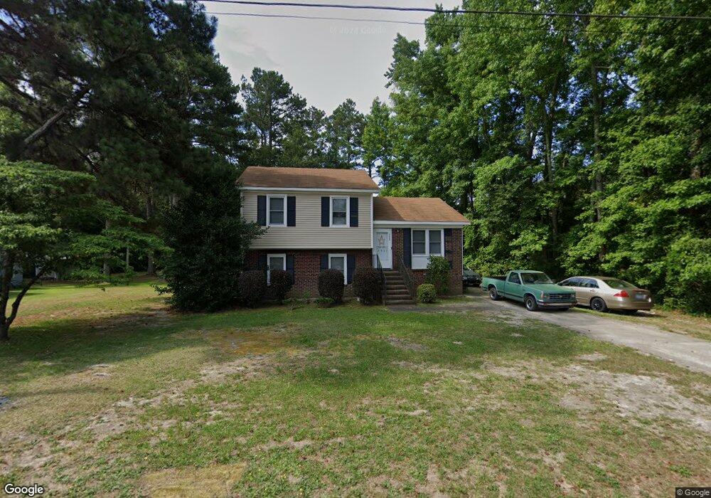
12980 Andrews Dr Laurinburg, NC 28352
Estimated Value: $115,000 - $173,000
3
Beds
2
Baths
1,532
Sq Ft
$95/Sq Ft
Est. Value
About This Home
This home is located at 12980 Andrews Dr, Laurinburg, NC 28352 and is currently estimated at $145,598, approximately $95 per square foot. 12980 Andrews Dr is a home located in Scotland County with nearby schools including South Scotland Elementary, Scotland High School, and Christ the Cornerstone Academy.
Ownership History
Date
Name
Owned For
Owner Type
Purchase Details
Closed on
Jan 31, 2020
Sold by
Reneau Joseph M and Reneau Lindsey
Bought by
Mccall Randay C and Mccall Chasity C
Current Estimated Value
Purchase Details
Closed on
Sep 27, 2007
Sold by
Bullard Judson D and Bullard Helen W
Bought by
Reneau Joseph M and Oliver Lindsey L
Home Financials for this Owner
Home Financials are based on the most recent Mortgage that was taken out on this home.
Original Mortgage
$73,841
Interest Rate
6.49%
Mortgage Type
FHA
Create a Home Valuation Report for This Property
The Home Valuation Report is an in-depth analysis detailing your home's value as well as a comparison with similar homes in the area
Home Values in the Area
Average Home Value in this Area
Purchase History
| Date | Buyer | Sale Price | Title Company |
|---|---|---|---|
| Mccall Randay C | $55,000 | None Available | |
| Reneau Joseph M | $75,000 | None Available |
Source: Public Records
Mortgage History
| Date | Status | Borrower | Loan Amount |
|---|---|---|---|
| Previous Owner | Reneau Joseph M | $73,841 |
Source: Public Records
Tax History Compared to Growth
Tax History
| Year | Tax Paid | Tax Assessment Tax Assessment Total Assessment is a certain percentage of the fair market value that is determined by local assessors to be the total taxable value of land and additions on the property. | Land | Improvement |
|---|---|---|---|---|
| 2025 | $783 | $73,570 | $11,000 | $62,570 |
| 2024 | $776 | $73,570 | $11,000 | $62,570 |
| 2023 | $783 | $73,570 | $11,000 | $62,570 |
| 2022 | $783 | $73,570 | $11,000 | $62,570 |
| 2021 | $791 | $73,570 | $11,000 | $62,570 |
| 2020 | $783 | $73,570 | $11,000 | $62,570 |
| 2019 | $791 | $73,570 | $11,000 | $62,570 |
| 2018 | $804 | $74,920 | $11,000 | $63,920 |
| 2017 | $812 | $74,920 | $11,000 | $63,920 |
| 2016 | $819 | $74,920 | $11,000 | $63,920 |
| 2015 | $827 | $74,920 | $11,000 | $63,920 |
| 2014 | $772 | $0 | $0 | $0 |
Source: Public Records
Map
Nearby Homes
- 11760 Azalea Dr
- 0 Spring Branch Dr
- 11561 Purcell Rd
- 12881 Scottish Ave
- 11661 Azalea Dr
- 12760 S Pine Villa Dr
- 11621 Purcell Rd
- 12460 Appin Rd
- 12520 Saddle Path Cir
- Lots 7-9 Greenbrier St
- Lots 10-12 Greenbrier St
- 9881 McColl Rd
- 12401 Purcell Rd
- 12400 Olde Farm Cir
- 0 Blues Farm Rd
- 12521 Bagpipe Ln
- 12521 Bag Pipe Ln
- 0 Turnpike
- 12501 Blues Farm Rd
- 13280 Blues Farm Rd
- 12960 Andrews Dr
- 13000 Andrews Dr
- 12940 Andrews Dr
- 12961 Andrews Dr
- 12981 Andrews Dr
- 12021 Simmons Ave
- 12920 Andrews Dr
- 12941 Andrews Dr
- 12041 Simmons Ave
- 12080 Simmons Ave
- 12921 Andrews Dr
- 12900 Andrews Dr
- 12061 Simmons Ave
- 13000 Todd Cir
- 12061 McCarter Ave
- 12100 Simmons Ave
- 12101 Simmons Ave
- 12081 McCarter Ave
- 12900 Todd Cir
- 13001 Todd Cir