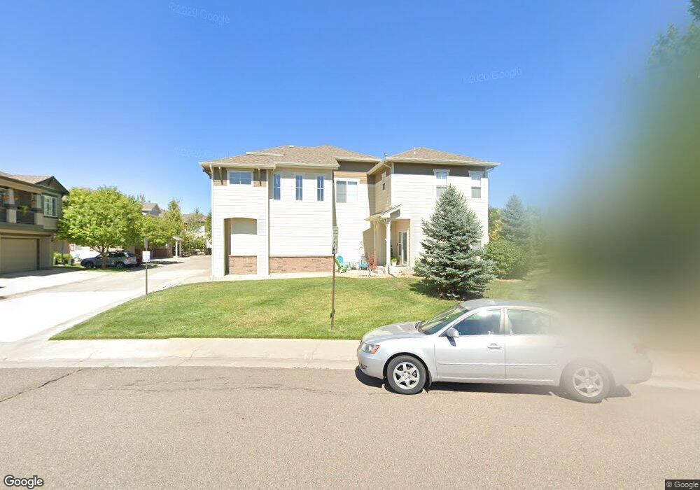
12980 Grant Cir W Unit B Thornton, CO 80241
Estimated Value: $421,955 - $438,000
2
Beds
3
Baths
1,553
Sq Ft
$278/Sq Ft
Est. Value
About This Home
This home is located at 12980 Grant Cir W Unit B, Thornton, CO 80241 and is currently estimated at $431,239, approximately $277 per square foot. 12980 Grant Cir W Unit B is a home located in Adams County with nearby schools including Hunters Glen Elementary School, Century Middle School, and Mountain Range High School.
Ownership History
Date
Name
Owned For
Owner Type
Purchase Details
Closed on
Mar 30, 2016
Sold by
Merritt Michael Aaron and Hearing Brittany Ellen
Bought by
Ribordy Vangie and Luse Kevin
Current Estimated Value
Home Financials for this Owner
Home Financials are based on the most recent Mortgage that was taken out on this home.
Original Mortgage
$188,700
Outstanding Balance
$149,763
Interest Rate
3.65%
Mortgage Type
New Conventional
Estimated Equity
$281,476
Purchase Details
Closed on
Apr 2, 2009
Sold by
Ccs Thorncreek I Llc
Bought by
Merritt Michael Aaron and Hearing Brittany Ellen
Home Financials for this Owner
Home Financials are based on the most recent Mortgage that was taken out on this home.
Original Mortgage
$181,649
Interest Rate
5.14%
Mortgage Type
FHA
Create a Home Valuation Report for This Property
The Home Valuation Report is an in-depth analysis detailing your home's value as well as a comparison with similar homes in the area
Home Values in the Area
Average Home Value in this Area
Purchase History
| Date | Buyer | Sale Price | Title Company |
|---|---|---|---|
| Ribordy Vangie | $255,000 | Homestead Title And Escrow | |
| Merritt Michael Aaron | $185,000 | Fahtco |
Source: Public Records
Mortgage History
| Date | Status | Borrower | Loan Amount |
|---|---|---|---|
| Open | Ribordy Vangie | $188,700 | |
| Previous Owner | Merritt Michael Aaron | $181,649 |
Source: Public Records
Tax History Compared to Growth
Tax History
| Year | Tax Paid | Tax Assessment Tax Assessment Total Assessment is a certain percentage of the fair market value that is determined by local assessors to be the total taxable value of land and additions on the property. | Land | Improvement |
|---|---|---|---|---|
| 2024 | $2,627 | $25,750 | $5,000 | $20,750 |
| 2023 | $2,600 | $29,090 | $4,400 | $24,690 |
| 2022 | $2,709 | $23,800 | $4,240 | $19,560 |
| 2021 | $2,709 | $23,800 | $4,240 | $19,560 |
| 2020 | $2,585 | $23,170 | $4,360 | $18,810 |
| 2019 | $2,590 | $23,170 | $4,360 | $18,810 |
| 2018 | $2,320 | $20,160 | $1,160 | $19,000 |
| 2017 | $2,109 | $20,160 | $1,160 | $19,000 |
| 2016 | $1,661 | $15,460 | $1,280 | $14,180 |
| 2015 | $1,659 | $15,460 | $1,280 | $14,180 |
| 2014 | -- | $13,320 | $1,280 | $12,040 |
Source: Public Records
Map
Nearby Homes
- 13043 Grant Cir E Unit C
- 12962 Grant Cir E Unit C
- 12921 Grant Cir W Unit B
- 12910 Grant Cir W Unit C
- 12901 Grant Cir W Unit C
- 13141 Grant Cir N Unit B
- 13151 Grant Cir N Unit B
- 13151 Grant Cir N Unit C
- 0 128th & Washington St
- 609 W 130th Ave
- 13283 Clarkson St
- 943 E 130th Dr
- 12901 Galapago St
- 1124 E 130th Ave Unit C
- 1089 E 131st Dr
- 811 W 128th Place
- 1162 E 130th Ave Unit B
- 834 W 128th Place
- 12941 Lafayette St Unit G
- 12941 Lafayette St Unit A
- 12980 Grant Cir W Unit C
- 12980 Grant Cir W Unit A
- 12980 Grant Cir W
- 12984 Grant Circle West #B
- 12970 Grant Cir W Unit A
- 12970 Grant Cir W Unit B
- 12970 Grant Cir W Unit C
- 12970 Grant Cir W
- 12970 Grant Cir W Unit 73B
- 12984 Grant Cir W Unit A
- 12984 Grant Cir W Unit B
- 12984 Grant Cir W Unit C
- 12969 Grant Cir E Unit C
- 12969 Grant Cir E Unit B
- 12969 Grant Cir E Unit A
- 12969 Grant Cir E
- 12969 Grant Cir E Unit 50A
- 12990 Grant Cir W Unit C
- 12990 Grant Cir W Unit B
- 12990 Grant Cir W Unit A