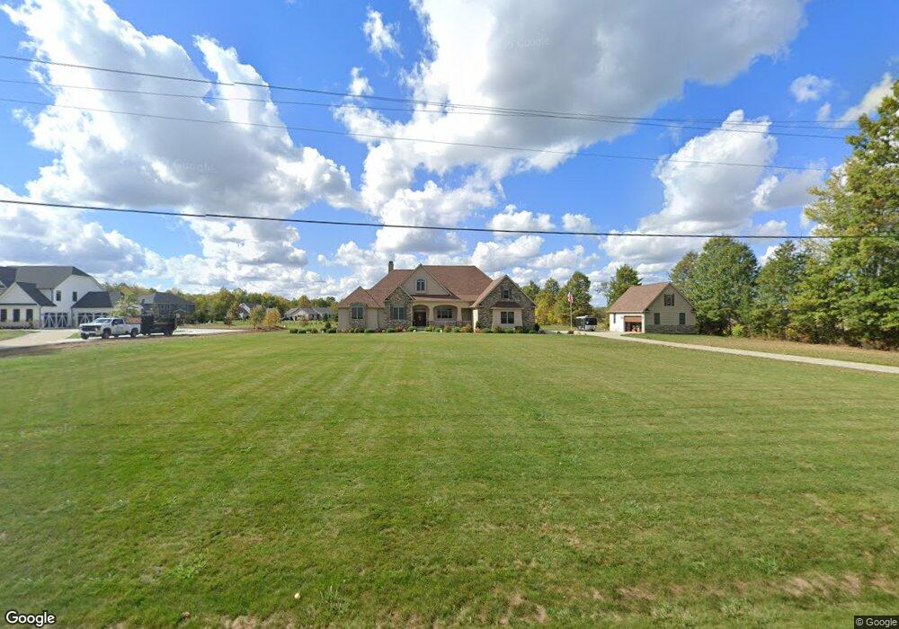
12980 State Route 301 Lagrange, OH 44050
Estimated Value: $668,000 - $854,000
3
Beds
3
Baths
3,001
Sq Ft
$253/Sq Ft
Est. Value
About This Home
This home is located at 12980 State Route 301, Lagrange, OH 44050 and is currently estimated at $759,676, approximately $253 per square foot. 12980 State Route 301 is a home with nearby schools including Keystone Elementary School, Keystone Middle School, and Keystone High School.
Ownership History
Date
Name
Owned For
Owner Type
Purchase Details
Closed on
Apr 26, 2017
Sold by
Raintree Development Ltd
Bought by
Cole Patricia L and Bitting Dale L
Current Estimated Value
Create a Home Valuation Report for This Property
The Home Valuation Report is an in-depth analysis detailing your home's value as well as a comparison with similar homes in the area
Purchase History
| Date | Buyer | Sale Price | Title Company |
|---|---|---|---|
| Cole Patricia L | $32,000 | Fidelity National Title |
Source: Public Records
Tax History
| Year | Tax Paid | Tax Assessment Tax Assessment Total Assessment is a certain percentage of the fair market value that is determined by local assessors to be the total taxable value of land and additions on the property. | Land | Improvement |
|---|---|---|---|---|
| 2024 | $11,095 | $270,344 | $30,240 | $240,104 |
| 2023 | $11,693 | $235,284 | $28,770 | $206,514 |
| 2022 | $11,560 | $235,284 | $28,770 | $206,514 |
| 2021 | $11,563 | $235,284 | $28,770 | $206,514 |
| 2020 | $11,608 | $214,680 | $26,250 | $188,430 |
| 2019 | $1,129 | $21,000 | $21,000 | $0 |
| 2018 | $913 | $21,000 | $21,000 | $0 |
| 2017 | $692 | $11,980 | $11,980 | $0 |
| 2016 | $688 | $11,980 | $11,980 | $0 |
| 2015 | $677 | $11,980 | $11,980 | $0 |
| 2014 | $595 | $11,980 | $11,980 | $0 |
| 2013 | $619 | $11,980 | $11,980 | $0 |
Source: Public Records
Map
Nearby Homes
- 41341 Ravines Edge Way
- 40163 Banks Rd
- 40175 Banks Rd
- 13301 Indian Hollow Rd
- 11861 Indian Hollow Rd
- 39535 Butternut Ridge Rd
- 39277 Butternut Ridge Rd
- 1207 Fox Run
- 1167 Fox Run
- 114 River Run Dr
- 502 Cedarwood Trail
- 437 Pheasant Run
- 40000 Myrtle Ct
- 421 Pheasant Run
- 430 Pheasant Run
- 10832 Indian Hollow Rd
- 246 River Run Dr
- 426 Pheasant Run
- 221 River Run Dr
- 229 River Run Dr
- 41063 Ravines Edge Way
- 12980 Lagrange Rd
- 41042 Ravines Edge Way
- 12933 State Route 301
- 41064 Ravines Edge Way
- 41096 Ravines Edge Way
- 41113 Ravines Edge Way
- 12930 Lagrange Rd
- 40999 Slife Rd
- 41114 Ravines Edge Way
- 41138 Ravines Edge Way
- 41137 Ravines Edge Way
- 40957 Slife Rd
- 18 Ravines Edge Way
- 6 Ravines Edge Way Unit 6
- 16 Ravines Edge Way Unit 16
- 5 Ravines Edge Way Unit SL5
- 7 Ravines Edge Way Unit 7
- 13110 State Route 301
- 41172 Ravines Edge Way
Your Personal Tour Guide
Ask me questions while you tour the home.