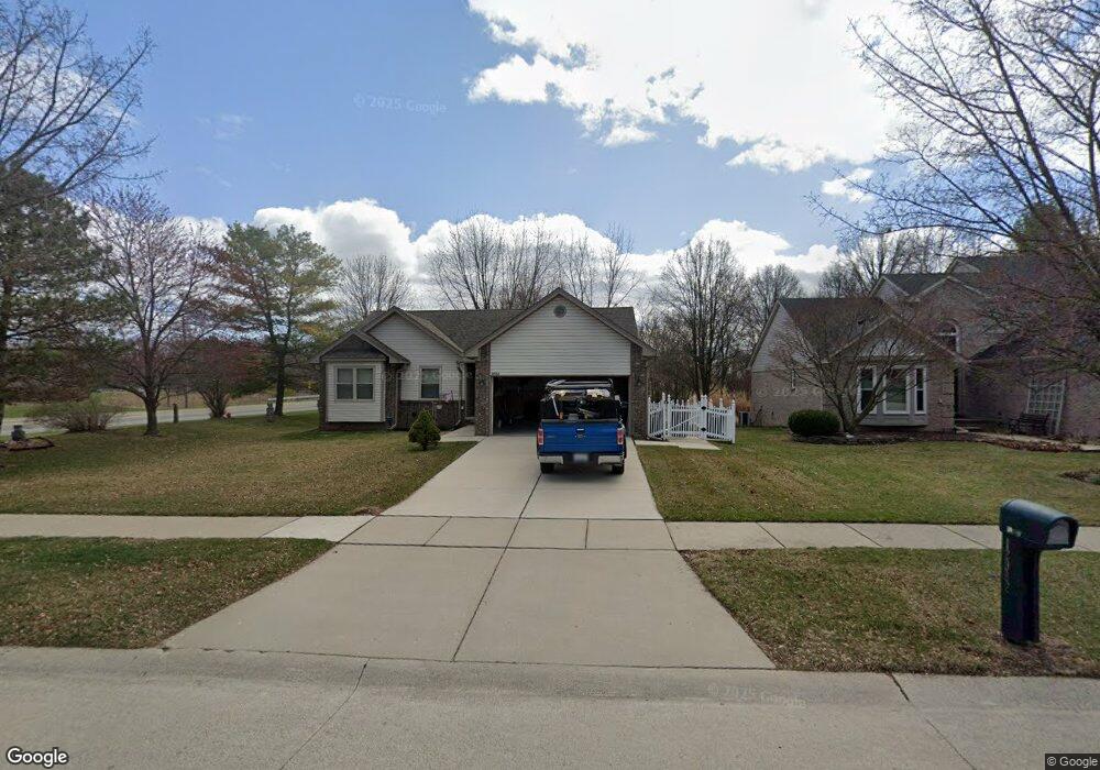
12982 Rolling Brook Ct Sterling Heights, MI 48313
Estimated Value: $329,620 - $380,000
3
Beds
3
Baths
1,545
Sq Ft
$231/Sq Ft
Est. Value
About This Home
This home is located at 12982 Rolling Brook Ct, Sterling Heights, MI 48313 and is currently estimated at $356,155, approximately $230 per square foot. 12982 Rolling Brook Ct is a home located in Macomb County with nearby schools including Dekeyser Elementary School, Davis Junior High School, and Adlai Stevenson High School.
Ownership History
Date
Name
Owned For
Owner Type
Purchase Details
Closed on
Apr 29, 2020
Sold by
Bramham Diane and Halaberda Barbara
Bought by
Twardesky James M and Twardesky Deborah S
Current Estimated Value
Purchase Details
Closed on
Jan 2, 2015
Sold by
Krueger Richard E and Krueger Janice M
Bought by
Trustees Of The Richard E Krueger & Jani
Purchase Details
Closed on
May 27, 1999
Sold by
Hillcrest Homes Inc
Bought by
Norkus David
Create a Home Valuation Report for This Property
The Home Valuation Report is an in-depth analysis detailing your home's value as well as a comparison with similar homes in the area
Home Values in the Area
Average Home Value in this Area
Purchase History
| Date | Buyer | Sale Price | Title Company |
|---|---|---|---|
| Twardesky James M | $268,000 | Stg | |
| Trustees Of The Richard E Krueger & Jani | -- | None Available | |
| Norkus David | $206,684 | -- |
Source: Public Records
Tax History Compared to Growth
Tax History
| Year | Tax Paid | Tax Assessment Tax Assessment Total Assessment is a certain percentage of the fair market value that is determined by local assessors to be the total taxable value of land and additions on the property. | Land | Improvement |
|---|---|---|---|---|
| 2025 | $3,677 | $160,800 | $0 | $0 |
| 2024 | $3,362 | $153,800 | $0 | $0 |
| 2023 | $3,174 | $138,000 | $0 | $0 |
| 2022 | $3,309 | $122,400 | $0 | $0 |
| 2021 | $3,240 | $117,800 | $0 | $0 |
| 2020 | $2,890 | $111,600 | $0 | $0 |
| 2019 | $2,961 | $108,100 | $0 | $0 |
| 2018 | $3,716 | $100,200 | $0 | $0 |
| 2017 | $2,861 | $94,200 | $20,800 | $73,400 |
| 2016 | $2,764 | $94,200 | $0 | $0 |
| 2015 | -- | $86,200 | $0 | $0 |
| 2014 | -- | $75,700 | $0 | $0 |
Source: Public Records
Map
Nearby Homes
- 12816 Kinlock Dr
- 39400 Utica Rd
- 39252 Della Rosa Dr
- 39275 Della Rosa Dr
- 13386 Winona Dr
- 13311 Picadilly Dr
- 39239 Chantilly Dr
- 38171 Jamestown Dr Unit 116
- 38146 Jamestown Dr Unit 86
- 39839 Utica Rd
- 13466 Denver Cir E
- 13470 Denver Cir E
- 13000 Plumbrook Rd
- 13104 Carnaby Ct
- 39044 Dodge Park Rd
- 39123 Boston Dr
- 13762 Halleck Dr
- 14326 Merci Ave
- 39346 Zofia Ave
- 13722 Diversion Dr
- 12946 Rolling Brook Ct
- 12921 Rolling Brook Ct
- 12903 Rolling Brook Ct
- 12928 Rolling
- 12928 Rolling Brook Ct
- 12885 Rolling Brook Ct
- 39100 Utica Rd
- 39171 Utica Rd
- 12910 Rolling Brook Ct
- 12867 Rolling Brook Ct
- 39120 Utica Rd
- 39193 Utica Rd
- 12892 Rolling Brook Ct
- 12849 Rolling Brook Ct
- 12874 Rolling Brook Ct
- 39215 Utica Rd
- 12831 Rolling Brook Ct
- 12856 Rolling Brook Ct
- 12838 Rolling Brook Ct
- 13041 Kinlock Dr