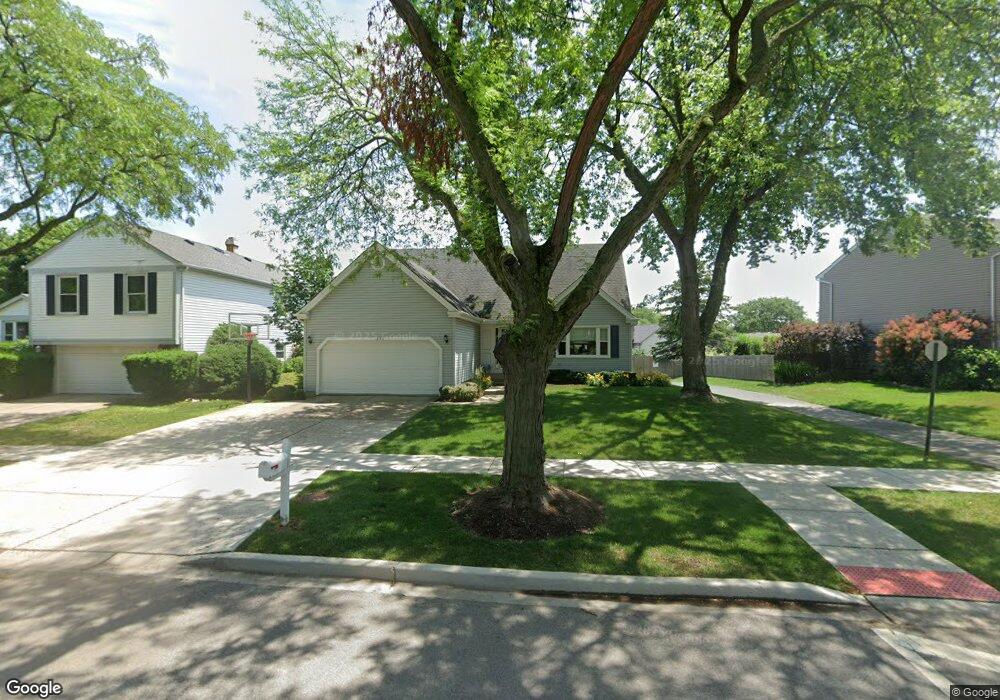
1299 Brandywyn Ln Buffalo Grove, IL 60089
Estimated Value: $578,000 - $632,000
--
Bed
3
Baths
2,163
Sq Ft
$279/Sq Ft
Est. Value
About This Home
This home is located at 1299 Brandywyn Ln, Buffalo Grove, IL 60089 and is currently estimated at $603,201, approximately $278 per square foot. 1299 Brandywyn Ln is a home located in Lake County with nearby schools including Prairie Elementary School, Twin Groves Middle School, and Adlai E Stevenson High School.
Ownership History
Date
Name
Owned For
Owner Type
Purchase Details
Closed on
Apr 20, 2001
Sold by
Naidoff Mark W and Naidoff Caren E I
Bought by
Ezrol Jonathan A and Ezrol Lisa
Current Estimated Value
Home Financials for this Owner
Home Financials are based on the most recent Mortgage that was taken out on this home.
Original Mortgage
$275,000
Outstanding Balance
$100,847
Interest Rate
6.95%
Estimated Equity
$502,354
Purchase Details
Closed on
Mar 6, 1998
Sold by
Evans Mark D and Evans Claire L
Bought by
Naidoff Mark W and Naidoff Caren E
Home Financials for this Owner
Home Financials are based on the most recent Mortgage that was taken out on this home.
Original Mortgage
$200,000
Interest Rate
6.62%
Create a Home Valuation Report for This Property
The Home Valuation Report is an in-depth analysis detailing your home's value as well as a comparison with similar homes in the area
Home Values in the Area
Average Home Value in this Area
Purchase History
| Date | Buyer | Sale Price | Title Company |
|---|---|---|---|
| Ezrol Jonathan A | $357,000 | Chicago Title Insurance Co | |
| Naidoff Mark W | $250,000 | -- |
Source: Public Records
Mortgage History
| Date | Status | Borrower | Loan Amount |
|---|---|---|---|
| Open | Ezrol Jonathan A | $275,000 | |
| Previous Owner | Naidoff Mark W | $200,000 |
Source: Public Records
Tax History Compared to Growth
Tax History
| Year | Tax Paid | Tax Assessment Tax Assessment Total Assessment is a certain percentage of the fair market value that is determined by local assessors to be the total taxable value of land and additions on the property. | Land | Improvement |
|---|---|---|---|---|
| 2024 | $15,004 | $171,668 | $33,004 | $138,664 |
| 2023 | $13,810 | $154,269 | $29,659 | $124,610 |
| 2022 | $13,810 | $138,441 | $26,616 | $111,825 |
| 2021 | $13,287 | $136,948 | $26,329 | $110,619 |
| 2020 | $12,974 | $137,415 | $26,419 | $110,996 |
| 2019 | $12,795 | $136,909 | $26,322 | $110,587 |
| 2018 | $12,136 | $134,117 | $26,014 | $108,103 |
| 2017 | $11,906 | $130,987 | $25,407 | $105,580 |
| 2016 | $11,596 | $125,430 | $24,329 | $101,101 |
| 2015 | $11,290 | $117,301 | $22,752 | $94,549 |
| 2014 | $10,597 | $108,964 | $24,436 | $84,528 |
| 2012 | $10,527 | $109,182 | $24,485 | $84,697 |
Source: Public Records
Map
Nearby Homes
- 1265 Devonshire Rd
- 1141 Devonshire Rd
- 327 Lasalle Ln
- 890 Knollwood Dr
- 931 Shady Grove Ln
- 1118 Larraway Dr
- 950 Belmar Ln
- 1546 Brandywyn Ln
- 1152 Courtland Dr Unit 406
- 1032 Courtland Dr Unit 9
- 437 Caren Dr
- 614 Lyon Ct
- 1113 Lockwood Dr
- 538 Lasalle Ct
- 12 Cloverdale Ct
- 711 Woodhollow Ln
- 5107 N Arlington Heights Rd
- 938 Hidden Lake Dr
- 800 Clohesey Dr
- 610 Checker Dr
- 1311 Brandywyn Ln
- 1285 Brandywyn Ln
- 1278 Gail Dr
- 1321 Brandywyn Ln
- 1270 Gail Dr
- 1286 Gail Dr
- 1271 Brandywyn Ln
- 1294 Gail Dr
- 740 Chaucer Way
- 729 Chaucer Way
- 1331 Brandywyn Ln
- 1255 Brandywyn Ln
- 1298 Brandywyn Ln
- 1306 Gail Dr
- 1254 Gail Dr
- 1342 Brandywyn Ln Unit 2
- 1284 Brandywyn Ln
- 1295 Gail Dr
- 741 Chaucer Way
- 752 Chaucer Way