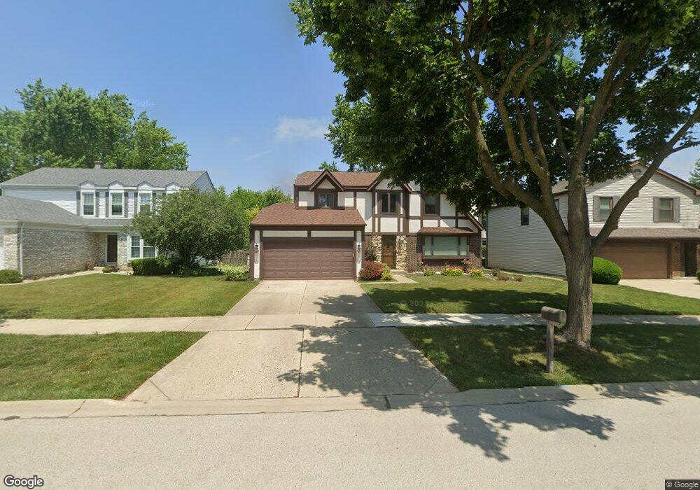
1299 Devonshire Rd Buffalo Grove, IL 60089
Prairie Park-Lake County NeighborhoodEstimated Value: $545,712 - $603,000
--
Bed
3
Baths
2,199
Sq Ft
$260/Sq Ft
Est. Value
About This Home
This home is located at 1299 Devonshire Rd, Buffalo Grove, IL 60089 and is currently estimated at $571,178, approximately $259 per square foot. 1299 Devonshire Rd is a home located in Lake County with nearby schools including Prairie Elementary School, Twin Groves Middle School, and Adlai E Stevenson High School.
Ownership History
Date
Name
Owned For
Owner Type
Purchase Details
Closed on
May 7, 1998
Sold by
Teplinsky Marvin and Teplinsky Lillian
Bought by
Hoy John P and Hoy Sharon M
Current Estimated Value
Home Financials for this Owner
Home Financials are based on the most recent Mortgage that was taken out on this home.
Original Mortgage
$133,800
Outstanding Balance
$26,486
Interest Rate
7.25%
Estimated Equity
$544,692
Create a Home Valuation Report for This Property
The Home Valuation Report is an in-depth analysis detailing your home's value as well as a comparison with similar homes in the area
Home Values in the Area
Average Home Value in this Area
Purchase History
| Date | Buyer | Sale Price | Title Company |
|---|---|---|---|
| Hoy John P | $230,500 | Mercury Title |
Source: Public Records
Mortgage History
| Date | Status | Borrower | Loan Amount |
|---|---|---|---|
| Open | Hoy John P | $133,800 |
Source: Public Records
Tax History Compared to Growth
Tax History
| Year | Tax Paid | Tax Assessment Tax Assessment Total Assessment is a certain percentage of the fair market value that is determined by local assessors to be the total taxable value of land and additions on the property. | Land | Improvement |
|---|---|---|---|---|
| 2024 | $14,235 | $155,555 | $33,162 | $122,393 |
| 2023 | $13,491 | $146,778 | $31,291 | $115,487 |
| 2022 | $13,491 | $135,377 | $28,860 | $106,517 |
| 2021 | $12,979 | $133,917 | $28,549 | $105,368 |
| 2020 | $12,673 | $134,373 | $28,646 | $105,727 |
| 2019 | $12,499 | $133,877 | $28,540 | $105,337 |
| 2018 | $12,056 | $133,275 | $28,208 | $105,067 |
| 2017 | $11,828 | $130,165 | $27,550 | $102,615 |
| 2016 | $11,520 | $124,643 | $26,381 | $98,262 |
| 2015 | $11,215 | $116,565 | $24,671 | $91,894 |
| 2014 | $10,256 | $105,647 | $26,496 | $79,151 |
| 2012 | $10,180 | $105,859 | $26,549 | $79,310 |
Source: Public Records
Map
Nearby Homes
- 1265 Devonshire Rd
- 890 Knollwood Dr
- 1141 Devonshire Rd
- 1152 Courtland Dr Unit 406
- 1032 Courtland Dr Unit 9
- 950 Belmar Ln
- 327 Lasalle Ln
- 931 Shady Grove Ln
- 1546 Brandywyn Ln
- 1118 Larraway Dr
- 5107 N Arlington Heights Rd
- 614 Lyon Ct
- 437 Caren Dr
- 12 Cloverdale Ct
- 538 Lasalle Ct
- 1113 Lockwood Dr
- 800 Clohesey Dr
- 1324 Fairfax Ln Unit B32
- 1325 Fairfax Ln
- 711 Woodhollow Ln
- 1293 Devonshire Rd
- 1301 Devonshire Rd
- 1303 Devonshire Rd
- 1287 Devonshire Rd
- 848 Chaucer Way
- 824 Chaucer Way
- 1264 Dayton Rd
- 1300 Devonshire Rd
- 860 Chaucer Way
- 812 Chaucer Way
- 1305 Devonshire Rd
- 1281 Devonshire Rd
- 1302 Devonshire Rd
- 1265 Dayton Rd
- 1304 Devonshire Rd
- 800 Chaucer Way
- 1307 Devonshire Rd
- 1275 Devonshire Rd
- 872 Chaucer Way
- 796 Dannet Rd