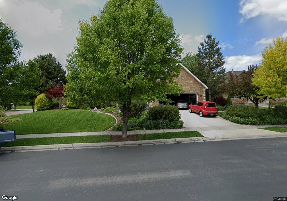
1299 N 1270 E American Fork, UT 84003
Estimated Value: $765,000 - $953,000
6
Beds
4
Baths
4,064
Sq Ft
$205/Sq Ft
Est. Value
About This Home
This home is located at 1299 N 1270 E, American Fork, UT 84003 and is currently estimated at $834,079, approximately $205 per square foot. 1299 N 1270 E is a home located in Utah County with nearby schools including Deerfield Elementary School, Mountain Ridge Junior High School, and American Fork High School.
Ownership History
Date
Name
Owned For
Owner Type
Purchase Details
Closed on
May 9, 2019
Sold by
Poulton Chet and Poulton Charlotte
Bought by
Chet & Charlotte Poulton Family Trust
Current Estimated Value
Purchase Details
Closed on
Sep 23, 2016
Sold by
Aldred Scott J and Aldred Gloria
Bought by
Poulton Chet and Poulton Charlotte
Home Financials for this Owner
Home Financials are based on the most recent Mortgage that was taken out on this home.
Original Mortgage
$269,000
Outstanding Balance
$214,867
Interest Rate
3.43%
Mortgage Type
New Conventional
Estimated Equity
$619,212
Purchase Details
Closed on
Dec 11, 2003
Sold by
Aldred Scott J
Bought by
Aldred Scott J and Aldred Gloria
Home Financials for this Owner
Home Financials are based on the most recent Mortgage that was taken out on this home.
Original Mortgage
$303,000
Interest Rate
4.01%
Mortgage Type
New Conventional
Purchase Details
Closed on
Mar 25, 2002
Sold by
Curtis Bruce V
Bought by
Aldred Scott J
Home Financials for this Owner
Home Financials are based on the most recent Mortgage that was taken out on this home.
Original Mortgage
$296,875
Interest Rate
6.84%
Purchase Details
Closed on
May 16, 2001
Sold by
American Springs Development Company Llc
Bought by
Curtis Bruce
Create a Home Valuation Report for This Property
The Home Valuation Report is an in-depth analysis detailing your home's value as well as a comparison with similar homes in the area
Home Values in the Area
Average Home Value in this Area
Purchase History
| Date | Buyer | Sale Price | Title Company |
|---|---|---|---|
| Chet & Charlotte Poulton Family Trust | -- | None Available | |
| Poulton Chet | -- | Bay National Title Co | |
| Aldred Scott J | -- | Sundance Title Insurance Ag | |
| Aldred Scott J | -- | Inwest Title Services Inc | |
| Curtis Bruce | -- | Signature Title |
Source: Public Records
Mortgage History
| Date | Status | Borrower | Loan Amount |
|---|---|---|---|
| Open | Poulton Chet | $269,000 | |
| Previous Owner | Aldred Scott J | $303,000 | |
| Previous Owner | Aldred Scott J | $296,875 |
Source: Public Records
Tax History Compared to Growth
Tax History
| Year | Tax Paid | Tax Assessment Tax Assessment Total Assessment is a certain percentage of the fair market value that is determined by local assessors to be the total taxable value of land and additions on the property. | Land | Improvement |
|---|---|---|---|---|
| 2025 | $3,352 | $386,100 | $246,800 | $455,200 |
| 2024 | $3,352 | $372,405 | $0 | $0 |
| 2023 | $3,199 | $376,860 | $0 | $0 |
| 2022 | $2,992 | $347,820 | $0 | $0 |
| 2021 | $2,627 | $477,100 | $172,800 | $304,300 |
| 2020 | $2,554 | $449,800 | $160,000 | $289,800 |
| 2019 | $2,404 | $437,800 | $148,000 | $289,800 |
| 2018 | $2,468 | $429,800 | $140,000 | $289,800 |
| 2017 | $2,383 | $224,015 | $0 | $0 |
| 2016 | -- | $204,545 | $0 | $0 |
| 2015 | $2,228 | $184,690 | $0 | $0 |
| 2014 | $1,981 | $161,920 | $0 | $0 |
Source: Public Records
Map
Nearby Homes
- 1243 N 1270 E
- 1172 Murdock Dr
- 4441 W Bridgestone Dr
- 1162 E 1180 N
- 9587 N 4500 W
- 248 N Deerfield Ln
- 9681 N Peach Ct
- 1228 E 1030 N
- 4631 W Harvey Blvd
- 1058 N 930 E Unit 64
- 1089 N 950 E
- 1059 N 930 E
- The McKenzie Plan at Autumn Crest
- The Christine Plan at Autumn Crest
- The Avery Plan at Autumn Crest
- The Madison Plan at Autumn Crest
- The Roosevelt Plan at Autumn Crest
- The Annie Plan at Autumn Crest
- The Michelle Plan at Autumn Crest
- 1053 N 930 E Unit 73
- 1251 E 1280 N
- 1331 N 1270 E
- 1296 N 1270 E
- 1262 E 1350 N
- 1262 E 1350 N Unit 81
- 1277 N 1270 E
- 1277 N 1270 E Unit 75
- 1243 E 1280 N
- 1338 N 1270 E
- 1338 N 1270 E Unit 50
- 1248 E 1280 N
- 1244 E 1350 N
- 1276 N 1270 E
- 1276 N 1270 E Unit 52
- 1342 N 1270 E
- 1265 N 1270 E
- 1265 N 1270 E Unit 74
- 1230 E 1350 N
- 9849 N 4500 W
- 1261 E 1350 N