Estimated Value: $850,844
3
Beds
2
Baths
--
Sq Ft
0.4
Acres
About This Home
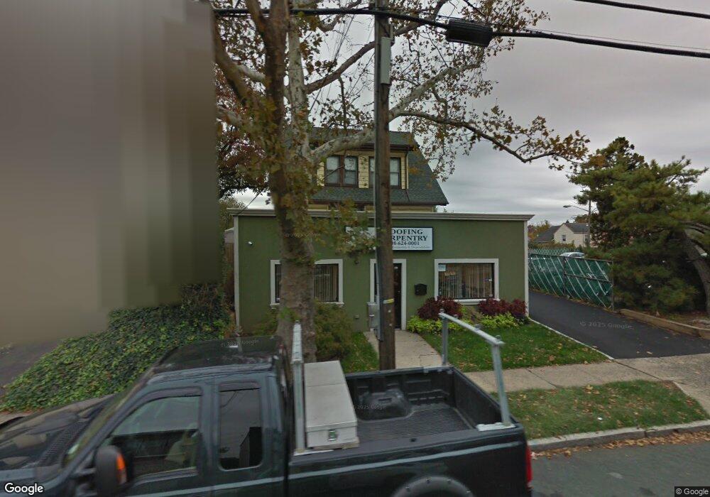
This home is located at 1299 Stuyvesant Ave, Union, NJ 07083 and is currently estimated at $850,844. 1299 Stuyvesant Ave is a home located in Union County with nearby schools including Franklin Elementary School, Burnet Middle School, and Union High School.
Ownership History
Date
Name
Owned For
Owner Type
Purchase Details
Closed on
Dec 10, 2013
Sold by
Metta Realty Llc
Bought by
Tico S Investment Llc
Current Estimated Value
Home Financials for this Owner
Home Financials are based on the most recent Mortgage that was taken out on this home.
Original Mortgage
$320,000
Outstanding Balance
$240,493
Interest Rate
4.35%
Mortgage Type
Commercial
Estimated Equity
$610,351
Purchase Details
Closed on
Feb 19, 2004
Sold by
Spaeth Arold
Bought by
Stevens Sammy
Home Financials for this Owner
Home Financials are based on the most recent Mortgage that was taken out on this home.
Original Mortgage
$165,000
Interest Rate
5.67%
Mortgage Type
Commercial
Create a Home Valuation Report for This Property
The Home Valuation Report is an in-depth analysis detailing your home's value as well as a comparison with similar homes in the area
Home Values in the Area
Average Home Value in this Area
Purchase History
| Date | Buyer | Sale Price | Title Company |
|---|---|---|---|
| Tico S Investment Llc | $400,000 | Agent For Old Republic Nati | |
| Stevens Sammy | $400,000 | -- |
Source: Public Records
Mortgage History
| Date | Status | Borrower | Loan Amount |
|---|---|---|---|
| Open | Tico S Investment Llc | $320,000 | |
| Previous Owner | Stevens Sammy | $165,000 |
Source: Public Records
Tax History Compared to Growth
Tax History
| Year | Tax Paid | Tax Assessment Tax Assessment Total Assessment is a certain percentage of the fair market value that is determined by local assessors to be the total taxable value of land and additions on the property. | Land | Improvement |
|---|---|---|---|---|
| 2025 | $18,820 | $84,200 | $42,800 | $41,400 |
| 2024 | $18,245 | $84,200 | $42,800 | $41,400 |
| 2023 | $18,245 | $84,200 | $42,800 | $41,400 |
| 2022 | $17,611 | $84,200 | $42,800 | $41,400 |
| 2021 | $17,184 | $84,200 | $42,800 | $41,400 |
| 2020 | $16,842 | $84,200 | $42,800 | $41,400 |
| 2019 | $16,615 | $84,200 | $42,800 | $41,400 |
| 2018 | $16,332 | $84,200 | $42,800 | $41,400 |
| 2017 | $13,568 | $71,000 | $42,800 | $28,200 |
| 2016 | $13,237 | $71,000 | $42,800 | $28,200 |
| 2015 | $13,018 | $71,000 | $42,800 | $28,200 |
| 2014 | $12,726 | $71,000 | $42,800 | $28,200 |
Source: Public Records
Map
Nearby Homes
- 1287 Oxford Ln
- 2010 Gless Ave
- 1263 Coolidge Ave
- 2021 Tyler St
- 1871 Pilgrim Way
- 1244 Grandview Ave
- 1893 Arbor Ln
- 1249 Plane St
- 1239 Victor Ave
- 2112 Gless Ave
- 1848 Portsmouth Way
- 2144 Tyler St
- 152 Glenwood Ct
- 1396 Orange Ave
- 1231 Glenn Ave
- 1084 Pine Ave
- 1764 Colgate Place
- 7 Jessica Ln
- 1534 Julian Terrace
- 1035 Pine Ave
- 1299 Stuyvesant Ave Unit 1
- 1307 Stuyvesant Ave Unit 1307
- 1291 Stuyvesant Ave
- 1292 Stuyvesant Ave
- 1300 Stuyvesant Ave
- 1991 Mountainview Ave
- 1988 Marianne Way
- 1987 Mountainview Ave
- 1286 Stuyvesant Ave Unit 1286
- 1984 Marianne Way
- 1981 Mountainview Ave
- 1975 Mountainview Ave
- 2011 Lentz Ave
- 2008 Kay Ave
- 1980 Marianne Way
- 2008 Lentz Ave
- 1967 Mountainview Ave
- 1971 Mountainview Ave
- 2015 Lentz Ave
- 2010 Kay Ave