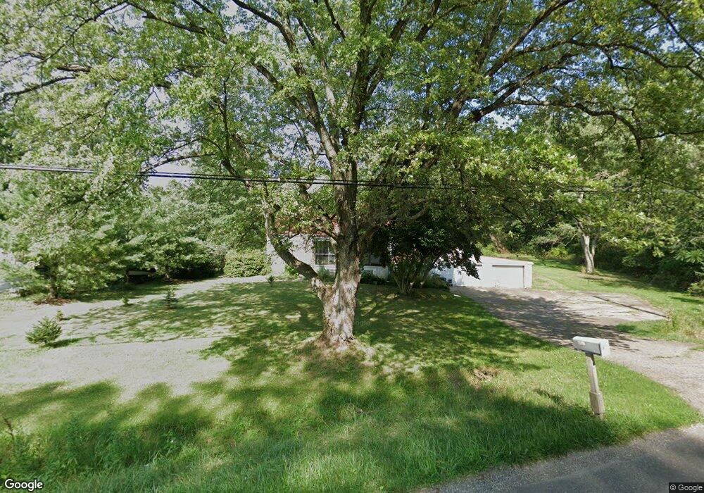
12990 Union Ave NE Alliance, OH 44601
Estimated Value: $126,000 - $247,000
4
Beds
2
Baths
1,722
Sq Ft
$98/Sq Ft
Est. Value
About This Home
This home is located at 12990 Union Ave NE, Alliance, OH 44601 and is currently estimated at $169,057, approximately $98 per square foot. 12990 Union Ave NE is a home located in Stark County with nearby schools including Marlington High School.
Ownership History
Date
Name
Owned For
Owner Type
Purchase Details
Closed on
Nov 29, 2011
Sold by
Betz Ronald
Bought by
Hughes Steven and Caplinger Sara
Current Estimated Value
Purchase Details
Closed on
Oct 21, 2011
Sold by
Us Bank National Association
Bought by
Betz Ronald E
Purchase Details
Closed on
Jul 18, 2011
Sold by
Pauley David S
Bought by
U S Bank National Associaton
Purchase Details
Closed on
Jan 25, 1999
Sold by
Brown Rosalyn L Natale and Natale Rosalyn L
Bought by
Pauley David S and Pauley Lori A
Home Financials for this Owner
Home Financials are based on the most recent Mortgage that was taken out on this home.
Original Mortgage
$92,150
Interest Rate
6.75%
Mortgage Type
FHA
Create a Home Valuation Report for This Property
The Home Valuation Report is an in-depth analysis detailing your home's value as well as a comparison with similar homes in the area
Home Values in the Area
Average Home Value in this Area
Purchase History
| Date | Buyer | Sale Price | Title Company |
|---|---|---|---|
| Hughes Steven | $13,100 | None Available | |
| Betz Ronald E | $22,600 | Quality Choice Title Box | |
| U S Bank National Associaton | $66,000 | None Available | |
| Pauley David S | $95,000 | Union Title Company |
Source: Public Records
Mortgage History
| Date | Status | Borrower | Loan Amount |
|---|---|---|---|
| Previous Owner | Pauley David S | $92,150 |
Source: Public Records
Tax History Compared to Growth
Tax History
| Year | Tax Paid | Tax Assessment Tax Assessment Total Assessment is a certain percentage of the fair market value that is determined by local assessors to be the total taxable value of land and additions on the property. | Land | Improvement |
|---|---|---|---|---|
| 2025 | $2,209 | $39,200 | $7,560 | $31,640 |
| 2024 | $745 | $39,200 | $7,560 | $31,640 |
| 2023 | $2,192 | $37,420 | $5,990 | $31,430 |
| 2022 | $1,324 | $37,420 | $5,990 | $31,430 |
| 2021 | $1,328 | $37,420 | $5,990 | $31,430 |
| 2020 | $1,301 | $32,660 | $5,180 | $27,480 |
| 2019 | $1,292 | $32,660 | $5,180 | $27,480 |
| 2018 | $1,293 | $32,660 | $5,180 | $27,480 |
| 2017 | $1,939 | $29,420 | $3,820 | $25,600 |
| 2016 | $2,528 | $29,420 | $3,820 | $25,600 |
| 2015 | $1,213 | $29,420 | $3,820 | $25,600 |
| 2014 | $1,416 | $32,070 | $7,770 | $24,300 |
| 2013 | $704 | $32,070 | $7,770 | $24,300 |
Source: Public Records
Map
Nearby Homes
- 0 Knoll St NE
- 15520 Coalbank St NE
- 15789 Coalbank St NE
- 15995 Elbrook St NE
- 14723 Bolton St NE
- 11344 Walnut Ave NE
- 14422 Sturbridge Rd NE
- 15832 Waverly St NE
- 11310 Webb Ave NE
- 0 Homestead Ave NE
- 0 Johnson Ave NE Unit 5142926
- 0 Klinger Ave NE
- 0 Meadowbrook Ave
- 652 N Webb Ave
- 124 E Wayne St
- 710 N Freedom Ave
- 505 N Union Ave
- 608 N Freedom Ave
- 000 Klinger Ave
- 11480 Aebi Ave NE
- 13020 Union Ave NE
- 13058 Union Ave NE
- 12908 Union Ave NE
- 12907 Union Ave NE
- 15432 Knoll St NE
- 15470 Knoll St NE
- 15394 Knoll St NE
- 13090 Union Ave NE
- 15407 Knoll St NE
- 15355 Knoll St NE
- 13053 Union Ave NE
- 13051 Union Ave NE
- 13100 Union Ave NE
- 12788 Union Ave NE
- 15574 Coalbank St NE
- 15574 Coalbank St NE
- 12750 Union Ave NE
- 13180 Lexington Ave NE
- 15058 Greenbower St NE
- 12720 Union Ave NE