Estimated Value: $253,000 - $286,000
2
Beds
3
Baths
1,271
Sq Ft
$209/Sq Ft
Est. Value
About This Home
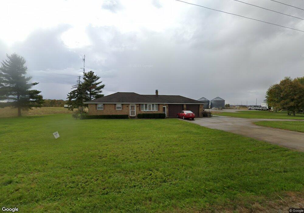
This home is located at 12993 State Route 29, Anna, OH 45302 and is currently estimated at $266,000, approximately $209 per square foot. 12993 State Route 29 is a home located in Shelby County with nearby schools including Anna Elementary School, Anna Middle School, and Anna High School.
Ownership History
Date
Name
Owned For
Owner Type
Purchase Details
Closed on
Sep 28, 2021
Sold by
Hahn Lynnette and Estate Of Larry R Vehorn
Bought by
Inman William Craig
Current Estimated Value
Home Financials for this Owner
Home Financials are based on the most recent Mortgage that was taken out on this home.
Original Mortgage
$199,500
Outstanding Balance
$181,925
Interest Rate
2.8%
Mortgage Type
New Conventional
Estimated Equity
$84,075
Purchase Details
Closed on
Feb 20, 2020
Sold by
Raberding Deborah L and Buschur Family Trust
Bought by
Vehron Larry R
Home Financials for this Owner
Home Financials are based on the most recent Mortgage that was taken out on this home.
Original Mortgage
$40,000
Interest Rate
3.6%
Mortgage Type
New Conventional
Purchase Details
Closed on
Aug 18, 1992
Bought by
Buschur Harold
Create a Home Valuation Report for This Property
The Home Valuation Report is an in-depth analysis detailing your home's value as well as a comparison with similar homes in the area
Home Values in the Area
Average Home Value in this Area
Purchase History
| Date | Buyer | Sale Price | Title Company |
|---|---|---|---|
| Inman William Craig | $210,000 | None Available | |
| Vehron Larry R | $185,000 | None Available | |
| Buschur Harold | -- | -- |
Source: Public Records
Mortgage History
| Date | Status | Borrower | Loan Amount |
|---|---|---|---|
| Open | Inman William Craig | $199,500 | |
| Previous Owner | Vehron Larry R | $40,000 |
Source: Public Records
Tax History Compared to Growth
Tax History
| Year | Tax Paid | Tax Assessment Tax Assessment Total Assessment is a certain percentage of the fair market value that is determined by local assessors to be the total taxable value of land and additions on the property. | Land | Improvement |
|---|---|---|---|---|
| 2024 | $2,212 | $72,440 | $11,200 | $61,240 |
| 2023 | $2,212 | $72,440 | $11,200 | $61,240 |
| 2022 | $2,227 | $65,460 | $9,100 | $56,360 |
| 2021 | $2,249 | $65,460 | $9,100 | $56,360 |
| 2020 | $2,249 | $65,460 | $9,100 | $56,360 |
| 2019 | $1,627 | $56,720 | $7,560 | $49,160 |
| 2018 | $1,590 | $56,720 | $7,560 | $49,160 |
| 2017 | $1,601 | $56,720 | $7,560 | $49,160 |
| 2016 | $1,195 | $45,090 | $6,300 | $38,790 |
| 2015 | $1,103 | $45,090 | $6,300 | $38,790 |
| 2014 | $1,103 | $45,090 | $6,300 | $38,790 |
| 2013 | $1,017 | $40,580 | $6,300 | $34,280 |
Source: Public Records
Map
Nearby Homes
- 13400 Whitefeather Trail
- 10810 Wenger Rd
- 11968 Arling Rd
- 205 S 2nd St
- 208 W South St
- 114 W Main St
- 101 Sapphire St
- 101 W South St
- 206 Shannon Dr
- 305 E North St
- 205 Linkensmith Dr
- 320 Mill St
- 3538 N Kuther Rd
- 16785 Roettger Rd
- 14334 Meranda Rd
- 14666 Circle Dr
- 10100 Thompson-Schiff Rd
- 18250 Roettger Rd
- 4221 State Route 362
- 193 N Paris St
- 13080 Ohio 29
- 13080 St Rt 29
- 13080 State Route 29
- 13000 State Route 29
- 12800 State Route 29
- 13164 State Route 29 Unit 13166
- 9520 State Route 119 W
- 13199 State Route 29
- 13199 Ohio 29
- 12871 Hardin Wapakoneta Rd
- 13400 Renee Dr
- 12911 Hardin Wapakoneta Rd
- 13420 Renee Dr
- 13430 Renee Dr
- 13425 Renee Dr
- 12769 Hardin-Wapakoneta Rd
- 13010 McCartyville Rd
- 12920 McCartyville Rd
- 13440 Renee Dr
- 12769 Hardin Wapakoneta Rd