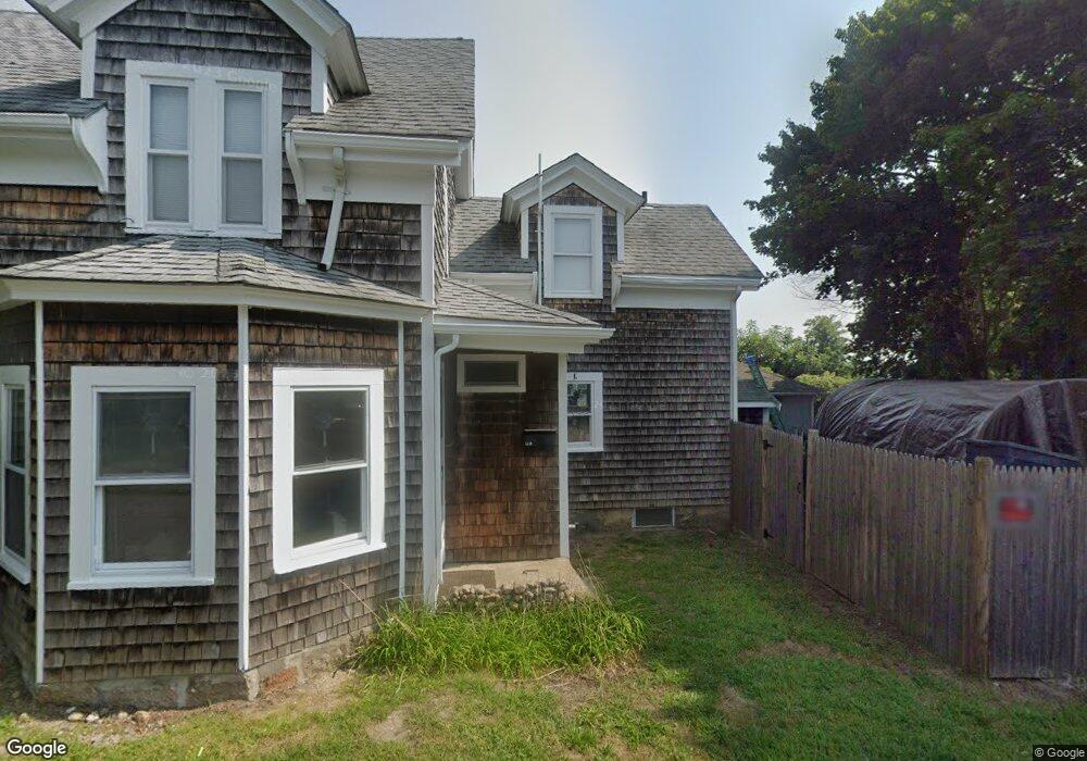
12A Cohasset Ave Buzzards Bay, MA 02532
Buzzards Bay NeighborhoodEstimated Value: $447,000 - $529,000
4
Beds
2
Baths
1,427
Sq Ft
$344/Sq Ft
Est. Value
About This Home
This home is located at 12A Cohasset Ave, Buzzards Bay, MA 02532 and is currently estimated at $490,754, approximately $343 per square foot. 12A Cohasset Ave is a home located in Barnstable County with nearby schools including Bourne High School and St Margaret Regional School.
Ownership History
Date
Name
Owned For
Owner Type
Purchase Details
Closed on
Jun 12, 2025
Sold by
Dittrich Christian
Bought by
Canal Side Dreams Llc
Current Estimated Value
Purchase Details
Closed on
Dec 3, 2024
Sold by
Jjz Int and Jjz Zappala
Bought by
Dittrich Christian
Purchase Details
Closed on
Mar 16, 2021
Sold by
Forlivesi Carla
Bought by
Jjz Int and Jjz Zappala
Create a Home Valuation Report for This Property
The Home Valuation Report is an in-depth analysis detailing your home's value as well as a comparison with similar homes in the area
Home Values in the Area
Average Home Value in this Area
Purchase History
| Date | Buyer | Sale Price | Title Company |
|---|---|---|---|
| Canal Side Dreams Llc | -- | None Available | |
| Canal Side Dreams Llc | -- | None Available | |
| Dittrich Christian | $480,000 | None Available | |
| Dittrich Christian | $480,000 | None Available | |
| Dittrich Christian | $480,000 | None Available | |
| Jjz Int | $195,000 | None Available | |
| Jjz Int | $195,000 | None Available | |
| Jjz Int | $195,000 | None Available |
Source: Public Records
Tax History Compared to Growth
Tax History
| Year | Tax Paid | Tax Assessment Tax Assessment Total Assessment is a certain percentage of the fair market value that is determined by local assessors to be the total taxable value of land and additions on the property. | Land | Improvement |
|---|---|---|---|---|
| 2025 | $3,241 | $415,000 | $169,300 | $245,700 |
| 2024 | $3,077 | $383,700 | $161,200 | $222,500 |
| 2023 | $2,742 | $311,200 | $114,200 | $197,000 |
| 2022 | $2,744 | $272,000 | $101,000 | $171,000 |
| 2021 | $2,522 | $234,200 | $91,900 | $142,300 |
| 2020 | $2,384 | $222,000 | $91,100 | $130,900 |
| 2019 | $2,255 | $214,600 | $91,100 | $123,500 |
| 2018 | $1,922 | $182,400 | $86,700 | $95,700 |
| 2017 | $1,668 | $161,900 | $85,900 | $76,000 |
| 2016 | $1,633 | $160,700 | $85,900 | $74,800 |
| 2015 | $1,618 | $160,700 | $85,900 | $74,800 |
Source: Public Records
Map
Nearby Homes
- 16 Washington Ave
- 34 Washington Ave
- 151 - 153 Main St
- 46 Holt Rd
- 46 Holt Rd Unit A
- 56 Rip Van Winkle Way
- 3 Wolf Rd
- 17 Maple St
- 1 Pine Tree Dr
- 41 Lewis Point Rd
- 3 Fairway Dr Unit F
- 38 Old Bridge Rd
- 0 Lewis Point Rd
- 304 Main St
- 162 Puritan Rd
- 65 Lewis Point Rd
- 73 Lewis Point Rd
- 171 Puritan Rd
- 18 Martin St
- 44 Cotuit Rd
- 12 Cohasset Ave Unit 1
- 14 Cohasset Ave
- 14 Cohasset Ave
- 6 Cohasset Ave
- 6 Cohasset Ave Unit 1-4
- 6 Cohasset Ave
- 6 Cohasset Ave
- 16 Cohasset Ave
- 16 Cohasset Ave Unit 16A+
- 16 Cohasset Ave
- 1 Lafayette Ave
- 1 Lafayette Ave
- 11 Cohasset Ave
- 10 Lafayette Ave
- 6 Washington Ave Unit A
- 6 Washington Ave
- 4 Washington Ave
- 4 Washington Ave
- 4 Washington Ave Unit 1
- 15 Cohasset Ave