E
Seller's Agent in 2025
Elizabeth Stott
Elite Team Realty, LLC
(609) 214-3265
2 in this area
7 Total Sales
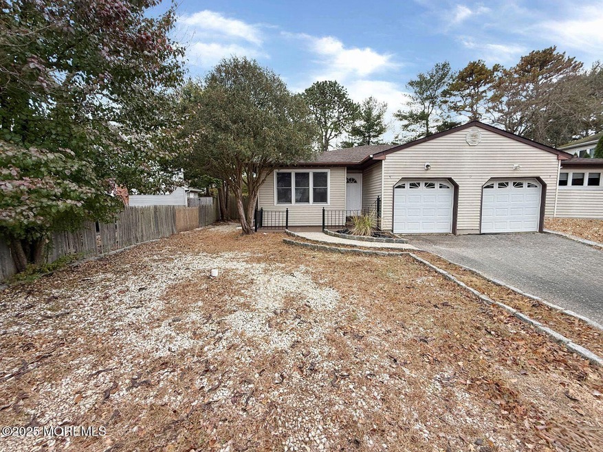
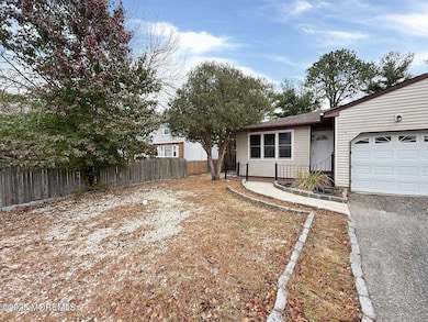
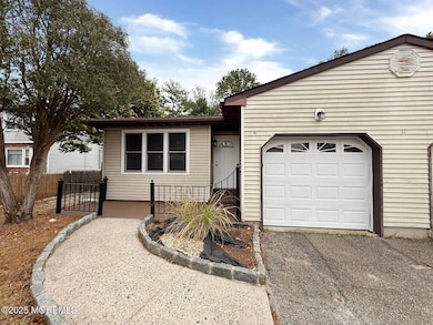

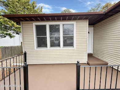
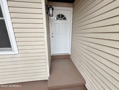
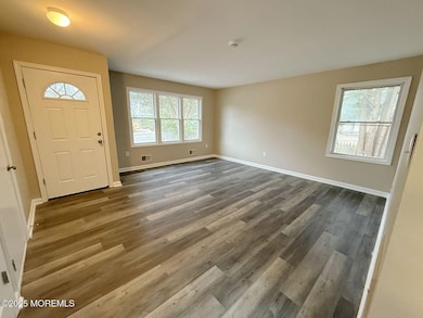
Welcome to this delightful 2-bedroom, 2-full-bath duplex offering comfort, and convenience. The home features a 1 car garage, a charming front patio, and a cozy back deck. Inside, you'll enjoy a bright, cozy layout with well-sized bedrooms and two full bathrooms. The living and dining areas flow smoothly, creating an inviting atmosphere for both quiet nights in and casual entertaining. You'll have access to a sparkling pool and clubhouse, adding to the appeal of this convenient lifestyle. Located just minutes from stores, banks, schools, neighborhood parks, and a local public beach, this home puts everything you need within easy reach. Ideal for those seeking a comfortable home with minimal upkeep in a great location—don't miss this opportunity!
Last Agent to Sell the Property
Elite Team Realty, LLC License #2322839 Listed on: 11/18/2025
| Date | Type | Sale Price | Title Company |
|---|---|---|---|
| Deed | $299,000 | Coastal Title Agency | |
| Deed | $190,000 | Coastline Title Agency Inc | |
| Deed | $120,000 | Coastline Title Agency Inc | |
| Deed | $60,000 | -- |
| Date | Status | Loan Amount | Loan Type |
|---|---|---|---|
| Open | $284,050 | New Conventional | |
| Previous Owner | $171,000 | Purchase Money Mortgage | |
| Previous Owner | $40,000 | Purchase Money Mortgage |
| Date | Event | Price | List to Sale | Price per Sq Ft |
|---|---|---|---|---|
| 12/23/2025 12/23/25 | Sold | $299,000 | -0.3% | $292 / Sq Ft |
| 12/01/2025 12/01/25 | Pending | -- | -- | -- |
| 11/18/2025 11/18/25 | For Sale | $299,900 | -- | $293 / Sq Ft |
| Year | Tax Paid | Tax Assessment Tax Assessment Total Assessment is a certain percentage of the fair market value that is determined by local assessors to be the total taxable value of land and additions on the property. | Land | Improvement |
|---|---|---|---|---|
| 2025 | $3,545 | $115,000 | $56,700 | $58,300 |
| 2024 | $3,348 | $115,000 | $56,700 | $58,300 |
| 2023 | $3,240 | $115,000 | $56,700 | $58,300 |
| 2022 | $3,240 | $115,000 | $56,700 | $58,300 |
| 2021 | $3,225 | $115,000 | $56,700 | $58,300 |
| 2020 | $3,210 | $115,000 | $56,700 | $58,300 |
| 2019 | $3,163 | $115,000 | $56,700 | $58,300 |
| 2018 | $3,335 | $122,200 | $56,700 | $65,500 |
| 2017 | $3,280 | $122,200 | $56,700 | $65,500 |
| 2016 | $3,213 | $122,200 | $56,700 | $65,500 |
| 2015 | $3,111 | $122,200 | $56,700 | $65,500 |
| 2014 | $3,404 | $137,200 | $71,700 | $65,500 |
E
Seller's Agent in 2025
Elizabeth Stott
Elite Team Realty, LLC
(609) 214-3265
2 in this area
7 Total Sales

Seller Co-Listing Agent in 2025
Anamaria Delvalle
Elite Team Realty, LLC
(609) 713-6740
10 in this area
93 Total Sales
T
Buyer's Agent in 2025
Taylor Bozan
Coldwell Banker Home Connection Realty
(609) 698-7003
1 in this area
7 Total Sales
Source: MOREMLS (Monmouth Ocean Regional REALTORS®)
MLS Number: 22534841
APN: 01-00208-07-00010-0000-CA
Disclaimer: Certain information contained herein is derived from information provided by parties other than Homes.com. All information provided is deemed reliable, but is not guaranteed to be accurate and should be independently verified.
![]() IDX information is provided exclusively for personal, non-commercial use, and may not be used for any purpose other than to identify prospective properties consumers may be interested in purchasing.
IDX information is provided exclusively for personal, non-commercial use, and may not be used for any purpose other than to identify prospective properties consumers may be interested in purchasing.
Information is deemed reliable but not guaranteed.
Ask me questions while you tour the home.