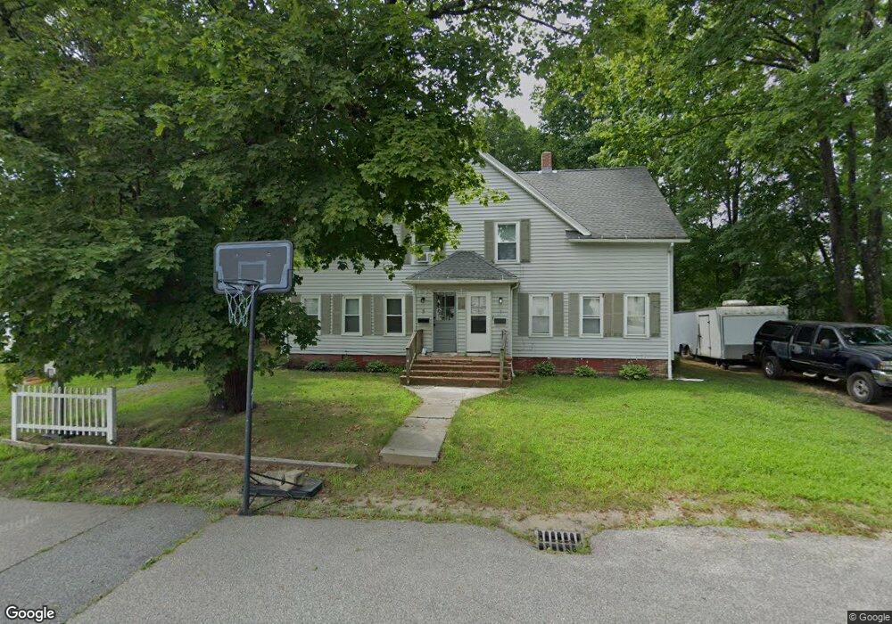
13 4th St Unit 15 Plainfield, CT 06374
Estimated Value: $295,906 - $392,000
6
Beds
2
Baths
2,630
Sq Ft
$134/Sq Ft
Est. Value
About This Home
This home is located at 13 4th St Unit 15, Plainfield, CT 06374 and is currently estimated at $352,977, approximately $134 per square foot. 13 4th St Unit 15 is a home located in Windham County with nearby schools including Plainfield Memorial School, Plainfield Central Middle School, and Plainfield High School.
Ownership History
Date
Name
Owned For
Owner Type
Purchase Details
Closed on
May 18, 2016
Sold by
Gagnon Francis E and Gagnon Sanda A
Bought by
Eames Rose M and Eames Michael M
Current Estimated Value
Home Financials for this Owner
Home Financials are based on the most recent Mortgage that was taken out on this home.
Original Mortgage
$129,609
Interest Rate
3.59%
Mortgage Type
FHA
Purchase Details
Closed on
Dec 8, 2000
Sold by
Haggett Mary D
Bought by
Rsf Llc
Purchase Details
Closed on
Dec 22, 1988
Sold by
Miller Robert
Bought by
Haggett Mary
Purchase Details
Closed on
Dec 6, 1985
Bought by
Gagnon Francis E and Gagnon Sandra A
Create a Home Valuation Report for This Property
The Home Valuation Report is an in-depth analysis detailing your home's value as well as a comparison with similar homes in the area
Home Values in the Area
Average Home Value in this Area
Purchase History
| Date | Buyer | Sale Price | Title Company |
|---|---|---|---|
| Eames Rose M | $132,000 | -- | |
| Eames Rose M | $132,000 | -- | |
| Rsf Llc | $89,000 | -- | |
| Rsf Llc | $89,000 | -- | |
| Haggett Mary | $110,000 | -- | |
| Gagnon Francis E | $63,000 | -- |
Source: Public Records
Mortgage History
| Date | Status | Borrower | Loan Amount |
|---|---|---|---|
| Open | Gagnon Francis E | $138,260 | |
| Closed | Gagnon Francis E | $129,609 |
Source: Public Records
Tax History Compared to Growth
Tax History
| Year | Tax Paid | Tax Assessment Tax Assessment Total Assessment is a certain percentage of the fair market value that is determined by local assessors to be the total taxable value of land and additions on the property. | Land | Improvement |
|---|---|---|---|---|
| 2025 | $3,350 | $144,140 | $25,290 | $118,850 |
| 2024 | $3,219 | $144,140 | $25,290 | $118,850 |
| 2023 | $3,203 | $144,140 | $25,290 | $118,850 |
| 2022 | $3,648 | $89,130 | $22,950 | $66,180 |
| 2021 | $2,685 | $89,130 | $22,950 | $66,180 |
| 2020 | $2,677 | $89,130 | $22,950 | $66,180 |
| 2019 | $2,677 | $89,130 | $22,950 | $66,180 |
| 2018 | $2,644 | $89,130 | $22,950 | $66,180 |
| 2017 | $3,233 | $102,250 | $20,250 | $82,000 |
| 2016 | $3,119 | $102,250 | $20,250 | $82,000 |
| 2015 | $3,048 | $102,250 | $20,250 | $82,000 |
| 2014 | $3,048 | $102,250 | $20,250 | $82,000 |
Source: Public Records
Map
Nearby Homes
- 34 Pleasant St Unit 3
- 34 Pleasant St Unit 7
- 33 Railroad Ave
- 42 Church St Unit 44
- 49 Canterbury Rd Unit K
- 00 Norwich Rd
- 0A Norwich Rd
- 0 Pond St Unit 24037041
- 26 Perkins St
- 0 Dow Rd Unit 24128109
- 75 Academy Hill Rd
- 230 Cemetery Rd
- 0 Plainfield Pike
- 3 Terrace Dr
- 2 Terrace Dr
- 462 Norwich Rd
- 40 Tarbox Rd
- 36 Plainfield Pike
- 128 Lathrop Rd
- 146 Lathrop Rd