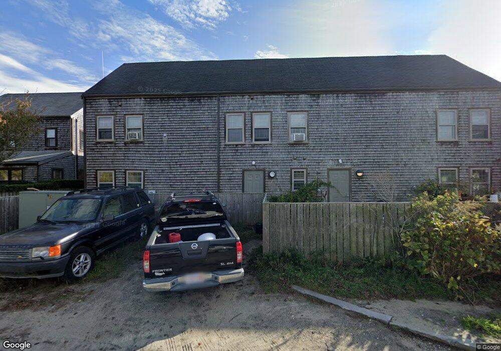
13 Arrowhead Dr Nantucket, MA 02554
Estimated Value: $6,905,432
1
Bed
4
Baths
8,635
Sq Ft
$800/Sq Ft
Est. Value
About This Home
This home is located at 13 Arrowhead Dr, Nantucket, MA 02554 and is currently estimated at $6,905,432, approximately $799 per square foot. 13 Arrowhead Dr is a home located in Nantucket County with nearby schools including Nantucket Elementary School, Cyrus Peirce Middle School, and Nantucket High School.
Ownership History
Date
Name
Owned For
Owner Type
Purchase Details
Closed on
Jan 18, 2005
Sold by
Lombardi Mark A and Lombardi
Bought by
Arrowhead Nursery T and Lombardi
Current Estimated Value
Home Financials for this Owner
Home Financials are based on the most recent Mortgage that was taken out on this home.
Original Mortgage
$2,200,000
Outstanding Balance
$1,084,836
Interest Rate
5.81%
Mortgage Type
Commercial
Estimated Equity
$5,820,596
Create a Home Valuation Report for This Property
The Home Valuation Report is an in-depth analysis detailing your home's value as well as a comparison with similar homes in the area
Home Values in the Area
Average Home Value in this Area
Purchase History
| Date | Buyer | Sale Price | Title Company |
|---|---|---|---|
| Arrowhead Nursery T | -- | -- | |
| Arrowhead Nursery T | -- | -- | |
| Arrowhead Nursery T | -- | -- | |
| Great Point Partners L | -- | -- |
Source: Public Records
Mortgage History
| Date | Status | Borrower | Loan Amount |
|---|---|---|---|
| Open | Great Point Partners L | $2,200,000 | |
| Closed | Arrowhead Nursery T | $2,200,000 |
Source: Public Records
Tax History
| Year | Tax Paid | Tax Assessment Tax Assessment Total Assessment is a certain percentage of the fair market value that is determined by local assessors to be the total taxable value of land and additions on the property. | Land | Improvement |
|---|---|---|---|---|
| 2025 | -- | $4,354,000 | $1,220,300 | $3,133,700 |
| 2024 | -- | $4,261,500 | $1,220,300 | $3,041,200 |
| 2023 | $0 | $3,173,400 | $1,212,500 | $1,960,900 |
| 2022 | $0 | $2,852,800 | $970,000 | $1,882,800 |
| 2021 | $0 | $2,852,800 | $970,000 | $1,882,800 |
| 2020 | $17,340 | $2,712,400 | $970,000 | $1,742,400 |
| 2019 | $0 | $2,712,400 | $970,000 | $1,742,400 |
| 2018 | $12,970 | $2,106,200 | $646,900 | $1,459,300 |
| 2017 | $0 | $2,015,600 | $556,300 | $1,459,300 |
| 2016 | -- | $2,095,800 | $645,600 | $1,450,200 |
| 2015 | -- | $2,095,800 | $645,600 | $1,450,200 |
| 2014 | -- | $2,095,800 | $645,600 | $1,450,200 |
Source: Public Records
Map
Nearby Homes
- 133 A Old South Rd Unit A
- 106 Old South Rd Unit A Unit B
- 1 Airport Rd Unit Lot A
- 1 Airport Rd Unit Lot B
- 9 Nobadeer Way
- 4 Goldenrod Ct
- 10 Beach Grass Rd
- 2 Goldenrod Ct
- 11 Sesapana Rd
- 21 Kittiwake Ln
- 6 Honeysuckle Dr
- 20 Evergreen Way
- 87 Goldfinch Dr
- 20 Nancy Ann Ln
- 15 Nancy Ann Ln
- 11 Woodland Dr
- 15 Skyline Dr
- 2A Forest Ave Unit 5
- 2A Forest Ave Unit 1
- 2B Forest Ave Unit 6
- 13 Arrowhead Dr Unit 1
- 63 Hinsdale Rd
- 20 Arrowhead Dr
- 8 Flint Rd
- 6 Flint Rd
- 13 Teasdale Cir
- 18 Arrowhead Dr
- 11 Teasdale Cir Unit D
- 11 Teasdale Cir Unit C
- 11 Teasdale Cir Unit B
- 11 Teasdale Cir Unit A
- 11 B Teasdale Cir Unit B
- 11 B Teasdale Cir
- 4 Flint Rd
- 15 Teasdale Cir
- 9 Teasdale Cir Unit 1
- 9 Teasdale Cir Unit 2
- 9 Teasdale Cir Unit 3
- 9 Teasdale Cir Unit 3 & 4
- 1 Spearhead Dr
Your Personal Tour Guide
Ask me questions while you tour the home.