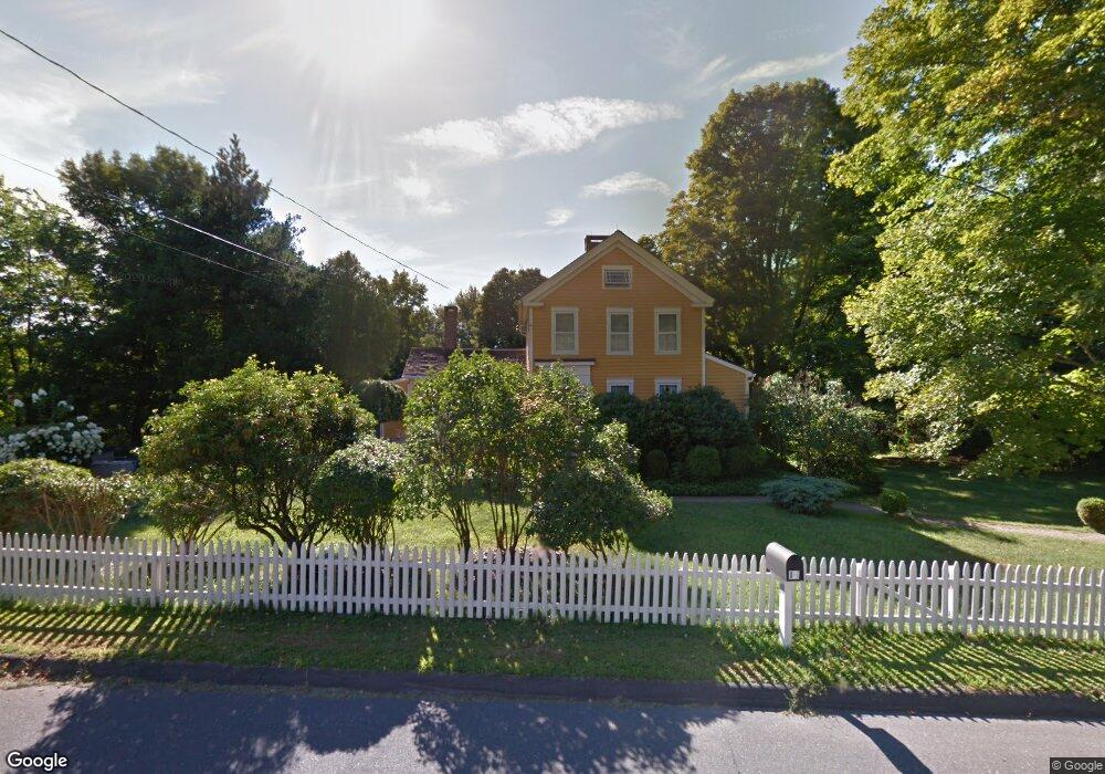
13 Bennetts Bridge Rd Sandy Hook, CT 06482
Estimated Value: $562,000 - $799,000
4
Beds
2
Baths
1,512
Sq Ft
$414/Sq Ft
Est. Value
About This Home
This home is located at 13 Bennetts Bridge Rd, Sandy Hook, CT 06482 and is currently estimated at $625,587, approximately $413 per square foot. 13 Bennetts Bridge Rd is a home located in Fairfield County with nearby schools including Sandy Hook Elementary School, Reed Intermediate School, and Newtown Middle School.
Ownership History
Date
Name
Owned For
Owner Type
Purchase Details
Closed on
Dec 12, 2025
Sold by
Haugeto Kirstin L
Bought by
Kirstin L Haugeto Ret and Haugeto
Current Estimated Value
Purchase Details
Closed on
Jun 5, 2008
Sold by
Macaluso Jeffrey T and Macaluso Andrea D
Bought by
Sirva Relocation Cred
Create a Home Valuation Report for This Property
The Home Valuation Report is an in-depth analysis detailing your home's value as well as a comparison with similar homes in the area
Home Values in the Area
Average Home Value in this Area
Purchase History
| Date | Buyer | Sale Price | Title Company |
|---|---|---|---|
| Kirstin L Haugeto Ret | -- | -- | |
| Sirva Relocation Cred | $390,000 | -- | |
| Sirva Relocation Cred | $390,000 | -- |
Source: Public Records
Mortgage History
| Date | Status | Borrower | Loan Amount |
|---|---|---|---|
| Previous Owner | Sirva Relocation Cred | $145,000 | |
| Previous Owner | Sirva Relocation Cred | $203,500 | |
| Previous Owner | Sirva Relocation Cred | $600,000 |
Source: Public Records
Tax History Compared to Growth
Tax History
| Year | Tax Paid | Tax Assessment Tax Assessment Total Assessment is a certain percentage of the fair market value that is determined by local assessors to be the total taxable value of land and additions on the property. | Land | Improvement |
|---|---|---|---|---|
| 2025 | $8,307 | $289,050 | $63,770 | $225,280 |
| 2024 | $7,818 | $289,890 | $63,770 | $226,120 |
| 2023 | $7,607 | $289,890 | $63,770 | $226,120 |
| 2022 | $6,847 | $197,480 | $67,430 | $130,050 |
| 2021 | $6,843 | $197,480 | $67,430 | $130,050 |
| 2020 | $6,864 | $197,480 | $67,430 | $130,050 |
| 2019 | $6,866 | $197,480 | $67,430 | $130,050 |
| 2018 | $6,762 | $197,480 | $67,430 | $130,050 |
| 2017 | $5,777 | $170,550 | $69,430 | $101,120 |
| 2016 | $5,730 | $170,550 | $69,430 | $101,120 |
| 2015 | $5,640 | $170,550 | $69,430 | $101,120 |
| 2014 | $5,681 | $170,550 | $69,430 | $101,120 |
Source: Public Records
Map
Nearby Homes
- 18 Osborne Hill Rd
- 34 Yogananda St
- 8 Holly Ln
- 23 Fawnwood Rd
- 238 Berkshire Rd
- 22 Misty Vale Rd
- 53 A Toddy Hill Rd
- 61 High Rock Rd
- 40 Great Ring Rd
- 42 Great Ring Rd
- 66 Marlin Rd
- 49 Great Ring Rd
- 59 Great Ring Rd
- 30 Cedarhurst Trail
- 13 Jordan Hill Rd
- 27 Pole Bridge Rd
- 69 Engleside Terrace
- 30 Capitol Dr
- 89 Alpine Dr
- 167 Toddy Hill Rd
- 3 Becket Village
- 1 Becket Village
- 5 Becket Village
- 18 Bennetts Bridge Rd
- 7 Becket Village
- 4 Becket Village
- 4 Bresson Farm Rd
- 9 Becket Village
- 6 Becket Village
- 8 Beckett Village
- 8 Becket Village
- 14 Founders Ln
- 17A Bennetts Bridge Rd
- 6 Bresson Farm Rd
- 17 Bennetts Bridge Rd
- 9 Bennetts Bridge Rd
- 10 Becket Village
- 19 Bennetts Bridge Rd
- 13 Osborne Hill Rd
- 12 Founders Ln