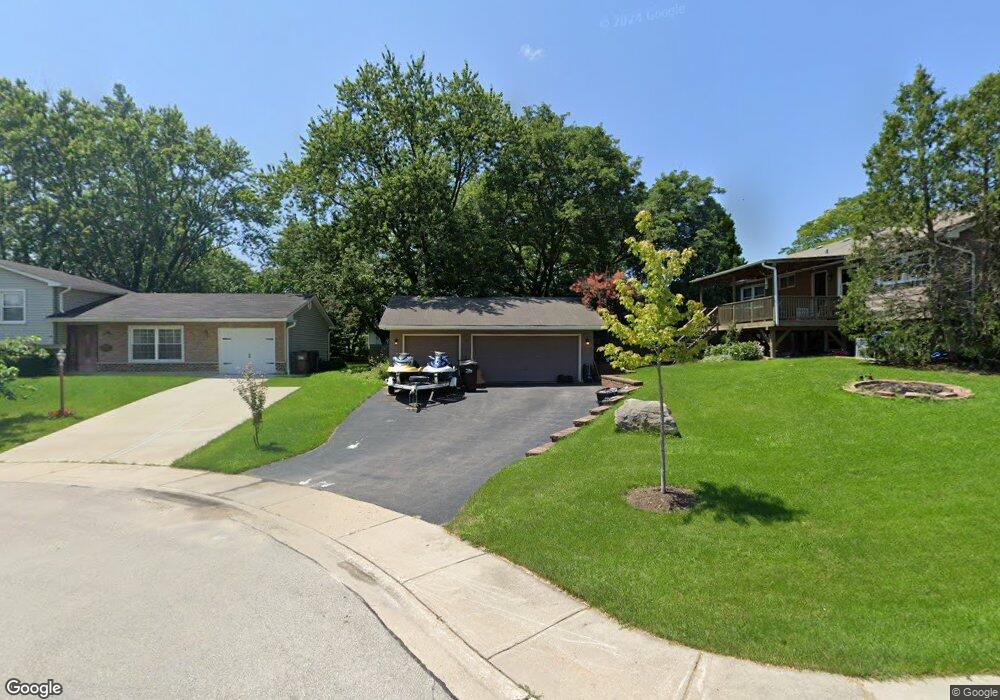
13 Black Twig Cir Lake Zurich, IL 60047
Estimated Value: $386,420 - $410,000
4
Beds
2
Baths
1,257
Sq Ft
$321/Sq Ft
Est. Value
About This Home
This home is located at 13 Black Twig Cir, Lake Zurich, IL 60047 and is currently estimated at $403,605, approximately $321 per square foot. 13 Black Twig Cir is a home located in Lake County with nearby schools including Sarah Adams Elementary School, Lake Zurich Middle School - South Campus, and Lake Zurich High School.
Ownership History
Date
Name
Owned For
Owner Type
Purchase Details
Closed on
Mar 18, 2004
Sold by
Nader John Paul and Nader Mary
Bought by
Sayers Michael S and Sayers Linda J
Current Estimated Value
Home Financials for this Owner
Home Financials are based on the most recent Mortgage that was taken out on this home.
Original Mortgage
$197,600
Outstanding Balance
$85,516
Interest Rate
4.62%
Mortgage Type
Purchase Money Mortgage
Estimated Equity
$318,089
Purchase Details
Closed on
Jun 13, 1995
Sold by
Harbaugh John A
Bought by
Grear Joseph A and Grear Linda A
Home Financials for this Owner
Home Financials are based on the most recent Mortgage that was taken out on this home.
Original Mortgage
$134,100
Interest Rate
8.27%
Create a Home Valuation Report for This Property
The Home Valuation Report is an in-depth analysis detailing your home's value as well as a comparison with similar homes in the area
Home Values in the Area
Average Home Value in this Area
Purchase History
| Date | Buyer | Sale Price | Title Company |
|---|---|---|---|
| Sayers Michael S | $247,000 | Multiple | |
| Grear Joseph A | $149,000 | Republic Title Company |
Source: Public Records
Mortgage History
| Date | Status | Borrower | Loan Amount |
|---|---|---|---|
| Open | Sayers Michael S | $197,600 | |
| Previous Owner | Grear Joseph A | $134,100 | |
| Closed | Sayers Michael S | $49,400 |
Source: Public Records
Tax History Compared to Growth
Tax History
| Year | Tax Paid | Tax Assessment Tax Assessment Total Assessment is a certain percentage of the fair market value that is determined by local assessors to be the total taxable value of land and additions on the property. | Land | Improvement |
|---|---|---|---|---|
| 2024 | $7,544 | $116,366 | $24,820 | $91,546 |
| 2023 | $7,513 | $103,890 | $22,159 | $81,731 |
| 2022 | $7,513 | $101,371 | $17,377 | $83,994 |
| 2021 | $7,250 | $98,774 | $16,932 | $81,842 |
| 2020 | $7,119 | $98,774 | $16,932 | $81,842 |
| 2019 | $7,011 | $97,912 | $16,784 | $81,128 |
| 2018 | $6,154 | $86,980 | $18,057 | $68,923 |
| 2017 | $6,111 | $85,931 | $17,839 | $68,092 |
| 2016 | $5,986 | $83,210 | $17,274 | $65,936 |
| 2015 | $5,893 | $79,255 | $16,453 | $62,802 |
| 2014 | $5,693 | $75,976 | $19,842 | $56,134 |
| 2012 | $5,991 | $76,136 | $19,884 | $56,252 |
Source: Public Records
Map
Nearby Homes
- 533 Surryse Rd
- 600 Ivy Ct
- 429 Grand Ave
- 155 Canterbury Way
- 795 Harvest Dr
- 890 June Terrace Unit 140
- 898 S Rand Rd
- 54 Mionske Dr
- 77 Mionske Dr
- 21763 Deerpath Rd
- 21742 N Ashley St
- 21839 Cambridge Dr
- 27 Maple Ave
- 20992 W Preserve Dr
- 21186 W Preserve Dr
- 461 N Newberry Ct
- 21031 N Quentin Rd
- 21041-51 N Quentin Rd
- 99 Quentin Rd
- O Midlothian Rd
- 16 Red Haw Ln
- 11 Black Twig Cir
- 22 Red Haw Ln
- 8 Red Haw Ln
- 17 Red Haw Ln
- 9 Black Twig Cir
- 4 Red Haw Ln
- 19 Red Haw Ln
- 3 Black Twig Cir
- 15 Red Haw Ln
- 21 Red Haw Ln
- 470 Surryse Rd
- 2 Red Haw Ln
- 13 Red Haw Ln
- 7 Black Twig Cir
- 5 Black Twig Cir
- 480 Surryse Rd
- 23 Red Haw Ln
- 28 Red Haw Ln
- 11 Red Haw Ln Unit 2