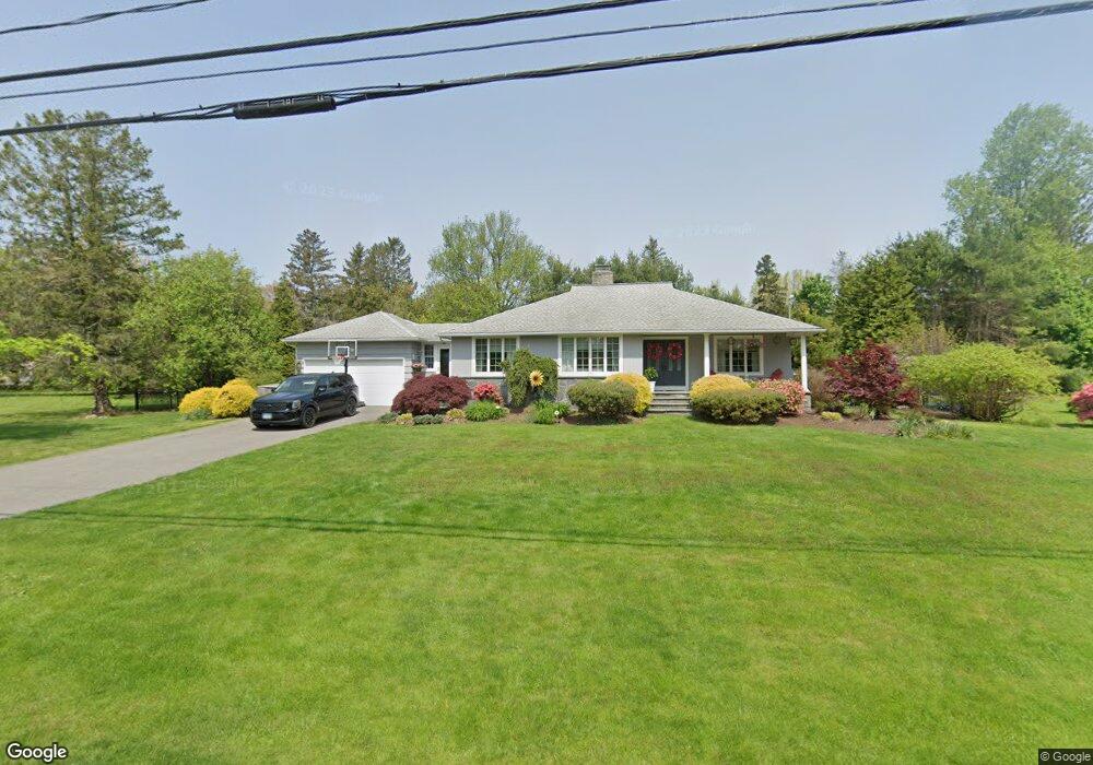
13 Blanchard Rd Easton, CT 06612
Estimated Value: $730,000 - $989,000
3
Beds
2
Baths
1,564
Sq Ft
$524/Sq Ft
Est. Value
About This Home
This home is located at 13 Blanchard Rd, Easton, CT 06612 and is currently estimated at $818,910, approximately $523 per square foot. 13 Blanchard Rd is a home located in Fairfield County with nearby schools including Samuel Staples Elementary School, Helen Keller Middle School, and Joel Barlow High School.
Ownership History
Date
Name
Owned For
Owner Type
Purchase Details
Closed on
Apr 17, 2007
Sold by
Haddad Dayan M and Haddad Christopher M
Bought by
Elliott Mark and Elliott Lindsay
Current Estimated Value
Home Financials for this Owner
Home Financials are based on the most recent Mortgage that was taken out on this home.
Original Mortgage
$400,000
Interest Rate
6.24%
Mortgage Type
Purchase Money Mortgage
Purchase Details
Closed on
Aug 27, 1998
Sold by
Filakosky Louis
Bought by
Haddad Christopher M and Haddad Dayan M
Create a Home Valuation Report for This Property
The Home Valuation Report is an in-depth analysis detailing your home's value as well as a comparison with similar homes in the area
Home Values in the Area
Average Home Value in this Area
Purchase History
| Date | Buyer | Sale Price | Title Company |
|---|---|---|---|
| Elliott Mark | $675,000 | -- | |
| Elliott Mark | $675,000 | -- | |
| Haddad Christopher M | $265,000 | -- | |
| Haddad Christopher M | $265,000 | -- |
Source: Public Records
Mortgage History
| Date | Status | Borrower | Loan Amount |
|---|---|---|---|
| Open | Haddad Christopher M | $400,000 | |
| Closed | Haddad Christopher M | $400,000 |
Source: Public Records
Tax History
| Year | Tax Paid | Tax Assessment Tax Assessment Total Assessment is a certain percentage of the fair market value that is determined by local assessors to be the total taxable value of land and additions on the property. | Land | Improvement |
|---|---|---|---|---|
| 2025 | $10,917 | $352,170 | $184,800 | $167,370 |
| 2024 | $10,403 | $352,170 | $184,800 | $167,370 |
| 2023 | $10,199 | $352,170 | $184,800 | $167,370 |
| 2022 | $10,016 | $352,170 | $184,800 | $167,370 |
| 2021 | $8,844 | $273,380 | $181,440 | $91,940 |
| 2020 | $8,475 | $273,380 | $181,440 | $91,940 |
| 2019 | $8,565 | $273,380 | $181,440 | $91,940 |
| 2018 | $8,579 | $273,380 | $181,440 | $91,940 |
| 2017 | $9,125 | $273,380 | $181,440 | $91,940 |
| 2016 | $8,699 | $282,330 | $184,790 | $97,540 |
| 2015 | $8,577 | $282,330 | $184,790 | $97,540 |
| 2014 | $8,442 | $282,330 | $184,790 | $97,540 |
Source: Public Records
Map
Nearby Homes
- 12 Ridgeway Rd
- 36 Rosewood Dr
- 108 Ferndale Dr
- 93 Tersana Dr
- 35 Sturbridge Rd
- 305 Sport Hill Rd
- 84 Delaware Rd
- 28 Hillside Dr
- 132 Toll House Ln
- 40 Toll House Ln
- 340 Morehouse Rd
- 134 Delaware Rd
- 5763 Park Ave
- 18 Ridgebury Dr
- 121 Campbell Rd
- 8 Raleigh Rd
- lot 194 Prospect Ave
- 3460 Old Town Rd
- 81 Lance Cir
- 71 Schiller Rd